Magdalena García Martínez, Luis Jesús Osornio Berthet, Jorge Meléndez Estrada, Oscar Cruz Castro
{"title":"在墨西哥河谷地区使用HEC-RAS 2D模型识别洪水易发地区","authors":"Magdalena García Martínez, Luis Jesús Osornio Berthet, Jorge Meléndez Estrada, Oscar Cruz Castro","doi":"10.1016/j.chemosphere.2025.144609","DOIUrl":null,"url":null,"abstract":"<div><div>This study aims to identify flood-prone areas in the Almoloya-Otzolotepec sub-basin, located in the Valley of Mexico, by applying HEC-RAS 2D model. The region, characterized by a semi-arid climate and variable topography, faces increased flood risks due to accelerated urbanization, which has significantly reduced agricultural land and expanded urban areas. A comprehensive hydrological analysis was conducted, incorporating meteorological data from local stations, IDF curves, and topographic information to develop a Digital Elevation Model (DEM) for simulation purposes. The HEC-RAS 2D model was applied under three different return periods (2, 100, and 500 years) to simulate various flooding scenarios. Results indicated moderate flooding in Zone I during the 2-year return period, with a higher severity observed in Zones II and VI during the 100- and 500-year return periods, where flooding depths could reach up to 5 m. The analysis emphasized the vulnerability of urban areas with insufficient drainage infrastructure, increasing the likelihood of severe flooding in these regions. These findings highlight the critical need for improved flood risk management, including enhanced drainage systems, larger reservoirs, and better urban planning to mitigate the impacts of climate change and protect vulnerable communities. This study provides essential information for designing effective flood mitigation strategies and serves as a basis for future planning and infrastructure improvements in the region to minimize flood damage and enhance resilience to extreme weather events.</div></div>","PeriodicalId":276,"journal":{"name":"Chemosphere","volume":"386 ","pages":"Article 144609"},"PeriodicalIF":8.1000,"publicationDate":"2025-08-12","publicationTypes":"Journal Article","fieldsOfStudy":null,"isOpenAccess":false,"openAccessPdf":"","citationCount":"0","resultStr":"{\"title\":\"Identification of flood-prone areas using the HEC-RAS 2D model in a region of the Valley of Mexico\",\"authors\":\"Magdalena García Martínez, Luis Jesús Osornio Berthet, Jorge Meléndez Estrada, Oscar Cruz Castro\",\"doi\":\"10.1016/j.chemosphere.2025.144609\",\"DOIUrl\":null,\"url\":null,\"abstract\":\"<div><div>This study aims to identify flood-prone areas in the Almoloya-Otzolotepec sub-basin, located in the Valley of Mexico, by applying HEC-RAS 2D model. The region, characterized by a semi-arid climate and variable topography, faces increased flood risks due to accelerated urbanization, which has significantly reduced agricultural land and expanded urban areas. A comprehensive hydrological analysis was conducted, incorporating meteorological data from local stations, IDF curves, and topographic information to develop a Digital Elevation Model (DEM) for simulation purposes. The HEC-RAS 2D model was applied under three different return periods (2, 100, and 500 years) to simulate various flooding scenarios. Results indicated moderate flooding in Zone I during the 2-year return period, with a higher severity observed in Zones II and VI during the 100- and 500-year return periods, where flooding depths could reach up to 5 m. The analysis emphasized the vulnerability of urban areas with insufficient drainage infrastructure, increasing the likelihood of severe flooding in these regions. These findings highlight the critical need for improved flood risk management, including enhanced drainage systems, larger reservoirs, and better urban planning to mitigate the impacts of climate change and protect vulnerable communities. This study provides essential information for designing effective flood mitigation strategies and serves as a basis for future planning and infrastructure improvements in the region to minimize flood damage and enhance resilience to extreme weather events.</div></div>\",\"PeriodicalId\":276,\"journal\":{\"name\":\"Chemosphere\",\"volume\":\"386 \",\"pages\":\"Article 144609\"},\"PeriodicalIF\":8.1000,\"publicationDate\":\"2025-08-12\",\"publicationTypes\":\"Journal Article\",\"fieldsOfStudy\":null,\"isOpenAccess\":false,\"openAccessPdf\":\"\",\"citationCount\":\"0\",\"resultStr\":null,\"platform\":\"Semanticscholar\",\"paperid\":null,\"PeriodicalName\":\"Chemosphere\",\"FirstCategoryId\":\"93\",\"ListUrlMain\":\"https://www.sciencedirect.com/science/article/pii/S0045653525005545\",\"RegionNum\":2,\"RegionCategory\":\"环境科学与生态学\",\"ArticlePicture\":[],\"TitleCN\":null,\"AbstractTextCN\":null,\"PMCID\":null,\"EPubDate\":\"\",\"PubModel\":\"\",\"JCR\":\"Q1\",\"JCRName\":\"ENVIRONMENTAL SCIENCES\",\"Score\":null,\"Total\":0}","platform":"Semanticscholar","paperid":null,"PeriodicalName":"Chemosphere","FirstCategoryId":"93","ListUrlMain":"https://www.sciencedirect.com/science/article/pii/S0045653525005545","RegionNum":2,"RegionCategory":"环境科学与生态学","ArticlePicture":[],"TitleCN":null,"AbstractTextCN":null,"PMCID":null,"EPubDate":"","PubModel":"","JCR":"Q1","JCRName":"ENVIRONMENTAL SCIENCES","Score":null,"Total":0}
Identification of flood-prone areas using the HEC-RAS 2D model in a region of the Valley of Mexico
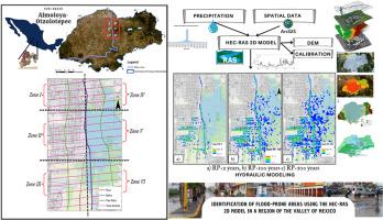
This study aims to identify flood-prone areas in the Almoloya-Otzolotepec sub-basin, located in the Valley of Mexico, by applying HEC-RAS 2D model. The region, characterized by a semi-arid climate and variable topography, faces increased flood risks due to accelerated urbanization, which has significantly reduced agricultural land and expanded urban areas. A comprehensive hydrological analysis was conducted, incorporating meteorological data from local stations, IDF curves, and topographic information to develop a Digital Elevation Model (DEM) for simulation purposes. The HEC-RAS 2D model was applied under three different return periods (2, 100, and 500 years) to simulate various flooding scenarios. Results indicated moderate flooding in Zone I during the 2-year return period, with a higher severity observed in Zones II and VI during the 100- and 500-year return periods, where flooding depths could reach up to 5 m. The analysis emphasized the vulnerability of urban areas with insufficient drainage infrastructure, increasing the likelihood of severe flooding in these regions. These findings highlight the critical need for improved flood risk management, including enhanced drainage systems, larger reservoirs, and better urban planning to mitigate the impacts of climate change and protect vulnerable communities. This study provides essential information for designing effective flood mitigation strategies and serves as a basis for future planning and infrastructure improvements in the region to minimize flood damage and enhance resilience to extreme weather events.
期刊介绍:
Chemosphere, being an international multidisciplinary journal, is dedicated to publishing original communications and review articles on chemicals in the environment. The scope covers a wide range of topics, including the identification, quantification, behavior, fate, toxicology, treatment, and remediation of chemicals in the bio-, hydro-, litho-, and atmosphere, ensuring the broad dissemination of research in this field.