{"title":"卡霍夫卡溃坝情景下受影响人口与建成区的时空评价","authors":"Mengxue Zhang, Jiahong Liu, Tianxu Song, Chao Mei, Jia Wang, Feng Jin, Hao Wang","doi":"10.1111/jfr3.70106","DOIUrl":null,"url":null,"abstract":"<p>Flood risk assessment serves as a critical tool, providing theoretical foundations for minimizing flood damage and effective flood management. In June 2023, the Kakhovka Dam failure highlighted the need for accurate flood risk assessment under different breach scenarios. This study assessed the spatiotemporal flood risk to population and built-up areas under partial (S1) and complete (S2) dam-breach scenarios using the HEV (hazard–exposure–vulnerability) framework. Hotspot analysis was used to identify high-risk zones, and classification differences between HEV and DV methods were compared. The results are as follows: Flood propagation was simulated using the TELEMAC-2D model, yielding an NSE of 0.98 based on observed water depths. Spatial validation produced a precision (<i>P</i>) of 70.7%, a false positive rate (FPR) of 22.9%, a false negative rate (FNR) of 3.2%, and an accuracy of 84.6%. For population flood risk, the total number of people at risk was approximately 101,000 under S1, increasing sharply within the first 41 h. Under S2, the total rose to approximately 296,000, with a rapid increase observed in the first 20 h. For built-up area, the total flood-affected extent was 51.6 km<sup>2</sup> under S1, showing a sharp increase in the first 41 h. Under S2, the total affected area expanded to 157.4 km<sup>2</sup>, with a rapid rise during the first 20 h. High-risk clusters of both population and buildings were mainly located near the dam site and in the midstream right-bank urban area. New high-risk zones also emerged in the southern part of the left riverbank under S2. Although the DV-based method produced a wider spatial extent of flood risk, it underestimated risk levels in both scenarios. The results provide a practical basis for flood risk assessment and emergency management.</p>","PeriodicalId":49294,"journal":{"name":"Journal of Flood Risk Management","volume":"18 3","pages":""},"PeriodicalIF":3.0000,"publicationDate":"2025-07-30","publicationTypes":"Journal Article","fieldsOfStudy":null,"isOpenAccess":false,"openAccessPdf":"https://onlinelibrary.wiley.com/doi/epdf/10.1111/jfr3.70106","citationCount":"0","resultStr":"{\"title\":\"Spatiotemporal Assessment of Affected Population and Built-Up Area Under Dam-Breach Scenarios of Kakhovka\",\"authors\":\"Mengxue Zhang, Jiahong Liu, Tianxu Song, Chao Mei, Jia Wang, Feng Jin, Hao Wang\",\"doi\":\"10.1111/jfr3.70106\",\"DOIUrl\":null,\"url\":null,\"abstract\":\"<p>Flood risk assessment serves as a critical tool, providing theoretical foundations for minimizing flood damage and effective flood management. In June 2023, the Kakhovka Dam failure highlighted the need for accurate flood risk assessment under different breach scenarios. This study assessed the spatiotemporal flood risk to population and built-up areas under partial (S1) and complete (S2) dam-breach scenarios using the HEV (hazard–exposure–vulnerability) framework. Hotspot analysis was used to identify high-risk zones, and classification differences between HEV and DV methods were compared. The results are as follows: Flood propagation was simulated using the TELEMAC-2D model, yielding an NSE of 0.98 based on observed water depths. Spatial validation produced a precision (<i>P</i>) of 70.7%, a false positive rate (FPR) of 22.9%, a false negative rate (FNR) of 3.2%, and an accuracy of 84.6%. For population flood risk, the total number of people at risk was approximately 101,000 under S1, increasing sharply within the first 41 h. Under S2, the total rose to approximately 296,000, with a rapid increase observed in the first 20 h. For built-up area, the total flood-affected extent was 51.6 km<sup>2</sup> under S1, showing a sharp increase in the first 41 h. Under S2, the total affected area expanded to 157.4 km<sup>2</sup>, with a rapid rise during the first 20 h. High-risk clusters of both population and buildings were mainly located near the dam site and in the midstream right-bank urban area. New high-risk zones also emerged in the southern part of the left riverbank under S2. Although the DV-based method produced a wider spatial extent of flood risk, it underestimated risk levels in both scenarios. The results provide a practical basis for flood risk assessment and emergency management.</p>\",\"PeriodicalId\":49294,\"journal\":{\"name\":\"Journal of Flood Risk Management\",\"volume\":\"18 3\",\"pages\":\"\"},\"PeriodicalIF\":3.0000,\"publicationDate\":\"2025-07-30\",\"publicationTypes\":\"Journal Article\",\"fieldsOfStudy\":null,\"isOpenAccess\":false,\"openAccessPdf\":\"https://onlinelibrary.wiley.com/doi/epdf/10.1111/jfr3.70106\",\"citationCount\":\"0\",\"resultStr\":null,\"platform\":\"Semanticscholar\",\"paperid\":null,\"PeriodicalName\":\"Journal of Flood Risk Management\",\"FirstCategoryId\":\"93\",\"ListUrlMain\":\"https://onlinelibrary.wiley.com/doi/10.1111/jfr3.70106\",\"RegionNum\":3,\"RegionCategory\":\"环境科学与生态学\",\"ArticlePicture\":[],\"TitleCN\":null,\"AbstractTextCN\":null,\"PMCID\":null,\"EPubDate\":\"\",\"PubModel\":\"\",\"JCR\":\"Q2\",\"JCRName\":\"ENVIRONMENTAL SCIENCES\",\"Score\":null,\"Total\":0}","platform":"Semanticscholar","paperid":null,"PeriodicalName":"Journal of Flood Risk Management","FirstCategoryId":"93","ListUrlMain":"https://onlinelibrary.wiley.com/doi/10.1111/jfr3.70106","RegionNum":3,"RegionCategory":"环境科学与生态学","ArticlePicture":[],"TitleCN":null,"AbstractTextCN":null,"PMCID":null,"EPubDate":"","PubModel":"","JCR":"Q2","JCRName":"ENVIRONMENTAL SCIENCES","Score":null,"Total":0}
Spatiotemporal Assessment of Affected Population and Built-Up Area Under Dam-Breach Scenarios of Kakhovka
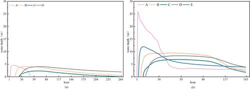
Flood risk assessment serves as a critical tool, providing theoretical foundations for minimizing flood damage and effective flood management. In June 2023, the Kakhovka Dam failure highlighted the need for accurate flood risk assessment under different breach scenarios. This study assessed the spatiotemporal flood risk to population and built-up areas under partial (S1) and complete (S2) dam-breach scenarios using the HEV (hazard–exposure–vulnerability) framework. Hotspot analysis was used to identify high-risk zones, and classification differences between HEV and DV methods were compared. The results are as follows: Flood propagation was simulated using the TELEMAC-2D model, yielding an NSE of 0.98 based on observed water depths. Spatial validation produced a precision (P) of 70.7%, a false positive rate (FPR) of 22.9%, a false negative rate (FNR) of 3.2%, and an accuracy of 84.6%. For population flood risk, the total number of people at risk was approximately 101,000 under S1, increasing sharply within the first 41 h. Under S2, the total rose to approximately 296,000, with a rapid increase observed in the first 20 h. For built-up area, the total flood-affected extent was 51.6 km2 under S1, showing a sharp increase in the first 41 h. Under S2, the total affected area expanded to 157.4 km2, with a rapid rise during the first 20 h. High-risk clusters of both population and buildings were mainly located near the dam site and in the midstream right-bank urban area. New high-risk zones also emerged in the southern part of the left riverbank under S2. Although the DV-based method produced a wider spatial extent of flood risk, it underestimated risk levels in both scenarios. The results provide a practical basis for flood risk assessment and emergency management.
期刊介绍:
Journal of Flood Risk Management provides an international platform for knowledge sharing in all areas related to flood risk. Its explicit aim is to disseminate ideas across the range of disciplines where flood related research is carried out and it provides content ranging from leading edge academic papers to applied content with the practitioner in mind.
Readers and authors come from a wide background and include hydrologists, meteorologists, geographers, geomorphologists, conservationists, civil engineers, social scientists, policy makers, insurers and practitioners. They share an interest in managing the complex interactions between the many skills and disciplines that underpin the management of flood risk across the world.

 求助内容:
求助内容: 应助结果提醒方式:


