中国东部铜庐山矽卡岩型铜铁金矿床环境噪声地震层析成像

IF 3.6 2区 地球科学 Q1 GEOLOGY
Jialiang Jing , Guoxiong Chen , Pei Li , Fuwen Xu
{"title":"中国东部铜庐山矽卡岩型铜铁金矿床环境噪声地震层析成像","authors":"Jialiang Jing ,&nbsp;Guoxiong Chen ,&nbsp;Pei Li ,&nbsp;Fuwen Xu","doi":"10.1016/j.oregeorev.2025.106718","DOIUrl":null,"url":null,"abstract":"<div><div>The Tonglushan (TLS) skarn-type Cu-Fe-Au deposit, located in Hubei Province of China, is facing the challenge of depletion of shallow mineral resources, highlighting the urgent need for deep mineral exploration to sustain future resource development. A range of geophysical methods has been employed to delineate subsurface lithology beneath the TLS deposit, with a particular focus on identifying skarn mineralization, which is commonly occurs along granite-marble boundaries. However, gravity and magnetic methods are less effective for detecting small geological bodies at depths &gt; 1 km, while electromagnetic methods suffer from strong noise interference from ongoing mining activities herein. In this study, we present the first application of ambient noise tomography (ANT) to TLS ore deposit for imaging shear wave velocity structures by using a dense linear seismic array (∼10 km). The velocity images agree well with geological information revealed by drilling holes, accurately delineating the marble formation and fault structures, both of which are characterized by low-velocity anomalies. Notably, the magnetic responses of lithological model inferred from ANT agree well with the observed aeromagnetic data. The inversion results precisely delineate the interfaces between granite and marble, where the largest ore body of the TLS ore deposit is located. The geological model derived from geophysical inversion results provides a more comprehensive understanding of the TLS Cu-Fe-Au mineral system. It reveals that the granite intrusion extends to a depth of ca. 2.5 km, while the captive marble formation may reach depths of up to 2 km beneath the TLS ore deposit. These results provide key clues for finding potential skar-type Cu-Fe-Au ore bodies related to granite-sediment boundaries in the deep space (at ca. 1.0–2.0 km) of the TLS ore deposits.</div></div>","PeriodicalId":19644,"journal":{"name":"Ore Geology Reviews","volume":"184 ","pages":"Article 106718"},"PeriodicalIF":3.6000,"publicationDate":"2025-06-05","publicationTypes":"Journal Article","fieldsOfStudy":null,"isOpenAccess":false,"openAccessPdf":"","citationCount":"0","resultStr":"{\"title\":\"Ambient noise seismic tomography of Tonglushan skarn-type Cu-Fe-Au deposit in Eastern China\",\"authors\":\"Jialiang Jing ,&nbsp;Guoxiong Chen ,&nbsp;Pei Li ,&nbsp;Fuwen Xu\",\"doi\":\"10.1016/j.oregeorev.2025.106718\",\"DOIUrl\":null,\"url\":null,\"abstract\":\"<div><div>The Tonglushan (TLS) skarn-type Cu-Fe-Au deposit, located in Hubei Province of China, is facing the challenge of depletion of shallow mineral resources, highlighting the urgent need for deep mineral exploration to sustain future resource development. A range of geophysical methods has been employed to delineate subsurface lithology beneath the TLS deposit, with a particular focus on identifying skarn mineralization, which is commonly occurs along granite-marble boundaries. However, gravity and magnetic methods are less effective for detecting small geological bodies at depths &gt; 1 km, while electromagnetic methods suffer from strong noise interference from ongoing mining activities herein. In this study, we present the first application of ambient noise tomography (ANT) to TLS ore deposit for imaging shear wave velocity structures by using a dense linear seismic array (∼10 km). The velocity images agree well with geological information revealed by drilling holes, accurately delineating the marble formation and fault structures, both of which are characterized by low-velocity anomalies. Notably, the magnetic responses of lithological model inferred from ANT agree well with the observed aeromagnetic data. The inversion results precisely delineate the interfaces between granite and marble, where the largest ore body of the TLS ore deposit is located. The geological model derived from geophysical inversion results provides a more comprehensive understanding of the TLS Cu-Fe-Au mineral system. It reveals that the granite intrusion extends to a depth of ca. 2.5 km, while the captive marble formation may reach depths of up to 2 km beneath the TLS ore deposit. These results provide key clues for finding potential skar-type Cu-Fe-Au ore bodies related to granite-sediment boundaries in the deep space (at ca. 1.0–2.0 km) of the TLS ore deposits.</div></div>\",\"PeriodicalId\":19644,\"journal\":{\"name\":\"Ore Geology Reviews\",\"volume\":\"184 \",\"pages\":\"Article 106718\"},\"PeriodicalIF\":3.6000,\"publicationDate\":\"2025-06-05\",\"publicationTypes\":\"Journal Article\",\"fieldsOfStudy\":null,\"isOpenAccess\":false,\"openAccessPdf\":\"\",\"citationCount\":\"0\",\"resultStr\":null,\"platform\":\"Semanticscholar\",\"paperid\":null,\"PeriodicalName\":\"Ore Geology Reviews\",\"FirstCategoryId\":\"89\",\"ListUrlMain\":\"https://www.sciencedirect.com/science/article/pii/S0169136825002781\",\"RegionNum\":2,\"RegionCategory\":\"地球科学\",\"ArticlePicture\":[],\"TitleCN\":null,\"AbstractTextCN\":null,\"PMCID\":null,\"EPubDate\":\"\",\"PubModel\":\"\",\"JCR\":\"Q1\",\"JCRName\":\"GEOLOGY\",\"Score\":null,\"Total\":0}","platform":"Semanticscholar","paperid":null,"PeriodicalName":"Ore Geology Reviews","FirstCategoryId":"89","ListUrlMain":"https://www.sciencedirect.com/science/article/pii/S0169136825002781","RegionNum":2,"RegionCategory":"地球科学","ArticlePicture":[],"TitleCN":null,"AbstractTextCN":null,"PMCID":null,"EPubDate":"","PubModel":"","JCR":"Q1","JCRName":"GEOLOGY","Score":null,"Total":0}
引用次数: 0

摘要

湖北省铜庐山矽卡岩型铜铁金矿正面临着浅层矿产资源枯竭的挑战,迫切需要进行深部矿产勘查以支撑未来的资源开发。采用了一系列地球物理方法来描绘TLS矿床下的地下岩性,特别侧重于识别矽卡岩矿化,这通常发生在花岗岩-大理石边界上。然而,重磁法探测深部小地质体的效果较差;而电磁方法受到正在进行的采矿活动的强烈噪声干扰。在这项研究中,我们首次将环境噪声层析成像(ANT)应用于TLS矿床,利用密集线性地震阵列(~ 10公里)成像横波速度结构。速度图像与钻孔显示的地质信息吻合较好,准确圈定了大理岩地层和断裂构造,均具有低速异常特征。值得注意的是,ANT反演的岩性模型的磁响应与实测航磁数据吻合较好。反演结果准确圈定了TLS矿床最大矿体所在的花岗岩与大理岩界面。利用地球物理反演结果建立的地质模型,对TLS Cu-Fe-Au矿物系统有了更全面的认识。结果表明,花岗岩侵入延伸至约2.5 km的深度,而圈闭大理岩地层可能达到TLS矿床下方2 km的深度。这些结果为在TLS矿床深部(约1.0 ~ 2.0 km)寻找与花岗岩-沉积物边界相关的潜在skar型Cu-Fe-Au矿体提供了关键线索。
本文章由计算机程序翻译,如有差异,请以英文原文为准。

Ambient noise seismic tomography of Tonglushan skarn-type Cu-Fe-Au deposit in Eastern China

Ambient noise seismic tomography of Tonglushan skarn-type Cu-Fe-Au deposit in Eastern China
The Tonglushan (TLS) skarn-type Cu-Fe-Au deposit, located in Hubei Province of China, is facing the challenge of depletion of shallow mineral resources, highlighting the urgent need for deep mineral exploration to sustain future resource development. A range of geophysical methods has been employed to delineate subsurface lithology beneath the TLS deposit, with a particular focus on identifying skarn mineralization, which is commonly occurs along granite-marble boundaries. However, gravity and magnetic methods are less effective for detecting small geological bodies at depths > 1 km, while electromagnetic methods suffer from strong noise interference from ongoing mining activities herein. In this study, we present the first application of ambient noise tomography (ANT) to TLS ore deposit for imaging shear wave velocity structures by using a dense linear seismic array (∼10 km). The velocity images agree well with geological information revealed by drilling holes, accurately delineating the marble formation and fault structures, both of which are characterized by low-velocity anomalies. Notably, the magnetic responses of lithological model inferred from ANT agree well with the observed aeromagnetic data. The inversion results precisely delineate the interfaces between granite and marble, where the largest ore body of the TLS ore deposit is located. The geological model derived from geophysical inversion results provides a more comprehensive understanding of the TLS Cu-Fe-Au mineral system. It reveals that the granite intrusion extends to a depth of ca. 2.5 km, while the captive marble formation may reach depths of up to 2 km beneath the TLS ore deposit. These results provide key clues for finding potential skar-type Cu-Fe-Au ore bodies related to granite-sediment boundaries in the deep space (at ca. 1.0–2.0 km) of the TLS ore deposits.
求助全文
通过发布文献求助,成功后即可免费获取论文全文。 去求助
来源期刊
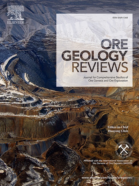
Ore Geology Reviews
Ore Geology Reviews 地学-地质学
CiteScore
6.50
自引率
27.30%
发文量
546
审稿时长
22.9 weeks
期刊介绍: Ore Geology Reviews aims to familiarize all earth scientists with recent advances in a number of interconnected disciplines related to the study of, and search for, ore deposits. The reviews range from brief to longer contributions, but the journal preferentially publishes manuscripts that fill the niche between the commonly shorter journal articles and the comprehensive book coverages, and thus has a special appeal to many authors and readers.
×
引用
GB/T 7714-2015
复制
MLA
复制
APA
复制
导出至
BibTeX EndNote RefMan NoteFirst NoteExpress
×
提示
您的信息不完整,为了账户安全,请先补充。
现在去补充
×
提示
您因"违规操作"
具体请查看互助需知
我知道了
×
提示
确定
请完成安全验证×
copy
已复制链接
快去分享给好友吧!
我知道了
右上角分享
点击右上角分享
0
联系我们:info@booksci.cn Book学术提供免费学术资源搜索服务,方便国内外学者检索中英文文献。致力于提供最便捷和优质的服务体验。 Copyright © 2023 布克学术 All rights reserved.
京ICP备2023020795号-1
ghs 京公网安备 11010802042870号
Book学术文献互助
Book学术文献互助群
群 号:604180095
Book学术官方微信