气候变化对巴基斯坦北部N-15高速公路沿线滑坡的影响

IF 6.4 1区 地球科学 Q1 ENVIRONMENTAL SCIENCES
Muhammad Ramzan , Peng Cui , Daniya Ualiyeva , Hamza Mukhtar , Nazir Ahmed Bazai , Muhammad Aslam Baig
{"title":"气候变化对巴基斯坦北部N-15高速公路沿线滑坡的影响","authors":"Muhammad Ramzan ,&nbsp;Peng Cui ,&nbsp;Daniya Ualiyeva ,&nbsp;Hamza Mukhtar ,&nbsp;Nazir Ahmed Bazai ,&nbsp;Muhammad Aslam Baig","doi":"10.1016/j.accre.2025.02.004","DOIUrl":null,"url":null,"abstract":"<div><div>Landslides, which are aggravated by climate change, greatly threaten mountainous regions like northern Pakistan. However, existing research lacks a complete, region-specific analysis of the climatic and environmental factors driving landslides across various climatic zones, specifically in vulnerable areas such as northern Pakistan. This study explores the N-15 Highway in northern Pakistan. This region is frequently impacted by landslides induced by extreme climatic events, including heavy rainfall and flooding, which usually lead to blockages along the route. We collected a complete landslide inventory using 455 satellite images from 1990 to 2023 and ground surveys. We also analysed the relationship between landslides and climate change over the period of 1990–2023, encompassing soil moisture, vegetation, precipitation, temperature and snow cover. Using meteorological data, we found that the frequency of landslides rose exponentially from 1990 to 2023 due to the impacts of climate change. Especially after 2005, substantial increases in precipitation, temperature and snowmelt led to a more significant rise in landslide occurrences (<em>p</em> &lt; 0.05). In the warm season (April–October), 84.1% of the landslides occurred, which were mainly due to precipitation and snowmelt. Balakot, Babusar–Naran and Chilas were the primary areas along the highway, each with distinct landslide mechanisms. In the Balakot region, which is characterised by sub-tropical conditions, high precipitation played the leading role in landslide occurrences. Landslides at Babusar–Naran, which is known for Alpine conditions, were mostly driven by precipitation, soil moisture fluctuations and snowmelt dynamics. Geological reasons and high temperatures influenced the Chilas region, which is characterised by semi-arid conditions. The EC-Earth3 model from CMIP6 predicts a 1.6–6.5 °C warming and a 35% rise in precipitation by 2100, with more extreme variations under SSP3-7.0 and SSP5-8.5 scenarios. These changes are likely to result in a rise in the frequency of landslides. We suggest improving ground observation networks and utilising multiple datasets to better understand the relationship between landslides and climatic variables, which enables highly accurate risk assessment and management in high-mountain areas under the warming climate.</div></div>","PeriodicalId":48628,"journal":{"name":"Advances in Climate Change Research","volume":"16 2","pages":"Pages 397-408"},"PeriodicalIF":6.4000,"publicationDate":"2025-04-01","publicationTypes":"Journal Article","fieldsOfStudy":null,"isOpenAccess":false,"openAccessPdf":"","citationCount":"0","resultStr":"{\"title\":\"Impact of climate change on landslides along N-15 Highway, northern Pakistan\",\"authors\":\"Muhammad Ramzan ,&nbsp;Peng Cui ,&nbsp;Daniya Ualiyeva ,&nbsp;Hamza Mukhtar ,&nbsp;Nazir Ahmed Bazai ,&nbsp;Muhammad Aslam Baig\",\"doi\":\"10.1016/j.accre.2025.02.004\",\"DOIUrl\":null,\"url\":null,\"abstract\":\"<div><div>Landslides, which are aggravated by climate change, greatly threaten mountainous regions like northern Pakistan. However, existing research lacks a complete, region-specific analysis of the climatic and environmental factors driving landslides across various climatic zones, specifically in vulnerable areas such as northern Pakistan. This study explores the N-15 Highway in northern Pakistan. This region is frequently impacted by landslides induced by extreme climatic events, including heavy rainfall and flooding, which usually lead to blockages along the route. We collected a complete landslide inventory using 455 satellite images from 1990 to 2023 and ground surveys. We also analysed the relationship between landslides and climate change over the period of 1990–2023, encompassing soil moisture, vegetation, precipitation, temperature and snow cover. Using meteorological data, we found that the frequency of landslides rose exponentially from 1990 to 2023 due to the impacts of climate change. Especially after 2005, substantial increases in precipitation, temperature and snowmelt led to a more significant rise in landslide occurrences (<em>p</em> &lt; 0.05). In the warm season (April–October), 84.1% of the landslides occurred, which were mainly due to precipitation and snowmelt. Balakot, Babusar–Naran and Chilas were the primary areas along the highway, each with distinct landslide mechanisms. In the Balakot region, which is characterised by sub-tropical conditions, high precipitation played the leading role in landslide occurrences. Landslides at Babusar–Naran, which is known for Alpine conditions, were mostly driven by precipitation, soil moisture fluctuations and snowmelt dynamics. Geological reasons and high temperatures influenced the Chilas region, which is characterised by semi-arid conditions. The EC-Earth3 model from CMIP6 predicts a 1.6–6.5 °C warming and a 35% rise in precipitation by 2100, with more extreme variations under SSP3-7.0 and SSP5-8.5 scenarios. These changes are likely to result in a rise in the frequency of landslides. We suggest improving ground observation networks and utilising multiple datasets to better understand the relationship between landslides and climatic variables, which enables highly accurate risk assessment and management in high-mountain areas under the warming climate.</div></div>\",\"PeriodicalId\":48628,\"journal\":{\"name\":\"Advances in Climate Change Research\",\"volume\":\"16 2\",\"pages\":\"Pages 397-408\"},\"PeriodicalIF\":6.4000,\"publicationDate\":\"2025-04-01\",\"publicationTypes\":\"Journal Article\",\"fieldsOfStudy\":null,\"isOpenAccess\":false,\"openAccessPdf\":\"\",\"citationCount\":\"0\",\"resultStr\":null,\"platform\":\"Semanticscholar\",\"paperid\":null,\"PeriodicalName\":\"Advances in Climate Change Research\",\"FirstCategoryId\":\"89\",\"ListUrlMain\":\"https://www.sciencedirect.com/science/article/pii/S1674927825000395\",\"RegionNum\":1,\"RegionCategory\":\"地球科学\",\"ArticlePicture\":[],\"TitleCN\":null,\"AbstractTextCN\":null,\"PMCID\":null,\"EPubDate\":\"\",\"PubModel\":\"\",\"JCR\":\"Q1\",\"JCRName\":\"ENVIRONMENTAL SCIENCES\",\"Score\":null,\"Total\":0}","platform":"Semanticscholar","paperid":null,"PeriodicalName":"Advances in Climate Change Research","FirstCategoryId":"89","ListUrlMain":"https://www.sciencedirect.com/science/article/pii/S1674927825000395","RegionNum":1,"RegionCategory":"地球科学","ArticlePicture":[],"TitleCN":null,"AbstractTextCN":null,"PMCID":null,"EPubDate":"","PubModel":"","JCR":"Q1","JCRName":"ENVIRONMENTAL SCIENCES","Score":null,"Total":0}
引用次数: 0

摘要

由于气候变化而加剧的山体滑坡严重威胁着巴基斯坦北部等山区。然而,现有的研究缺乏对驱动不同气候带、特别是在巴基斯坦北部等脆弱地区的山体滑坡的气候和环境因素的完整的、特定区域的分析。本研究探讨了巴基斯坦北部的N-15高速公路。该地区经常受到极端气候事件(包括暴雨和洪水)引发的山体滑坡的影响,这通常会导致沿线的堵塞。我们利用1990年至2023年的455张卫星图像和地面调查收集了完整的滑坡清单。我们还分析了1990-2023年期间山体滑坡与气候变化之间的关系,包括土壤湿度、植被、降水、温度和积雪。利用气象数据分析发现,受气候变化的影响,1990 - 2023年滑坡发生频率呈指数级上升。特别是2005年以后,降水量、气温和融雪量的大幅度增加,导致滑坡的发生更为显著(p <;0.05)。在暖季(4 - 10月)发生的滑坡占84.1%,主要是降水和融雪造成的。Balakot, Babusar-Naran和Chilas是高速公路沿线的主要地区,每个地区都有不同的滑坡机制。巴拉科特地区属于亚热带气候,高降水是滑坡发生的主要原因。巴布萨尔-纳兰的山体滑坡主要是由降水、土壤湿度波动和融雪动态驱动的。地质原因和高温影响了奇拉斯地区,该地区的特点是半干旱条件。CMIP6的EC-Earth3模式预测到2100年升温1.6-6.5°C,降水增加35%,在SSP3-7.0和SSP5-8.5情景下变化更为极端。这些变化很可能导致山体滑坡的频率上升。我们建议改进地面观测网络,利用多数据集来更好地了解滑坡与气候变量之间的关系,从而实现气候变暖下高山地区的高精度风险评估和管理。
本文章由计算机程序翻译,如有差异,请以英文原文为准。
Impact of climate change on landslides along N-15 Highway, northern Pakistan
Landslides, which are aggravated by climate change, greatly threaten mountainous regions like northern Pakistan. However, existing research lacks a complete, region-specific analysis of the climatic and environmental factors driving landslides across various climatic zones, specifically in vulnerable areas such as northern Pakistan. This study explores the N-15 Highway in northern Pakistan. This region is frequently impacted by landslides induced by extreme climatic events, including heavy rainfall and flooding, which usually lead to blockages along the route. We collected a complete landslide inventory using 455 satellite images from 1990 to 2023 and ground surveys. We also analysed the relationship between landslides and climate change over the period of 1990–2023, encompassing soil moisture, vegetation, precipitation, temperature and snow cover. Using meteorological data, we found that the frequency of landslides rose exponentially from 1990 to 2023 due to the impacts of climate change. Especially after 2005, substantial increases in precipitation, temperature and snowmelt led to a more significant rise in landslide occurrences (p < 0.05). In the warm season (April–October), 84.1% of the landslides occurred, which were mainly due to precipitation and snowmelt. Balakot, Babusar–Naran and Chilas were the primary areas along the highway, each with distinct landslide mechanisms. In the Balakot region, which is characterised by sub-tropical conditions, high precipitation played the leading role in landslide occurrences. Landslides at Babusar–Naran, which is known for Alpine conditions, were mostly driven by precipitation, soil moisture fluctuations and snowmelt dynamics. Geological reasons and high temperatures influenced the Chilas region, which is characterised by semi-arid conditions. The EC-Earth3 model from CMIP6 predicts a 1.6–6.5 °C warming and a 35% rise in precipitation by 2100, with more extreme variations under SSP3-7.0 and SSP5-8.5 scenarios. These changes are likely to result in a rise in the frequency of landslides. We suggest improving ground observation networks and utilising multiple datasets to better understand the relationship between landslides and climatic variables, which enables highly accurate risk assessment and management in high-mountain areas under the warming climate.
求助全文
通过发布文献求助,成功后即可免费获取论文全文。 去求助
来源期刊
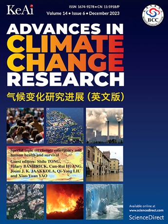
Advances in Climate Change Research
Advances in Climate Change Research Earth and Planetary Sciences-Atmospheric Science
CiteScore
9.80
自引率
4.10%
发文量
424
审稿时长
107 days
期刊介绍: Advances in Climate Change Research publishes scientific research and analyses on climate change and the interactions of climate change with society. This journal encompasses basic science and economic, social, and policy research, including studies on mitigation and adaptation to climate change. Advances in Climate Change Research attempts to promote research in climate change and provide an impetus for the application of research achievements in numerous aspects, such as socioeconomic sustainable development, responses to the adaptation and mitigation of climate change, diplomatic negotiations of climate and environment policies, and the protection and exploitation of natural resources.
×
引用
GB/T 7714-2015
复制
MLA
复制
APA
复制
导出至
BibTeX EndNote RefMan NoteFirst NoteExpress
×
提示
您的信息不完整,为了账户安全,请先补充。
现在去补充
×
提示
您因"违规操作"
具体请查看互助需知
我知道了
×
提示
确定
请完成安全验证×
copy
已复制链接
快去分享给好友吧!
我知道了
右上角分享
点击右上角分享
0
联系我们:info@booksci.cn Book学术提供免费学术资源搜索服务,方便国内外学者检索中英文文献。致力于提供最便捷和优质的服务体验。 Copyright © 2023 布克学术 All rights reserved.
京ICP备2023020795号-1
ghs 京公网安备 11010802042870号
Book学术文献互助
Book学术文献互助群
群 号:481959085
Book学术官方微信