比较激光雷达生成的地上生物量与澳大利亚原始城市森林的野外数据
引用次数: 0
摘要
城市森林对生态系统服务作出了重大贡献,特别是在碳的封存和储存方面。人们对量化地上生物量(AGB)以评估其对减缓气候变化的贡献越来越感兴趣。遥感技术的最新进展使公众可以获得数据,从而有助于估计各种森林类型的AGB。为了评估其对城市森林的适用性,我们将光探测和测距(LiDAR)数据与几种光谱指数进行了比较分析,特别是来自卫星图像的归一化植被指数(NDVI)、增强植被指数(EVI)和叶面积指数(LAI)。这一比较是与从澳大利亚昆士兰州布里斯班136公顷原始森林中获得的基于实地的AGB估计进行的。最初,在森林的14个样地内(7个区域生态系统中每个样地2个样地,每个样地0.1 ha)记录了树木的高度、胸径和活树种类。随后将这些实地数据与木材密度信息相结合,以估计每个地块的AGB。然后将野外估计值与通过计算数字地形模型和数字地表模型之间的差异构建的冠层高度模型(CHM)并置,该模型均使用LiDAR数据生成,并与从Sentinel-2图像获得的每个地块的NDVI, EVI和LAI值并置。结果表明,与野外数据相比,CHM对样地AGB的预测精度最高,而光谱指数的预测精度较低。利用简单线性回归(AGB = 19.97*CHM - 80.3, r²= 0.66,p值<;0.001),利用CHM对整个森林的AGB进行建模,其中包括总AGB和地上碳的计算。这是通过将1公顷网格中的估计AGB相加,然后将每个区域生态系统的平均AGB乘以其各自面积的AGB相加来实现的。这两个估计值(分别为32,210公吨和32,062公吨)都明显低于活树的实地数据估计值(37,876公吨)。本研究的结果表明,基于可公开获取的LiDAR数据的CHM可以可靠地预测样地水平的野外采样AGB,并有效地模拟整个森林尺度的AGB。此外,该模型还被用于预测不同区域生态系统带的AGB,突出了其在不同生态系统设置下捕获AGB变异性的能力。本文章由计算机程序翻译,如有差异,请以英文原文为准。
Comparing LiDAR-generated above-ground biomass with field data in an old-growth native urban forest in Australia
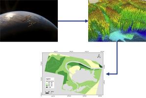
Urban forests contribute significantly to ecosystem services, notably in the sequestration and storage of carbon. There is a growing interest in quantifying Above Ground Biomass (AGB) to evaluate their contribution to climate mitigation. Recent advancements in remote sensing technology have resulted in publicly accessible data that facilitates the estimation of AGB across various forest types. To assess its applicability to urban forests, we conducted a comparative analysis involving Light Detection and Ranging (LiDAR) data alongside several spectral indices, specifically the Normalized Difference Vegetation Index (NDVI), Enhanced Vegetation Index (EVI), and Leaf Area Index (LAI), derived from satellite imagery. This comparison was made against field-based AGB estimates obtained from 136 ha of old-growth native forest in Brisbane, Queensland, Australia. Initially, the height, diameter at breast height, and species of living trees were recorded within 14 plots of 0.1 ha each (two plots from each of seven regional ecosystems) in the forest. This field data was subsequently integrated with wood density information to estimate AGB for each plot. The field estimates were then juxtaposed with a Canopy Height Model (CHM) constructed by calculating the difference between a digital terrain model and a digital surface model, both generated using LiDAR data, as well as with NDVI, EVI, and LAI values obtained from Sentinel-2 imagery for each plot. The results indicate that the CHM provided the most accurate predictions of AGB per plot when compared to field data, while the spectral indices yielded less satisfactory results. Utilizing simple linear regression (AGB = 19.97*CHM – 80.3, r-squared = 0.66, p-value < 0.001), the CHM was employed to model AGB across the entire forest, which included the calculation of total AGB and Above Ground Carbon. This was achieved by summing the estimated AGB across a one-ha grid and subsequently summing AGB based on the average AGB per regional ecosystem multiplied by its respective area. Both estimates (32,210 and 32,062 metric tons, respectively) were significantly lower than the field data estimate for living trees, which was 37,876 metric tons. The findings of this study demonstrate that CHM derived from publicly accessible LiDAR data reliably predicts field-sampled AGB at the plot level and effectively models AGB at the entire forest scale. Furthermore, the model was utilized to predict AGB across distinct regional ecosystem zones, highlighting its capability to capture the variability of AGB within diverse ecosystem settings.
求助全文
通过发布文献求助,成功后即可免费获取论文全文。
去求助

 求助内容:
求助内容: 应助结果提醒方式:


