结合地理空间数据和人工智能的土地适宜性建模
IF 6.1
1区 农林科学
Q1 AGRICULTURE, MULTIDISCIPLINARY
引用次数: 0
摘要
在当今世界应对气候变化和自然资源压力的过程中,可持续农业实践至关重要。无计划的农业扩张往往会损害生态系统及其提供的服务。平衡粮食生产与环境保护需要复杂的工具,如空间分析和人工智能来为土地利用决策提供信息。本研究引入了一个人工智能驱动的过程,通过纳入更广泛的景观特征,超越了传统方法,来评估土地对农林复合系统的适宜性。该方法综合考虑了气候、水资源、土壤特性、形态特征和可达性,提高了适宜性制图的准确性。方法构建由100个地理空间层组成的数据立方体,代表不同的景观属性。来自巴西米纳斯吉拉斯州两个流域的实地观测数据被用于训练和验证随机森林分类模型。我们评估了模型的准确性,并量化了每个属性组对适用性确定的影响。与仅使用土壤类别、岩性和坡度相比,将气候、水、土壤和形态属性整合在一起显著提高了模型的准确性,并提供了对农林复合适宜性的更细致的理解。气候和地理变量成为适宜性的关键驱动因素。这种方法确定了一种更受限制、但可能更可持续的合适土地分配方式。意义:我们的研究结果强调了从传统的土地适宜性评估向考虑环境因素复杂相互作用的更全面、数据驱动的方法转变的必要性。该模型为指导可持续土地利用规划提供了有价值的工具,可在优化农牧生产的同时潜在地减轻环境影响。本文章由计算机程序翻译,如有差异,请以英文原文为准。
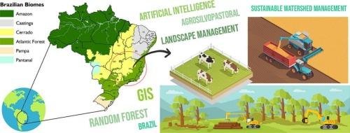
Land suitability modeling integrating geospatial data and artificial intelligence
Context
Sustainable agricultural practices are critical in a world grappling with climate change and pressure on natural resources. Unplanned agricultural expansion often harms ecosystems and the services they provide. Balancing food production with environmental protection demands sophisticated tools like spatial analysis and artificial intelligence to inform land-use decisions.
Objective
This study introduces an AI-driven process to assess land suitability for agrosilvopastoral systems, going beyond traditional methods by incorporating a broader spectrum of landscape characteristics. Our approach integrates climate, water resources, soil properties, morphological features, and accessibility to enhance the accuracy of suitability mapping.
Methods
We constructed a data cube comprising 100 geospatial layers representing diverse landscape attributes. Field observations from two watersheds in Minas Gerais, Brazil, were used to train and validate a Random Forest classification model. We evaluated the model's accuracy and quantified the influence of each attribute group on suitability determination.
Results
Integrating climate, water, edaphic, and morphological attributes significantly improved the model's accuracy and provided a more nuanced understanding of agrosilvopastoral suitability compared to using only soil class, lithology, and slope. Climate and edaphic variables emerged as key drivers of suitability. This approach identified a more constrained, yet potentially more sustainable, distribution of suitable land.
Significance
Our findings highlight the need to transition from conventional land suitability assessments towards more holistic, data-driven approaches that consider the complex interplay of environmental factors. This model offers a valuable tool for guiding sustainable land-use planning, potentially mitigating environmental impacts while optimizing agrosilvopastoral production.
求助全文
通过发布文献求助,成功后即可免费获取论文全文。
去求助
来源期刊
Agricultural Systems
农林科学-农业综合
CiteScore
13.30
自引率
7.60%
发文量
174
审稿时长
30 days
期刊介绍:
Agricultural Systems is an international journal that deals with interactions - among the components of agricultural systems, among hierarchical levels of agricultural systems, between agricultural and other land use systems, and between agricultural systems and their natural, social and economic environments.
The scope includes the development and application of systems analysis methodologies in the following areas:
Systems approaches in the sustainable intensification of agriculture; pathways for sustainable intensification; crop-livestock integration; farm-level resource allocation; quantification of benefits and trade-offs at farm to landscape levels; integrative, participatory and dynamic modelling approaches for qualitative and quantitative assessments of agricultural systems and decision making;
The interactions between agricultural and non-agricultural landscapes; the multiple services of agricultural systems; food security and the environment;
Global change and adaptation science; transformational adaptations as driven by changes in climate, policy, values and attitudes influencing the design of farming systems;
Development and application of farming systems design tools and methods for impact, scenario and case study analysis; managing the complexities of dynamic agricultural systems; innovation systems and multi stakeholder arrangements that support or promote change and (or) inform policy decisions.
 求助内容:
求助内容: 应助结果提醒方式:


