基于物联网传感器数据的多角度城市洪水灾害洞察力

IF 4.2 1区 地球科学 Q1 GEOSCIENCES, MULTIDISCIPLINARY
Dianchen Sun , Huimin Wang , Jing Huang , Weiqian Wang , Zehui Zhou , Weidong Huang
{"title":"基于物联网传感器数据的多角度城市洪水灾害洞察力","authors":"Dianchen Sun ,&nbsp;Huimin Wang ,&nbsp;Jing Huang ,&nbsp;Weiqian Wang ,&nbsp;Zehui Zhou ,&nbsp;Weidong Huang","doi":"10.1016/j.ijdrr.2024.104919","DOIUrl":null,"url":null,"abstract":"<div><div>Floods are major global natural disasters that cause significant damage. Analyzing urban flood hazards is essential for urban planning and sustainable development. The shift toward proactive urban disaster prevention requires expanding flood hazard assessments beyond flood depth to encompass a broader range of factors to enhance resilience. This study introduces a multiple perspective analysis of urban flood hazards based on internet of things (IoT) sensor data, such as maximum flood depth, total flood events, average drainage time, average accumulation efficiency and average drainage efficiency. This research assesses detailed flood hazards of urban areas and points of interest (POIs) and finds a significant difference of up to 14.6 % in extreme-hazard areas when multiple hazard indicators are used, with the maximum flood depth indicator showing the highest proportion. For medium-hazard areas, the total flood event indicator yielded the highest proportion, accounting for up to 35.7 % of the area. The findings also indicate that POI flood hazards vary significantly depending on the indicator. Medical facilities were found to have extended impacts due to prolonged water accumulation and drainage times, despite infrequent flooding, suggesting that many locations are subject to a moderate hazard level. The study also highlights the heightened hazard of residential buildings in extreme scenarios, underscoring the need for enhanced flood mitigation in residential planning. This study emphasizes adopting multiple perspectives in flood hazard assessment, challenging the traditional reliance on single metrics. This study provides valuable insights for urban planners and policy-makers and advocates for a holistic approach to urban flood risk.</div></div>","PeriodicalId":13915,"journal":{"name":"International journal of disaster risk reduction","volume":"114 ","pages":"Article 104919"},"PeriodicalIF":4.2000,"publicationDate":"2024-11-01","publicationTypes":"Journal Article","fieldsOfStudy":null,"isOpenAccess":false,"openAccessPdf":"","citationCount":"0","resultStr":"{\"title\":\"Urban flood hazard insights from multiple perspectives based on internet of things sensor data\",\"authors\":\"Dianchen Sun ,&nbsp;Huimin Wang ,&nbsp;Jing Huang ,&nbsp;Weiqian Wang ,&nbsp;Zehui Zhou ,&nbsp;Weidong Huang\",\"doi\":\"10.1016/j.ijdrr.2024.104919\",\"DOIUrl\":null,\"url\":null,\"abstract\":\"<div><div>Floods are major global natural disasters that cause significant damage. Analyzing urban flood hazards is essential for urban planning and sustainable development. The shift toward proactive urban disaster prevention requires expanding flood hazard assessments beyond flood depth to encompass a broader range of factors to enhance resilience. This study introduces a multiple perspective analysis of urban flood hazards based on internet of things (IoT) sensor data, such as maximum flood depth, total flood events, average drainage time, average accumulation efficiency and average drainage efficiency. This research assesses detailed flood hazards of urban areas and points of interest (POIs) and finds a significant difference of up to 14.6 % in extreme-hazard areas when multiple hazard indicators are used, with the maximum flood depth indicator showing the highest proportion. For medium-hazard areas, the total flood event indicator yielded the highest proportion, accounting for up to 35.7 % of the area. The findings also indicate that POI flood hazards vary significantly depending on the indicator. Medical facilities were found to have extended impacts due to prolonged water accumulation and drainage times, despite infrequent flooding, suggesting that many locations are subject to a moderate hazard level. The study also highlights the heightened hazard of residential buildings in extreme scenarios, underscoring the need for enhanced flood mitigation in residential planning. This study emphasizes adopting multiple perspectives in flood hazard assessment, challenging the traditional reliance on single metrics. This study provides valuable insights for urban planners and policy-makers and advocates for a holistic approach to urban flood risk.</div></div>\",\"PeriodicalId\":13915,\"journal\":{\"name\":\"International journal of disaster risk reduction\",\"volume\":\"114 \",\"pages\":\"Article 104919\"},\"PeriodicalIF\":4.2000,\"publicationDate\":\"2024-11-01\",\"publicationTypes\":\"Journal Article\",\"fieldsOfStudy\":null,\"isOpenAccess\":false,\"openAccessPdf\":\"\",\"citationCount\":\"0\",\"resultStr\":null,\"platform\":\"Semanticscholar\",\"paperid\":null,\"PeriodicalName\":\"International journal of disaster risk reduction\",\"FirstCategoryId\":\"89\",\"ListUrlMain\":\"https://www.sciencedirect.com/science/article/pii/S2212420924006812\",\"RegionNum\":1,\"RegionCategory\":\"地球科学\",\"ArticlePicture\":[],\"TitleCN\":null,\"AbstractTextCN\":null,\"PMCID\":null,\"EPubDate\":\"\",\"PubModel\":\"\",\"JCR\":\"Q1\",\"JCRName\":\"GEOSCIENCES, MULTIDISCIPLINARY\",\"Score\":null,\"Total\":0}","platform":"Semanticscholar","paperid":null,"PeriodicalName":"International journal of disaster risk reduction","FirstCategoryId":"89","ListUrlMain":"https://www.sciencedirect.com/science/article/pii/S2212420924006812","RegionNum":1,"RegionCategory":"地球科学","ArticlePicture":[],"TitleCN":null,"AbstractTextCN":null,"PMCID":null,"EPubDate":"","PubModel":"","JCR":"Q1","JCRName":"GEOSCIENCES, MULTIDISCIPLINARY","Score":null,"Total":0}
引用次数: 0

摘要

洪水是造成重大损失的全球性自然灾害。分析城市洪水灾害对城市规划和可持续发展至关重要。要实现积极主动的城市防灾转变,就必须将洪水危害评估扩展到洪水深度之外,以涵盖更广泛的因素,从而提高抗灾能力。本研究基于物联网(IoT)传感器数据,如最大洪水深度、洪水事件总数、平均排水时间、平均积水效率和平均排水效率,对城市洪水危害进行了多角度分析。这项研究详细评估了城市地区和兴趣点(POIs)的洪水危害,发现在使用多种危害指标时,极端危害地区的差异高达 14.6%,其中最大洪水深度指标所占比例最高。在中等灾害地区,总洪水事件指标所占比例最高,达 35.7%。研究结果还表明, POI 的洪水危害因指标的不同而有很大差异。研究发现,尽管洪水发生频率不高,但由于积水时间和排水时间较长,医疗设施受到的影响也较大,这表明许多地点的洪水危害程度处于中等水平。该研究还强调了住宅建筑在极端情况下的高度危险性,突出了在住宅规划中加强防洪减灾的必要性。本研究强调在洪水灾害评估中采用多种视角,对传统的单一指标依赖提出了挑战。本研究为城市规划者和政策制定者提供了宝贵的见解,并倡导采用综合方法来应对城市洪水风险。
本文章由计算机程序翻译,如有差异,请以英文原文为准。
Urban flood hazard insights from multiple perspectives based on internet of things sensor data
Floods are major global natural disasters that cause significant damage. Analyzing urban flood hazards is essential for urban planning and sustainable development. The shift toward proactive urban disaster prevention requires expanding flood hazard assessments beyond flood depth to encompass a broader range of factors to enhance resilience. This study introduces a multiple perspective analysis of urban flood hazards based on internet of things (IoT) sensor data, such as maximum flood depth, total flood events, average drainage time, average accumulation efficiency and average drainage efficiency. This research assesses detailed flood hazards of urban areas and points of interest (POIs) and finds a significant difference of up to 14.6 % in extreme-hazard areas when multiple hazard indicators are used, with the maximum flood depth indicator showing the highest proportion. For medium-hazard areas, the total flood event indicator yielded the highest proportion, accounting for up to 35.7 % of the area. The findings also indicate that POI flood hazards vary significantly depending on the indicator. Medical facilities were found to have extended impacts due to prolonged water accumulation and drainage times, despite infrequent flooding, suggesting that many locations are subject to a moderate hazard level. The study also highlights the heightened hazard of residential buildings in extreme scenarios, underscoring the need for enhanced flood mitigation in residential planning. This study emphasizes adopting multiple perspectives in flood hazard assessment, challenging the traditional reliance on single metrics. This study provides valuable insights for urban planners and policy-makers and advocates for a holistic approach to urban flood risk.
求助全文
通过发布文献求助,成功后即可免费获取论文全文。 去求助
来源期刊
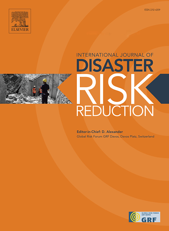
International journal of disaster risk reduction
International journal of disaster risk reduction GEOSCIENCES, MULTIDISCIPLINARYMETEOROLOGY-METEOROLOGY & ATMOSPHERIC SCIENCES
CiteScore
8.70
自引率
18.00%
发文量
688
审稿时长
79 days
期刊介绍: The International Journal of Disaster Risk Reduction (IJDRR) is the journal for researchers, policymakers and practitioners across diverse disciplines: earth sciences and their implications; environmental sciences; engineering; urban studies; geography; and the social sciences. IJDRR publishes fundamental and applied research, critical reviews, policy papers and case studies with a particular focus on multi-disciplinary research that aims to reduce the impact of natural, technological, social and intentional disasters. IJDRR stimulates exchange of ideas and knowledge transfer on disaster research, mitigation, adaptation, prevention and risk reduction at all geographical scales: local, national and international. Key topics:- -multifaceted disaster and cascading disasters -the development of disaster risk reduction strategies and techniques -discussion and development of effective warning and educational systems for risk management at all levels -disasters associated with climate change -vulnerability analysis and vulnerability trends -emerging risks -resilience against disasters. The journal particularly encourages papers that approach risk from a multi-disciplinary perspective.
×
引用
GB/T 7714-2015
复制
MLA
复制
APA
复制
导出至
BibTeX EndNote RefMan NoteFirst NoteExpress
×
提示
您的信息不完整,为了账户安全,请先补充。
现在去补充
×
提示
您因"违规操作"
具体请查看互助需知
我知道了
×
提示
确定
请完成安全验证×
copy
已复制链接
快去分享给好友吧!
我知道了
右上角分享
点击右上角分享
0
联系我们:info@booksci.cn Book学术提供免费学术资源搜索服务,方便国内外学者检索中英文文献。致力于提供最便捷和优质的服务体验。 Copyright © 2023 布克学术 All rights reserved.
京ICP备2023020795号-1
ghs 京公网安备 11010802042870号
Book学术文献互助
Book学术文献互助群
群 号:481959085
Book学术官方微信