用于评估沼泽生境退化和恢复的景观模型 SooSim

IF 5.8 2区 环境科学与生态学 Q1 ECOLOGY
Asko Lõhmus , Raido Kont , Triin Kaasiku , Marko Kohv , Tauri Arumäe , Ants Kaasik
{"title":"用于评估沼泽生境退化和恢复的景观模型 SooSim","authors":"Asko Lõhmus ,&nbsp;Raido Kont ,&nbsp;Triin Kaasiku ,&nbsp;Marko Kohv ,&nbsp;Tauri Arumäe ,&nbsp;Ants Kaasik","doi":"10.1016/j.ecoinf.2024.102844","DOIUrl":null,"url":null,"abstract":"<div><div>Open mires constitute a characteristic part of boreal natural landscapes, which is under various cumulative anthropogenic pressures. As a response, remaining mires are increasingly protected, and their degradation is addressed by ecological restoration (mostly drainage closure). To evaluate alternative environmental policies, there is a necessity for high-resolution landscape simulation models to assess future dynamics of mires under different management scenarios. We present such a model, <em>SooSim</em>, its R-script, and derivation and validation of its key parameters. <em>SooSim</em> iterates mire types and woody encroachment dynamics within 25 × 25 m grid at 1-year intervals. Management interventions (restoration; ditch renovation) are sequentially introduced based on priority rules in locations delineated prior to simulation. We applied <em>SooSim</em> to three management scenarios, compared with natural succession, until 2050 in Estonia. The ‘current’ (2022) database comprised &gt;3.8 M mire pixels and &gt; 7 M peatland-forest pixels (sparse-cover ones considered for mire restoration). The model parameterization, based on Lidar data, revealed rapid ongoing woody encroachment across all mire types, with significant positive feedback. The simulations revealed that, even in scenarios with intensive restoration (2500 ha annually), open mire conditions are reduced by &gt;10 % until 2050, while few mire types lose &gt;1 % in area. Ditch renovations mostly reduced restoration perspectives in currently forested peatlands. Thus, <em>SooSim</em> explicitly depicts a decision-making dilemma where mire restoration is time-sensitive but also uncertain. To address this and related land-use dilemmas in the environmental policy, landscape models such as <em>SooSim</em> have further importance as visualization tools to explain complex processes to a wide range of stakeholders.</div></div>","PeriodicalId":51024,"journal":{"name":"Ecological Informatics","volume":null,"pages":null},"PeriodicalIF":5.8000,"publicationDate":"2024-10-04","publicationTypes":"Journal Article","fieldsOfStudy":null,"isOpenAccess":false,"openAccessPdf":"","citationCount":"0","resultStr":"{\"title\":\"SooSim, a landscape model for assessing mire habitat degradation and restoration\",\"authors\":\"Asko Lõhmus ,&nbsp;Raido Kont ,&nbsp;Triin Kaasiku ,&nbsp;Marko Kohv ,&nbsp;Tauri Arumäe ,&nbsp;Ants Kaasik\",\"doi\":\"10.1016/j.ecoinf.2024.102844\",\"DOIUrl\":null,\"url\":null,\"abstract\":\"<div><div>Open mires constitute a characteristic part of boreal natural landscapes, which is under various cumulative anthropogenic pressures. As a response, remaining mires are increasingly protected, and their degradation is addressed by ecological restoration (mostly drainage closure). To evaluate alternative environmental policies, there is a necessity for high-resolution landscape simulation models to assess future dynamics of mires under different management scenarios. We present such a model, <em>SooSim</em>, its R-script, and derivation and validation of its key parameters. <em>SooSim</em> iterates mire types and woody encroachment dynamics within 25 × 25 m grid at 1-year intervals. Management interventions (restoration; ditch renovation) are sequentially introduced based on priority rules in locations delineated prior to simulation. We applied <em>SooSim</em> to three management scenarios, compared with natural succession, until 2050 in Estonia. The ‘current’ (2022) database comprised &gt;3.8 M mire pixels and &gt; 7 M peatland-forest pixels (sparse-cover ones considered for mire restoration). The model parameterization, based on Lidar data, revealed rapid ongoing woody encroachment across all mire types, with significant positive feedback. The simulations revealed that, even in scenarios with intensive restoration (2500 ha annually), open mire conditions are reduced by &gt;10 % until 2050, while few mire types lose &gt;1 % in area. Ditch renovations mostly reduced restoration perspectives in currently forested peatlands. Thus, <em>SooSim</em> explicitly depicts a decision-making dilemma where mire restoration is time-sensitive but also uncertain. To address this and related land-use dilemmas in the environmental policy, landscape models such as <em>SooSim</em> have further importance as visualization tools to explain complex processes to a wide range of stakeholders.</div></div>\",\"PeriodicalId\":51024,\"journal\":{\"name\":\"Ecological Informatics\",\"volume\":null,\"pages\":null},\"PeriodicalIF\":5.8000,\"publicationDate\":\"2024-10-04\",\"publicationTypes\":\"Journal Article\",\"fieldsOfStudy\":null,\"isOpenAccess\":false,\"openAccessPdf\":\"\",\"citationCount\":\"0\",\"resultStr\":null,\"platform\":\"Semanticscholar\",\"paperid\":null,\"PeriodicalName\":\"Ecological Informatics\",\"FirstCategoryId\":\"93\",\"ListUrlMain\":\"https://www.sciencedirect.com/science/article/pii/S1574954124003868\",\"RegionNum\":2,\"RegionCategory\":\"环境科学与生态学\",\"ArticlePicture\":[],\"TitleCN\":null,\"AbstractTextCN\":null,\"PMCID\":null,\"EPubDate\":\"\",\"PubModel\":\"\",\"JCR\":\"Q1\",\"JCRName\":\"ECOLOGY\",\"Score\":null,\"Total\":0}","platform":"Semanticscholar","paperid":null,"PeriodicalName":"Ecological Informatics","FirstCategoryId":"93","ListUrlMain":"https://www.sciencedirect.com/science/article/pii/S1574954124003868","RegionNum":2,"RegionCategory":"环境科学与生态学","ArticlePicture":[],"TitleCN":null,"AbstractTextCN":null,"PMCID":null,"EPubDate":"","PubModel":"","JCR":"Q1","JCRName":"ECOLOGY","Score":null,"Total":0}
引用次数: 0

摘要

裸露的沼泽是北方自然景观的一个特色部分,它承受着各种累积的人为压力。作为应对措施,剩余的沼泽地越来越多地受到保护,并通过生态恢复(主要是关闭排水系统)来解决其退化问题。为了评估其他环境政策,有必要建立高分辨率的景观模拟模型,以评估不同管理方案下未来的沼泽动态。我们将介绍这样一个模型 SooSim 及其 R 脚本,并对其关键参数进行推导和验证。SooSim 以 1 年为间隔,在 25 × 25 米的网格内迭代沼泽类型和林木侵占动态。管理干预措施(恢复;沟渠翻新)将根据优先规则在模拟前划定的位置依次引入。我们将 SooSim 应用于三种管理方案,并与爱沙尼亚 2050 年前的自然演替进行了比较。当前"(2022 年)数据库包括 380 万个沼泽像素和 700 万个泥炭地-森林像素(考虑用于沼泽恢复的稀疏覆盖像素)。基于激光雷达数据的模型参数化显示,所有类型的沼泽地都在迅速被林木侵占,并产生了显著的正反馈。模拟结果表明,即使在密集恢复(每年 2500 公顷)的情况下,开放沼泽的面积在 2050 年前也会减少 10%,而少数沼泽类型的面积会减少 1%。沟渠改造主要减少了当前森林泥炭地的恢复前景。因此,SooSim 明确描述了一种决策困境,即泥沼恢复具有时间敏感性和不确定性。为了解决环境政策中的这一问题以及相关的土地利用困境,SooSim 等景观模型作为向广泛的利益相关者解释复杂过程的可视化工具,具有更加重要的意义。
本文章由计算机程序翻译,如有差异,请以英文原文为准。

SooSim, a landscape model for assessing mire habitat degradation and restoration

SooSim, a landscape model for assessing mire habitat degradation and restoration
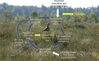
Open mires constitute a characteristic part of boreal natural landscapes, which is under various cumulative anthropogenic pressures. As a response, remaining mires are increasingly protected, and their degradation is addressed by ecological restoration (mostly drainage closure). To evaluate alternative environmental policies, there is a necessity for high-resolution landscape simulation models to assess future dynamics of mires under different management scenarios. We present such a model, SooSim, its R-script, and derivation and validation of its key parameters. SooSim iterates mire types and woody encroachment dynamics within 25 × 25 m grid at 1-year intervals. Management interventions (restoration; ditch renovation) are sequentially introduced based on priority rules in locations delineated prior to simulation. We applied SooSim to three management scenarios, compared with natural succession, until 2050 in Estonia. The ‘current’ (2022) database comprised >3.8 M mire pixels and > 7 M peatland-forest pixels (sparse-cover ones considered for mire restoration). The model parameterization, based on Lidar data, revealed rapid ongoing woody encroachment across all mire types, with significant positive feedback. The simulations revealed that, even in scenarios with intensive restoration (2500 ha annually), open mire conditions are reduced by >10 % until 2050, while few mire types lose >1 % in area. Ditch renovations mostly reduced restoration perspectives in currently forested peatlands. Thus, SooSim explicitly depicts a decision-making dilemma where mire restoration is time-sensitive but also uncertain. To address this and related land-use dilemmas in the environmental policy, landscape models such as SooSim have further importance as visualization tools to explain complex processes to a wide range of stakeholders.
求助全文
通过发布文献求助,成功后即可免费获取论文全文。 去求助
来源期刊
Ecological Informatics
Ecological Informatics 环境科学-生态学
CiteScore
8.30
自引率
11.80%
发文量
346
审稿时长
46 days
期刊介绍: The journal Ecological Informatics is devoted to the publication of high quality, peer-reviewed articles on all aspects of computational ecology, data science and biogeography. The scope of the journal takes into account the data-intensive nature of ecology, the growing capacity of information technology to access, harness and leverage complex data as well as the critical need for informing sustainable management in view of global environmental and climate change. The nature of the journal is interdisciplinary at the crossover between ecology and informatics. It focuses on novel concepts and techniques for image- and genome-based monitoring and interpretation, sensor- and multimedia-based data acquisition, internet-based data archiving and sharing, data assimilation, modelling and prediction of ecological data.
×
引用
GB/T 7714-2015
复制
MLA
复制
APA
复制
导出至
BibTeX EndNote RefMan NoteFirst NoteExpress
×
提示
您的信息不完整,为了账户安全,请先补充。
现在去补充
×
提示
您因"违规操作"
具体请查看互助需知
我知道了
×
提示
确定
请完成安全验证×
copy
已复制链接
快去分享给好友吧!
我知道了
右上角分享
点击右上角分享
0
联系我们:info@booksci.cn Book学术提供免费学术资源搜索服务,方便国内外学者检索中英文文献。致力于提供最便捷和优质的服务体验。 Copyright © 2023 布克学术 All rights reserved.
京ICP备2023020795号-1
ghs 京公网安备 11010802042870号
Book学术文献互助
Book学术文献互助群
群 号:481959085
Book学术官方微信