凯尔盖朗群岛库克冰盖表峡湾全新世晚期亚南极冰川变化记录

IF 3.2 1区 地球科学 Q1 GEOGRAPHY, PHYSICAL
Léo Chassiot , Emmanuel Chapron , Elisabeth Michel , Vincent Jomelli , Vincent Favier , Deborah Verfaillie , Anthony Foucher , Joanna Charton , Martine Paterne , Nathalie Van der Putten
{"title":"凯尔盖朗群岛库克冰盖表峡湾全新世晚期亚南极冰川变化记录","authors":"Léo Chassiot ,&nbsp;Emmanuel Chapron ,&nbsp;Elisabeth Michel ,&nbsp;Vincent Jomelli ,&nbsp;Vincent Favier ,&nbsp;Deborah Verfaillie ,&nbsp;Anthony Foucher ,&nbsp;Joanna Charton ,&nbsp;Martine Paterne ,&nbsp;Nathalie Van der Putten","doi":"10.1016/j.quascirev.2024.108980","DOIUrl":null,"url":null,"abstract":"<div><div>The subantarctic islands between 40 and 60°S are circum-polar landmasses influenced by the southern westerly wind (SWW) belt whose latitudinal shifts are driven by the Southern Annular Mode (SAM) over decadal timescales. In the Indian sector of the Southern Ocean, the Kerguelen Islands (49°S) form a volcanic archipelago that is home to the Cook Ice Cap (CIC). Atmospheric drying favored by a poleward migration of the SWW induced a dramatic shrinkage of the CIC over the past 50 years. Current knowledge of how this decline compares with the natural variability of the CIC is unclear and based exclusively on geomorphological records with limited temporal resolution. This paper introduces a 4 kyr marine record built from a transect of giant piston cores collected in Table Fjord, southwestern margin of the CIC. Interpretation of sedimentary and geochemical proxies is supported by statistical correlations with the CIC surface mass balance on the instrumental timescale, and by the age overlapping with dated landforms and deposits over the last two millennia. High-resolution geochronological data (<sup>137</sup>Cs and <sup>210</sup>Pb inventories along with 63 AMS <sup>14</sup>C dates) corrected from a local marine reservoir age allowed reconstructing glacier variability at a multidecadal resolution. The CIC was paced by periods of glacial advances at 3.4–2.8, 2.3–1.7, and 1.35–1.15 ka cal BP, followed by a two-stage ‘Little Ice Age’ maximum between 0.7 ka cal BP and the early 20th century. Comparison with paleoenvironmental records from the subantarctic fringe zone and the southern mid-latitudes suggests SWW-driven precipitation (wetter and windier conditions) were the main driver of centennial-scale glacier variability in the Kerguelen Islands, notably after 2.3 ka cal BP. The Kerguelen record thereby supports a zonally-synchronous, hemispheric-wide SWW pattern pacing Southern Ocean climatic variability in a SAM-like mode. The Little Ice Age maximum ice extent results from the coincidence of cold conditions caused by an equatorward shift of the Polar Front, an oceanic front bordering the Kerguelen archipelago resulting in lower sea surface temperatures, together with wetter conditions favored by strengthened SWW.</div></div>","PeriodicalId":20926,"journal":{"name":"Quaternary Science Reviews","volume":"344 ","pages":"Article 108980"},"PeriodicalIF":3.2000,"publicationDate":"2024-09-28","publicationTypes":"Journal Article","fieldsOfStudy":null,"isOpenAccess":false,"openAccessPdf":"","citationCount":"0","resultStr":"{\"title\":\"Late Holocene record of subantarctic glacier variability in Table Fjord, Cook Ice Cap, Kerguelen Islands\",\"authors\":\"Léo Chassiot ,&nbsp;Emmanuel Chapron ,&nbsp;Elisabeth Michel ,&nbsp;Vincent Jomelli ,&nbsp;Vincent Favier ,&nbsp;Deborah Verfaillie ,&nbsp;Anthony Foucher ,&nbsp;Joanna Charton ,&nbsp;Martine Paterne ,&nbsp;Nathalie Van der Putten\",\"doi\":\"10.1016/j.quascirev.2024.108980\",\"DOIUrl\":null,\"url\":null,\"abstract\":\"<div><div>The subantarctic islands between 40 and 60°S are circum-polar landmasses influenced by the southern westerly wind (SWW) belt whose latitudinal shifts are driven by the Southern Annular Mode (SAM) over decadal timescales. In the Indian sector of the Southern Ocean, the Kerguelen Islands (49°S) form a volcanic archipelago that is home to the Cook Ice Cap (CIC). Atmospheric drying favored by a poleward migration of the SWW induced a dramatic shrinkage of the CIC over the past 50 years. Current knowledge of how this decline compares with the natural variability of the CIC is unclear and based exclusively on geomorphological records with limited temporal resolution. This paper introduces a 4 kyr marine record built from a transect of giant piston cores collected in Table Fjord, southwestern margin of the CIC. Interpretation of sedimentary and geochemical proxies is supported by statistical correlations with the CIC surface mass balance on the instrumental timescale, and by the age overlapping with dated landforms and deposits over the last two millennia. High-resolution geochronological data (<sup>137</sup>Cs and <sup>210</sup>Pb inventories along with 63 AMS <sup>14</sup>C dates) corrected from a local marine reservoir age allowed reconstructing glacier variability at a multidecadal resolution. The CIC was paced by periods of glacial advances at 3.4–2.8, 2.3–1.7, and 1.35–1.15 ka cal BP, followed by a two-stage ‘Little Ice Age’ maximum between 0.7 ka cal BP and the early 20th century. Comparison with paleoenvironmental records from the subantarctic fringe zone and the southern mid-latitudes suggests SWW-driven precipitation (wetter and windier conditions) were the main driver of centennial-scale glacier variability in the Kerguelen Islands, notably after 2.3 ka cal BP. The Kerguelen record thereby supports a zonally-synchronous, hemispheric-wide SWW pattern pacing Southern Ocean climatic variability in a SAM-like mode. The Little Ice Age maximum ice extent results from the coincidence of cold conditions caused by an equatorward shift of the Polar Front, an oceanic front bordering the Kerguelen archipelago resulting in lower sea surface temperatures, together with wetter conditions favored by strengthened SWW.</div></div>\",\"PeriodicalId\":20926,\"journal\":{\"name\":\"Quaternary Science Reviews\",\"volume\":\"344 \",\"pages\":\"Article 108980\"},\"PeriodicalIF\":3.2000,\"publicationDate\":\"2024-09-28\",\"publicationTypes\":\"Journal Article\",\"fieldsOfStudy\":null,\"isOpenAccess\":false,\"openAccessPdf\":\"\",\"citationCount\":\"0\",\"resultStr\":null,\"platform\":\"Semanticscholar\",\"paperid\":null,\"PeriodicalName\":\"Quaternary Science Reviews\",\"FirstCategoryId\":\"89\",\"ListUrlMain\":\"https://www.sciencedirect.com/science/article/pii/S0277379124004815\",\"RegionNum\":1,\"RegionCategory\":\"地球科学\",\"ArticlePicture\":[],\"TitleCN\":null,\"AbstractTextCN\":null,\"PMCID\":null,\"EPubDate\":\"\",\"PubModel\":\"\",\"JCR\":\"Q1\",\"JCRName\":\"GEOGRAPHY, PHYSICAL\",\"Score\":null,\"Total\":0}","platform":"Semanticscholar","paperid":null,"PeriodicalName":"Quaternary Science Reviews","FirstCategoryId":"89","ListUrlMain":"https://www.sciencedirect.com/science/article/pii/S0277379124004815","RegionNum":1,"RegionCategory":"地球科学","ArticlePicture":[],"TitleCN":null,"AbstractTextCN":null,"PMCID":null,"EPubDate":"","PubModel":"","JCR":"Q1","JCRName":"GEOGRAPHY, PHYSICAL","Score":null,"Total":0}
引用次数: 0

摘要

南纬 40 至 60 度之间的亚南极岛屿是受南西风带影响的环极地陆地,其纬度变化是由南环带模式(SAM)在十年时间尺度上驱动的。在南大洋的印度洋部分,凯尔盖朗群岛(南纬 49 度)是一个火山群岛,也是库克冰帽(CIC)的所在地。在过去的 50 年里,西南气旋向极地移动造成大气干燥,导致库克冰帽急剧缩小。目前,人们对这一缩减与库克冰帽自然变化之间的关系尚不清楚,而且这种了解完全基于时间分辨率有限的地貌记录。本文介绍了从中欧和东欧大陆西南边缘表峡湾采集的巨型活塞岩芯横断面上建立的 4 千年海洋记录。沉积和地球化学代用指标的解释得到了仪器时间尺度上与中海地表质量平衡的统计相关性,以及与过去两千年的地貌和沉积物年代重叠的支持。根据当地海洋储层年龄校正的高分辨率地质年代数据(137Cs 和 210Pb 库存以及 63 个 AMS 14C 日期)可以重建十年级分辨率的冰川变化。CIC 期间的冰川推进期分别为公元前 3.4-2.8 年、2.3-1.7 年和 1.35-1.15 ka 年,随后是公元前 0.7 ka 年至 20 世纪初的两段 "小冰河时期"。与亚南极边缘地带和中纬度南部的古环境记录比较表明,西南风驱动的降水(更潮湿、风力更大的条件)是凯尔盖朗群岛百年尺度冰川变化的主要驱动力,尤其是在 2.3 ka cal BP 之后。因此,凯尔盖朗岛的记录支持了一种分区同步、全半球范围的西南风模式,它以类似于 SAM 的模式引导着南大洋的气候变迁。小冰河时期的最大冰冻范围是由于极地前线(凯尔盖朗群岛附近的海洋前线,导致海面温度较低)向赤道偏移所造成的寒冷条件与西南风增强所带来的潮湿条件共同作用的结果。
本文章由计算机程序翻译,如有差异,请以英文原文为准。
Late Holocene record of subantarctic glacier variability in Table Fjord, Cook Ice Cap, Kerguelen Islands
The subantarctic islands between 40 and 60°S are circum-polar landmasses influenced by the southern westerly wind (SWW) belt whose latitudinal shifts are driven by the Southern Annular Mode (SAM) over decadal timescales. In the Indian sector of the Southern Ocean, the Kerguelen Islands (49°S) form a volcanic archipelago that is home to the Cook Ice Cap (CIC). Atmospheric drying favored by a poleward migration of the SWW induced a dramatic shrinkage of the CIC over the past 50 years. Current knowledge of how this decline compares with the natural variability of the CIC is unclear and based exclusively on geomorphological records with limited temporal resolution. This paper introduces a 4 kyr marine record built from a transect of giant piston cores collected in Table Fjord, southwestern margin of the CIC. Interpretation of sedimentary and geochemical proxies is supported by statistical correlations with the CIC surface mass balance on the instrumental timescale, and by the age overlapping with dated landforms and deposits over the last two millennia. High-resolution geochronological data (137Cs and 210Pb inventories along with 63 AMS 14C dates) corrected from a local marine reservoir age allowed reconstructing glacier variability at a multidecadal resolution. The CIC was paced by periods of glacial advances at 3.4–2.8, 2.3–1.7, and 1.35–1.15 ka cal BP, followed by a two-stage ‘Little Ice Age’ maximum between 0.7 ka cal BP and the early 20th century. Comparison with paleoenvironmental records from the subantarctic fringe zone and the southern mid-latitudes suggests SWW-driven precipitation (wetter and windier conditions) were the main driver of centennial-scale glacier variability in the Kerguelen Islands, notably after 2.3 ka cal BP. The Kerguelen record thereby supports a zonally-synchronous, hemispheric-wide SWW pattern pacing Southern Ocean climatic variability in a SAM-like mode. The Little Ice Age maximum ice extent results from the coincidence of cold conditions caused by an equatorward shift of the Polar Front, an oceanic front bordering the Kerguelen archipelago resulting in lower sea surface temperatures, together with wetter conditions favored by strengthened SWW.
求助全文
通过发布文献求助,成功后即可免费获取论文全文。 去求助
来源期刊
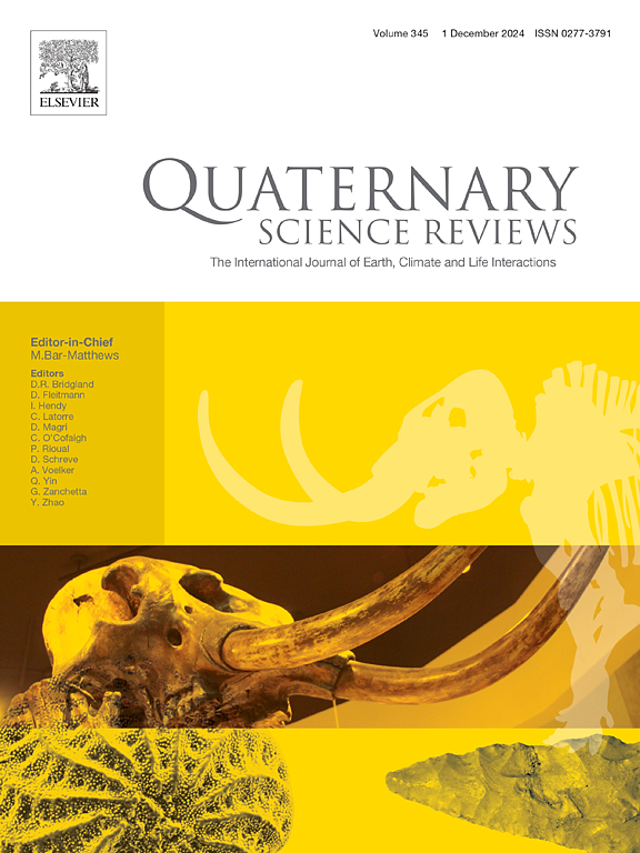
Quaternary Science Reviews
Quaternary Science Reviews 地学-地球科学综合
CiteScore
7.50
自引率
15.00%
发文量
388
审稿时长
3 months
期刊介绍: Quaternary Science Reviews caters for all aspects of Quaternary science, and includes, for example, geology, geomorphology, geography, archaeology, soil science, palaeobotany, palaeontology, palaeoclimatology and the full range of applicable dating methods. The dividing line between what constitutes the review paper and one which contains new original data is not easy to establish, so QSR also publishes papers with new data especially if these perform a review function. All the Quaternary sciences are changing rapidly and subject to re-evaluation as the pace of discovery quickens; thus the diverse but comprehensive role of Quaternary Science Reviews keeps readers abreast of the wider issues relating to new developments in the field.
×
引用
GB/T 7714-2015
复制
MLA
复制
APA
复制
导出至
BibTeX EndNote RefMan NoteFirst NoteExpress
×
提示
您的信息不完整,为了账户安全,请先补充。
现在去补充
×
提示
您因"违规操作"
具体请查看互助需知
我知道了
×
提示
确定
请完成安全验证×
copy
已复制链接
快去分享给好友吧!
我知道了
右上角分享
点击右上角分享
0
联系我们:info@booksci.cn Book学术提供免费学术资源搜索服务,方便国内外学者检索中英文文献。致力于提供最便捷和优质的服务体验。 Copyright © 2023 布克学术 All rights reserved.
京ICP备2023020795号-1
ghs 京公网安备 11010802042870号
Book学术文献互助
Book学术文献互助群
群 号:481959085
Book学术官方微信