{"title":"利用土地信息系统分析历史上土地覆盖变化对印度地区地表特征的影响","authors":"Vibin Jose, Anantharaman Chandrasekar, Suraj Reddy Rodda","doi":"10.1007/s00024-024-03523-y","DOIUrl":null,"url":null,"abstract":"<div><p>The present study has employed a regional Land Surface Model (LSM) to investigate the impact of historical land cover changes on land surface characteristics over the Indian subcontinent for the period of 1930–2013. Four simulations that include a control run and three experiment runs are performed with the Noah 3.6 LSM within the Land Information System (LIS). In the present study, the Noah LSM is driven by meteorological forcings, with radiation data obtained from the Global Data Assimilation System (GDAS) and the rainfall data obtained from IMD gridded rainfall data. The control run is performed with a MODIS-IGBP land cover map, while the three experimental runs are performed with three different potential land cover maps for the years 1930, 1975, and 2013. The potential land cover maps for the above three simulations are developed by blending the MODIS-IGBP data set with the fractional forest cover data set; the latter data is available for the years 1930, 1975, and 2013. Results indicate that the historical land cover change (1930 to 2013) has reduced the annual mean of latent heat flux and net surface heat flux over the Indian domain by <span>\\(-\\)</span>24.74 <span>\\(W/m^2\\)</span> and <span>\\(-\\)</span>14.18 <span>\\(W/m^2\\)</span> respectively, while the sensible heat flux and the soil temperature has increased by 4.97 <span>\\(W/m^2\\)</span> and 2.78 K. The annual mean change in latent heat flux, sensible heat flux, and soil temperature demonstrate that the largest changes occur when the land cover changes from forest to urban land as compared to forest to cropland, forest to grassland and forest to open shrubland. The annual mean change in latent heat flux is moderately large for the land cover change from forest to open shrubland when compared to forest to grassland and forest to cropland. The above is attributed to the effects of evapotranspiration, which has high values for the cropland followed by grassland and open shrubland. Furthermore, the triple collocation method is employed to assess the impact of historical land cover change on soil moisture. Results indicate that the triple collocation method effectively demonstrates the impact of land cover change on soil moisture.</p></div>","PeriodicalId":21078,"journal":{"name":"pure and applied geophysics","volume":"181 8","pages":"2561 - 2588"},"PeriodicalIF":1.9000,"publicationDate":"2024-07-05","publicationTypes":"Journal Article","fieldsOfStudy":null,"isOpenAccess":false,"openAccessPdf":"","citationCount":"0","resultStr":"{\"title\":\"Impact of Historical Land Cover Changes on Land Surface Characteristics over the Indian Region Using Land Information System\",\"authors\":\"Vibin Jose, Anantharaman Chandrasekar, Suraj Reddy Rodda\",\"doi\":\"10.1007/s00024-024-03523-y\",\"DOIUrl\":null,\"url\":null,\"abstract\":\"<div><p>The present study has employed a regional Land Surface Model (LSM) to investigate the impact of historical land cover changes on land surface characteristics over the Indian subcontinent for the period of 1930–2013. Four simulations that include a control run and three experiment runs are performed with the Noah 3.6 LSM within the Land Information System (LIS). In the present study, the Noah LSM is driven by meteorological forcings, with radiation data obtained from the Global Data Assimilation System (GDAS) and the rainfall data obtained from IMD gridded rainfall data. The control run is performed with a MODIS-IGBP land cover map, while the three experimental runs are performed with three different potential land cover maps for the years 1930, 1975, and 2013. The potential land cover maps for the above three simulations are developed by blending the MODIS-IGBP data set with the fractional forest cover data set; the latter data is available for the years 1930, 1975, and 2013. Results indicate that the historical land cover change (1930 to 2013) has reduced the annual mean of latent heat flux and net surface heat flux over the Indian domain by <span>\\\\(-\\\\)</span>24.74 <span>\\\\(W/m^2\\\\)</span> and <span>\\\\(-\\\\)</span>14.18 <span>\\\\(W/m^2\\\\)</span> respectively, while the sensible heat flux and the soil temperature has increased by 4.97 <span>\\\\(W/m^2\\\\)</span> and 2.78 K. The annual mean change in latent heat flux, sensible heat flux, and soil temperature demonstrate that the largest changes occur when the land cover changes from forest to urban land as compared to forest to cropland, forest to grassland and forest to open shrubland. The annual mean change in latent heat flux is moderately large for the land cover change from forest to open shrubland when compared to forest to grassland and forest to cropland. The above is attributed to the effects of evapotranspiration, which has high values for the cropland followed by grassland and open shrubland. Furthermore, the triple collocation method is employed to assess the impact of historical land cover change on soil moisture. Results indicate that the triple collocation method effectively demonstrates the impact of land cover change on soil moisture.</p></div>\",\"PeriodicalId\":21078,\"journal\":{\"name\":\"pure and applied geophysics\",\"volume\":\"181 8\",\"pages\":\"2561 - 2588\"},\"PeriodicalIF\":1.9000,\"publicationDate\":\"2024-07-05\",\"publicationTypes\":\"Journal Article\",\"fieldsOfStudy\":null,\"isOpenAccess\":false,\"openAccessPdf\":\"\",\"citationCount\":\"0\",\"resultStr\":null,\"platform\":\"Semanticscholar\",\"paperid\":null,\"PeriodicalName\":\"pure and applied geophysics\",\"FirstCategoryId\":\"89\",\"ListUrlMain\":\"https://link.springer.com/article/10.1007/s00024-024-03523-y\",\"RegionNum\":4,\"RegionCategory\":\"地球科学\",\"ArticlePicture\":[],\"TitleCN\":null,\"AbstractTextCN\":null,\"PMCID\":null,\"EPubDate\":\"\",\"PubModel\":\"\",\"JCR\":\"Q2\",\"JCRName\":\"GEOCHEMISTRY & GEOPHYSICS\",\"Score\":null,\"Total\":0}","platform":"Semanticscholar","paperid":null,"PeriodicalName":"pure and applied geophysics","FirstCategoryId":"89","ListUrlMain":"https://link.springer.com/article/10.1007/s00024-024-03523-y","RegionNum":4,"RegionCategory":"地球科学","ArticlePicture":[],"TitleCN":null,"AbstractTextCN":null,"PMCID":null,"EPubDate":"","PubModel":"","JCR":"Q2","JCRName":"GEOCHEMISTRY & GEOPHYSICS","Score":null,"Total":0}
Impact of Historical Land Cover Changes on Land Surface Characteristics over the Indian Region Using Land Information System
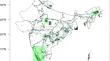
The present study has employed a regional Land Surface Model (LSM) to investigate the impact of historical land cover changes on land surface characteristics over the Indian subcontinent for the period of 1930–2013. Four simulations that include a control run and three experiment runs are performed with the Noah 3.6 LSM within the Land Information System (LIS). In the present study, the Noah LSM is driven by meteorological forcings, with radiation data obtained from the Global Data Assimilation System (GDAS) and the rainfall data obtained from IMD gridded rainfall data. The control run is performed with a MODIS-IGBP land cover map, while the three experimental runs are performed with three different potential land cover maps for the years 1930, 1975, and 2013. The potential land cover maps for the above three simulations are developed by blending the MODIS-IGBP data set with the fractional forest cover data set; the latter data is available for the years 1930, 1975, and 2013. Results indicate that the historical land cover change (1930 to 2013) has reduced the annual mean of latent heat flux and net surface heat flux over the Indian domain by \(-\)24.74 \(W/m^2\) and \(-\)14.18 \(W/m^2\) respectively, while the sensible heat flux and the soil temperature has increased by 4.97 \(W/m^2\) and 2.78 K. The annual mean change in latent heat flux, sensible heat flux, and soil temperature demonstrate that the largest changes occur when the land cover changes from forest to urban land as compared to forest to cropland, forest to grassland and forest to open shrubland. The annual mean change in latent heat flux is moderately large for the land cover change from forest to open shrubland when compared to forest to grassland and forest to cropland. The above is attributed to the effects of evapotranspiration, which has high values for the cropland followed by grassland and open shrubland. Furthermore, the triple collocation method is employed to assess the impact of historical land cover change on soil moisture. Results indicate that the triple collocation method effectively demonstrates the impact of land cover change on soil moisture.
期刊介绍:
pure and applied geophysics (pageoph), a continuation of the journal "Geofisica pura e applicata", publishes original scientific contributions in the fields of solid Earth, atmospheric and oceanic sciences. Regular and special issues feature thought-provoking reports on active areas of current research and state-of-the-art surveys.
Long running journal, founded in 1939 as Geofisica pura e applicata
Publishes peer-reviewed original scientific contributions and state-of-the-art surveys in solid earth and atmospheric sciences
Features thought-provoking reports on active areas of current research and is a major source for publications on tsunami research
Coverage extends to research topics in oceanic sciences
See Instructions for Authors on the right hand side.

 求助内容:
求助内容: 应助结果提醒方式:


