{"title":"为孟加拉国达卡大都市发展计划(DMDP)地区绘制基于 SPT-N60 和 USCS 的土壤类型区划图","authors":"Md. Shafiqur Rahman, Mehedi Ahmed Ansary","doi":"10.1007/s12517-024-11998-1","DOIUrl":null,"url":null,"abstract":"<p>This research paper has presented Unified Soil Classification System (USCS)–based soil type and Standard Penetration Test (SPT) N<sub>60</sub>–based zonation maps in the Dhaka Metropolitan Development Plan (DMDP) area of Bangladesh. For this purpose, 360 borehole data have been collected from different parts of the DMDP area. The data were analyzed in ArcGIS 10.5 using Ordinary Kriging and Inverse Distance Weighting (IDW) interpolation techniques. The spatial Analyst, Ordinary Kriging method, has demonstrated better results for SPT-N<sub>60</sub>-based, and IDW has provided superior outcomes of the USCS-based soil type zonation maps. This study has developed 13 SPT-N<sub>60</sub>-based and USCS soil-type zonation maps for the DMDP area at 1.5 to 19.5 m depth. To assess the reliability of the zonation map, SPT-N<sub>60</sub> values and USCS soil classification, acquired through field tests at 10 locations (depths: 1.5 to 19.5 m), were compared with anticipated SPT-N<sub>60</sub> values and USCS soil type at exact coordinates in the developed zonation maps. The root mean square error (RMSE) for the SPT-N<sub>60</sub> zonation maps was 8.29 blows, and the coefficient of determination (<i>R</i><sup>2</sup>) was 0.688. The comparison shows a correlation coefficient of 0.82. For USCS soil-type zonation maps, 55.81% of the field-validated data fully matched the model-anticipated USCS zonation maps data. The generated zonation maps in this research will help to understand the subsurface condition and geotechnical characteristics of soils in the DMDP area. This data will also help engineers to create an initial foundation layout for a new site using the existing data from the nearby locations.</p>","PeriodicalId":476,"journal":{"name":"Arabian Journal of Geosciences","volume":null,"pages":null},"PeriodicalIF":1.8270,"publicationDate":"2024-05-25","publicationTypes":"Journal Article","fieldsOfStudy":null,"isOpenAccess":false,"openAccessPdf":"","citationCount":"0","resultStr":"{\"title\":\"Development of SPT-N60 and USCS-based soil type zonation maps for Dhaka Metropolitan Development Plan (DMDP) Area, Bangladesh\",\"authors\":\"Md. Shafiqur Rahman, Mehedi Ahmed Ansary\",\"doi\":\"10.1007/s12517-024-11998-1\",\"DOIUrl\":null,\"url\":null,\"abstract\":\"<p>This research paper has presented Unified Soil Classification System (USCS)–based soil type and Standard Penetration Test (SPT) N<sub>60</sub>–based zonation maps in the Dhaka Metropolitan Development Plan (DMDP) area of Bangladesh. For this purpose, 360 borehole data have been collected from different parts of the DMDP area. The data were analyzed in ArcGIS 10.5 using Ordinary Kriging and Inverse Distance Weighting (IDW) interpolation techniques. The spatial Analyst, Ordinary Kriging method, has demonstrated better results for SPT-N<sub>60</sub>-based, and IDW has provided superior outcomes of the USCS-based soil type zonation maps. This study has developed 13 SPT-N<sub>60</sub>-based and USCS soil-type zonation maps for the DMDP area at 1.5 to 19.5 m depth. To assess the reliability of the zonation map, SPT-N<sub>60</sub> values and USCS soil classification, acquired through field tests at 10 locations (depths: 1.5 to 19.5 m), were compared with anticipated SPT-N<sub>60</sub> values and USCS soil type at exact coordinates in the developed zonation maps. The root mean square error (RMSE) for the SPT-N<sub>60</sub> zonation maps was 8.29 blows, and the coefficient of determination (<i>R</i><sup>2</sup>) was 0.688. The comparison shows a correlation coefficient of 0.82. For USCS soil-type zonation maps, 55.81% of the field-validated data fully matched the model-anticipated USCS zonation maps data. The generated zonation maps in this research will help to understand the subsurface condition and geotechnical characteristics of soils in the DMDP area. This data will also help engineers to create an initial foundation layout for a new site using the existing data from the nearby locations.</p>\",\"PeriodicalId\":476,\"journal\":{\"name\":\"Arabian Journal of Geosciences\",\"volume\":null,\"pages\":null},\"PeriodicalIF\":1.8270,\"publicationDate\":\"2024-05-25\",\"publicationTypes\":\"Journal Article\",\"fieldsOfStudy\":null,\"isOpenAccess\":false,\"openAccessPdf\":\"\",\"citationCount\":\"0\",\"resultStr\":null,\"platform\":\"Semanticscholar\",\"paperid\":null,\"PeriodicalName\":\"Arabian Journal of Geosciences\",\"FirstCategoryId\":\"1085\",\"ListUrlMain\":\"https://doi.org/10.1007/s12517-024-11998-1\",\"RegionNum\":0,\"RegionCategory\":null,\"ArticlePicture\":[],\"TitleCN\":null,\"AbstractTextCN\":null,\"PMCID\":null,\"EPubDate\":\"\",\"PubModel\":\"\",\"JCR\":\"Q2\",\"JCRName\":\"Earth and Planetary Sciences\",\"Score\":null,\"Total\":0}","platform":"Semanticscholar","paperid":null,"PeriodicalName":"Arabian Journal of Geosciences","FirstCategoryId":"1085","ListUrlMain":"https://doi.org/10.1007/s12517-024-11998-1","RegionNum":0,"RegionCategory":null,"ArticlePicture":[],"TitleCN":null,"AbstractTextCN":null,"PMCID":null,"EPubDate":"","PubModel":"","JCR":"Q2","JCRName":"Earth and Planetary Sciences","Score":null,"Total":0}
Development of SPT-N60 and USCS-based soil type zonation maps for Dhaka Metropolitan Development Plan (DMDP) Area, Bangladesh
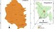
This research paper has presented Unified Soil Classification System (USCS)–based soil type and Standard Penetration Test (SPT) N60–based zonation maps in the Dhaka Metropolitan Development Plan (DMDP) area of Bangladesh. For this purpose, 360 borehole data have been collected from different parts of the DMDP area. The data were analyzed in ArcGIS 10.5 using Ordinary Kriging and Inverse Distance Weighting (IDW) interpolation techniques. The spatial Analyst, Ordinary Kriging method, has demonstrated better results for SPT-N60-based, and IDW has provided superior outcomes of the USCS-based soil type zonation maps. This study has developed 13 SPT-N60-based and USCS soil-type zonation maps for the DMDP area at 1.5 to 19.5 m depth. To assess the reliability of the zonation map, SPT-N60 values and USCS soil classification, acquired through field tests at 10 locations (depths: 1.5 to 19.5 m), were compared with anticipated SPT-N60 values and USCS soil type at exact coordinates in the developed zonation maps. The root mean square error (RMSE) for the SPT-N60 zonation maps was 8.29 blows, and the coefficient of determination (R2) was 0.688. The comparison shows a correlation coefficient of 0.82. For USCS soil-type zonation maps, 55.81% of the field-validated data fully matched the model-anticipated USCS zonation maps data. The generated zonation maps in this research will help to understand the subsurface condition and geotechnical characteristics of soils in the DMDP area. This data will also help engineers to create an initial foundation layout for a new site using the existing data from the nearby locations.
期刊介绍:
The Arabian Journal of Geosciences is the official journal of the Saudi Society for Geosciences and publishes peer-reviewed original and review articles on the entire range of Earth Science themes, focused on, but not limited to, those that have regional significance to the Middle East and the Euro-Mediterranean Zone.
Key topics therefore include; geology, hydrogeology, earth system science, petroleum sciences, geophysics, seismology and crustal structures, tectonics, sedimentology, palaeontology, metamorphic and igneous petrology, natural hazards, environmental sciences and sustainable development, geoarchaeology, geomorphology, paleo-environment studies, oceanography, atmospheric sciences, GIS and remote sensing, geodesy, mineralogy, volcanology, geochemistry and metallogenesis.

 求助内容:
求助内容: 应助结果提醒方式:


