{"title":"利用网格搜索和蝠鲼觅食优化确定的地震位置参数比较","authors":"Aykut Tunçel","doi":"10.1007/s11600-024-01359-7","DOIUrl":null,"url":null,"abstract":"<div><p>This study compared earthquake location estimation using grid search and manta ray foraging optimization algorithm for synthetic and real earthquakes data from Van, Turkey. Both locating methods worked well, and they achieved similar results. The horizontal coordinates (latitude and longitude) of the earthquake were obtained successfully with both methods, from the inversion of the arrival times calculated from the noisy and noise-free synthetic earthquake data. However, there was some deviation in depth parameter for the noisy data. The location parameters obtained from the inversion of the real earthquake data using grid search and manta ray foraging optimization methods were in accordance with the solutions presented in previous studies. The depth parameters for the Van earthquakes did not fully match those in the previous studies, possibly due to differences in crustal velocity models. The depth parameters obtained for both Van earthquakes using both methods performed in this study are self-consistent at around 24 km. In addition, Disaster and Emergency Management Presidency and German Research Centre seismology centres also reached depth solutions near those in this study. The grid search method has some disadvantages compared with the manta ray foraging method, as it must be applied gradually, and delays reaching a solution. The manta ray foraging method is an easy, fast way to determine the kinematic location of earthquake hypocentres.</p></div>","PeriodicalId":6988,"journal":{"name":"Acta Geophysica","volume":"72 4","pages":"2581 - 2596"},"PeriodicalIF":2.3000,"publicationDate":"2024-05-07","publicationTypes":"Journal Article","fieldsOfStudy":null,"isOpenAccess":false,"openAccessPdf":"","citationCount":"0","resultStr":"{\"title\":\"Comparison of earthquake location parameters determined using grid search and manta ray foraging optimization\",\"authors\":\"Aykut Tunçel\",\"doi\":\"10.1007/s11600-024-01359-7\",\"DOIUrl\":null,\"url\":null,\"abstract\":\"<div><p>This study compared earthquake location estimation using grid search and manta ray foraging optimization algorithm for synthetic and real earthquakes data from Van, Turkey. Both locating methods worked well, and they achieved similar results. The horizontal coordinates (latitude and longitude) of the earthquake were obtained successfully with both methods, from the inversion of the arrival times calculated from the noisy and noise-free synthetic earthquake data. However, there was some deviation in depth parameter for the noisy data. The location parameters obtained from the inversion of the real earthquake data using grid search and manta ray foraging optimization methods were in accordance with the solutions presented in previous studies. The depth parameters for the Van earthquakes did not fully match those in the previous studies, possibly due to differences in crustal velocity models. The depth parameters obtained for both Van earthquakes using both methods performed in this study are self-consistent at around 24 km. In addition, Disaster and Emergency Management Presidency and German Research Centre seismology centres also reached depth solutions near those in this study. The grid search method has some disadvantages compared with the manta ray foraging method, as it must be applied gradually, and delays reaching a solution. The manta ray foraging method is an easy, fast way to determine the kinematic location of earthquake hypocentres.</p></div>\",\"PeriodicalId\":6988,\"journal\":{\"name\":\"Acta Geophysica\",\"volume\":\"72 4\",\"pages\":\"2581 - 2596\"},\"PeriodicalIF\":2.3000,\"publicationDate\":\"2024-05-07\",\"publicationTypes\":\"Journal Article\",\"fieldsOfStudy\":null,\"isOpenAccess\":false,\"openAccessPdf\":\"\",\"citationCount\":\"0\",\"resultStr\":null,\"platform\":\"Semanticscholar\",\"paperid\":null,\"PeriodicalName\":\"Acta Geophysica\",\"FirstCategoryId\":\"89\",\"ListUrlMain\":\"https://link.springer.com/article/10.1007/s11600-024-01359-7\",\"RegionNum\":4,\"RegionCategory\":\"地球科学\",\"ArticlePicture\":[],\"TitleCN\":null,\"AbstractTextCN\":null,\"PMCID\":null,\"EPubDate\":\"\",\"PubModel\":\"\",\"JCR\":\"\",\"JCRName\":\"\",\"Score\":null,\"Total\":0}","platform":"Semanticscholar","paperid":null,"PeriodicalName":"Acta Geophysica","FirstCategoryId":"89","ListUrlMain":"https://link.springer.com/article/10.1007/s11600-024-01359-7","RegionNum":4,"RegionCategory":"地球科学","ArticlePicture":[],"TitleCN":null,"AbstractTextCN":null,"PMCID":null,"EPubDate":"","PubModel":"","JCR":"","JCRName":"","Score":null,"Total":0}
Comparison of earthquake location parameters determined using grid search and manta ray foraging optimization
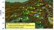
This study compared earthquake location estimation using grid search and manta ray foraging optimization algorithm for synthetic and real earthquakes data from Van, Turkey. Both locating methods worked well, and they achieved similar results. The horizontal coordinates (latitude and longitude) of the earthquake were obtained successfully with both methods, from the inversion of the arrival times calculated from the noisy and noise-free synthetic earthquake data. However, there was some deviation in depth parameter for the noisy data. The location parameters obtained from the inversion of the real earthquake data using grid search and manta ray foraging optimization methods were in accordance with the solutions presented in previous studies. The depth parameters for the Van earthquakes did not fully match those in the previous studies, possibly due to differences in crustal velocity models. The depth parameters obtained for both Van earthquakes using both methods performed in this study are self-consistent at around 24 km. In addition, Disaster and Emergency Management Presidency and German Research Centre seismology centres also reached depth solutions near those in this study. The grid search method has some disadvantages compared with the manta ray foraging method, as it must be applied gradually, and delays reaching a solution. The manta ray foraging method is an easy, fast way to determine the kinematic location of earthquake hypocentres.
期刊介绍:
Acta Geophysica is open to all kinds of manuscripts including research and review articles, short communications, comments to published papers, letters to the Editor as well as book reviews. Some of the issues are fully devoted to particular topics; we do encourage proposals for such topical issues. We accept submissions from scientists world-wide, offering high scientific and editorial standard and comprehensive treatment of the discussed topics.

 求助内容:
求助内容: 应助结果提醒方式:


