{"title":"NavIC Positioning from the Secondary Service Region and Beyond: A Study Using Compact NavIC Modules","authors":"Atanu Santra, Somnath Mahato, Surajit Kundu, Anindya Bose","doi":"10.1007/s40010-023-00825-z","DOIUrl":null,"url":null,"abstract":"<div><p>NavIC is a regional navigation system developed by India; NavIC signal is available in the central/primary service area covering the Indian landmass and 1500 km around India, and for the areas falling in the extended/secondary service region laying between latitude 30° S to 50° N and longitude 30° E to 130° E. Advantages and quality of NavIC-based position solution has been reported for the secondary service area based on simulated data. In this manuscript, real-time NMEA data are collected from NSSTC, Al Ain, UAE, NIMT, Pathum Thani, Thailand, falling within the extended/secondary service region and from TUMSAT, Tokyo, Japan, situated just outside the extended service region using compact, low-cost NavIC modules. Spread of the of position solution in 2-dimension, and its correspondence with rank defect satellite geometry is presented. The precision of solution and North-East-Up error plots are also estimated for those locations. Real-time data from the locations points towards the advantage of having NavIC satellites placed in GEO or IGSO from high elevation angles have been discussed towards seamless navigation operation in GNSS + NavIC hybrid operation within the constrained or degraded GNSS satellite visibility situations.</p></div>","PeriodicalId":744,"journal":{"name":"Proceedings of the National Academy of Sciences, India Section A: Physical Sciences","volume":"93 4","pages":"565 - 572"},"PeriodicalIF":1.2000,"publicationDate":"2023-05-17","publicationTypes":"Journal Article","fieldsOfStudy":null,"isOpenAccess":false,"openAccessPdf":"","citationCount":"0","resultStr":null,"platform":"Semanticscholar","paperid":null,"PeriodicalName":"Proceedings of the National Academy of Sciences, India Section A: Physical Sciences","FirstCategoryId":"103","ListUrlMain":"https://link.springer.com/article/10.1007/s40010-023-00825-z","RegionNum":4,"RegionCategory":"综合性期刊","ArticlePicture":[],"TitleCN":null,"AbstractTextCN":null,"PMCID":null,"EPubDate":"","PubModel":"","JCR":"Q3","JCRName":"MULTIDISCIPLINARY SCIENCES","Score":null,"Total":0}
引用次数: 0
Abstract
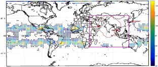
NavIC is a regional navigation system developed by India; NavIC signal is available in the central/primary service area covering the Indian landmass and 1500 km around India, and for the areas falling in the extended/secondary service region laying between latitude 30° S to 50° N and longitude 30° E to 130° E. Advantages and quality of NavIC-based position solution has been reported for the secondary service area based on simulated data. In this manuscript, real-time NMEA data are collected from NSSTC, Al Ain, UAE, NIMT, Pathum Thani, Thailand, falling within the extended/secondary service region and from TUMSAT, Tokyo, Japan, situated just outside the extended service region using compact, low-cost NavIC modules. Spread of the of position solution in 2-dimension, and its correspondence with rank defect satellite geometry is presented. The precision of solution and North-East-Up error plots are also estimated for those locations. Real-time data from the locations points towards the advantage of having NavIC satellites placed in GEO or IGSO from high elevation angles have been discussed towards seamless navigation operation in GNSS + NavIC hybrid operation within the constrained or degraded GNSS satellite visibility situations.

 求助内容:
求助内容: 应助结果提醒方式:


