Spatiotemporal Characteristics of Carbon Emissions in the Pearl River Basin, China: From the Perspective of Land Use and Biomass Burning

IF 3.7 2区 农林科学 Q2 ENVIRONMENTAL SCIENCES
Lei Xia, Changxu Ren, Shuhao Li, Weijia Yang, Yongling Yang, Jie Li, Wenxuan Fan, Rui Liu
{"title":"Spatiotemporal Characteristics of Carbon Emissions in the Pearl River Basin, China: From the Perspective of Land Use and Biomass Burning","authors":"Lei Xia, Changxu Ren, Shuhao Li, Weijia Yang, Yongling Yang, Jie Li, Wenxuan Fan, Rui Liu","doi":"10.1002/ldr.70043","DOIUrl":null,"url":null,"abstract":"The study of carbon emissions is crucial for climate change and sustainable development. The interaction between land use and human activities has a significant impact on the intensity of carbon emissions, and biomass burning generates carbon emissions by affecting the type of land use. Based on remote sensing data, including land use, nighttime lighting, and so forth, as well as carbon emission calculation methods for land use and biomass burning, we constructed a high‐resolution carbon emission grid for the Pearl River Basin, China (PRB) by combining land use and biomass burning carbon emissions (BBCE). The results reveal that forests, covering approximately 68% of the total area, are responsible for about 99% of the carbon absorption. Carbon emissions from construction land grew rapidly, with 85.15% of the increase in its area led to a 175.89% rise in its associated carbon emissions. Biomass burning is the main source of carbon emissions in the less economically developed counties of PRB. Furthermore, we applied an interpretable machine learning model (SHAP) to analyze the inequality of drivers across PRB. The results show that natural factors such as temperature have a more significant impact on carbon sink areas, while anthropogenic factors such as population have a more significant impact on carbon source areas. This study provides a spatial and temporal analysis of carbon emissions from land use and biomass burning in the PRB from 2001 to 2020. The assessment provides valuable insights for effective management and optimization strategies targeting land use carbon emissions within this basin.","PeriodicalId":203,"journal":{"name":"Land Degradation & Development","volume":"103 1","pages":""},"PeriodicalIF":3.7000,"publicationDate":"2025-07-20","publicationTypes":"Journal Article","fieldsOfStudy":null,"isOpenAccess":false,"openAccessPdf":"","citationCount":"0","resultStr":null,"platform":"Semanticscholar","paperid":null,"PeriodicalName":"Land Degradation & Development","FirstCategoryId":"97","ListUrlMain":"https://doi.org/10.1002/ldr.70043","RegionNum":2,"RegionCategory":"农林科学","ArticlePicture":[],"TitleCN":null,"AbstractTextCN":null,"PMCID":null,"EPubDate":"","PubModel":"","JCR":"Q2","JCRName":"ENVIRONMENTAL SCIENCES","Score":null,"Total":0}
引用次数: 0

Abstract

The study of carbon emissions is crucial for climate change and sustainable development. The interaction between land use and human activities has a significant impact on the intensity of carbon emissions, and biomass burning generates carbon emissions by affecting the type of land use. Based on remote sensing data, including land use, nighttime lighting, and so forth, as well as carbon emission calculation methods for land use and biomass burning, we constructed a high‐resolution carbon emission grid for the Pearl River Basin, China (PRB) by combining land use and biomass burning carbon emissions (BBCE). The results reveal that forests, covering approximately 68% of the total area, are responsible for about 99% of the carbon absorption. Carbon emissions from construction land grew rapidly, with 85.15% of the increase in its area led to a 175.89% rise in its associated carbon emissions. Biomass burning is the main source of carbon emissions in the less economically developed counties of PRB. Furthermore, we applied an interpretable machine learning model (SHAP) to analyze the inequality of drivers across PRB. The results show that natural factors such as temperature have a more significant impact on carbon sink areas, while anthropogenic factors such as population have a more significant impact on carbon source areas. This study provides a spatial and temporal analysis of carbon emissions from land use and biomass burning in the PRB from 2001 to 2020. The assessment provides valuable insights for effective management and optimization strategies targeting land use carbon emissions within this basin.
珠江流域碳排放时空特征——基于土地利用和生物质燃烧的视角
碳排放研究对气候变化和可持续发展至关重要。土地利用与人类活动的相互作用对碳排放强度有显著影响,生物质燃烧通过影响土地利用类型产生碳排放。基于土地利用、夜间照明等遥感数据,结合土地利用和生物质燃烧碳排放的计算方法,构建了珠江流域土地利用和生物质燃烧碳排放的高分辨率碳排放网格。结果表明,森林覆盖面积约占总面积的68%,吸收了约99%的碳。建设用地碳排放增长较快,建设用地面积增加85.15%,相关碳排放增加175.89%。生物质燃烧是经济欠发达地区碳排放的主要来源。此外,我们应用了一个可解释的机器学习模型(SHAP)来分析跨PRB的驾驶员不平等。结果表明,温度等自然因子对碳汇区影响更为显著,人口等人为因子对碳源区影响更为显著。本研究对2001 - 2020年青藏高原土地利用和生物质燃烧的碳排放进行了时空分析。该评价为该流域土地利用碳排放的有效管理和优化策略提供了有价值的见解。
本文章由计算机程序翻译,如有差异,请以英文原文为准。
求助全文
约1分钟内获得全文 求助全文
来源期刊
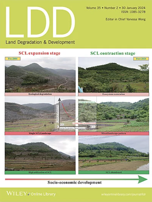
Land Degradation & Development
Land Degradation & Development 农林科学-环境科学
CiteScore
7.70
自引率
8.50%
发文量
379
审稿时长
5.5 months
期刊介绍: Land Degradation & Development is an international journal which seeks to promote rational study of the recognition, monitoring, control and rehabilitation of degradation in terrestrial environments. The journal focuses on: - what land degradation is; - what causes land degradation; - the impacts of land degradation - the scale of land degradation; - the history, current status or future trends of land degradation; - avoidance, mitigation and control of land degradation; - remedial actions to rehabilitate or restore degraded land; - sustainable land management.
×
引用
GB/T 7714-2015
复制
MLA
复制
APA
复制
导出至
BibTeX EndNote RefMan NoteFirst NoteExpress
×
提示
您的信息不完整,为了账户安全,请先补充。
现在去补充
×
提示
您因"违规操作"
具体请查看互助需知
我知道了
×
提示
确定
请完成安全验证×
copy
已复制链接
快去分享给好友吧!
我知道了
右上角分享
点击右上角分享
0
联系我们:info@booksci.cn Book学术提供免费学术资源搜索服务,方便国内外学者检索中英文文献。致力于提供最便捷和优质的服务体验。 Copyright © 2023 布克学术 All rights reserved.
京ICP备2023020795号-1
ghs 京公网安备 11010802042870号
Book学术文献互助
Book学术文献互助群
群 号:604180095
Book学术官方微信