Exploring the roles of recorded unprecedented rainfall-runoff characteristics and uplifted riverbeds in the catastrophic 2022 Pakistan megaflood
IF 5.2
1区 地球科学
Q1 ENVIRONMENTAL SCIENCES
引用次数: 0
Abstract
Catastrophic floods triggered by extreme monsoonal rainfall have increasingly posed challenges in flood management, particularly in low-income nations like Pakistan. The 2022 megaflood exposed substantial gaps in understanding the interplay between rainfall, sediment dynamics, and flood amplification processes. This study investigates the causes and impacts of the event, focusing on floodwater sources, geomorphological changes, and future risks and mitigation strategies. A multifaceted approach combined with remote sensing, field observations, hydro-meteorological data, and climate models was employed. In July–August 2022, the lower Hindukush, Koh-e-Suleman, and Kirther ranges experienced rainfall of 200–300 mm, up to 726% above historical averages (1991–2021). This high-intensity rainfall triggered high-magnitude discharges from approximately 1250 streams, 58 % of which were primary contributors with discharge at 4000–5000 m3/s for nearly a month, causing 80%–85% of downstream damage and expanding the flooded area to 49,711 km2. Some streams recorded 5–6 m flood levels, resulting in sedimentation deposition of 0.8–1 m in residential areas and about 2 m in the streambeds. Deposition downstream and along the Indus River reached 1.5–2 m, intensifying flood risks by reducing channel capacity and increasing water levels during flood events. Streambed uplift and sediment deposition emerged as critical factors amplifying flood magnitude, severity, and inundation, with floodwater levels rising by up to 2.4–3 m in some areas, posing severe risks for future events. These findings highlight the need to revise traditional flood risk models, which often overlook sediment dynamics and underscore the future challenges posed by ongoing sediment deposition and climate change, which are expected to exacerbate flood risks in the coming decades. The study emphasizes the importance of sediment management, river erosion control, and post-event interventions. Prioritizing flood management, enhancing early warning systems, and investing in resilient infrastructure are essential strategies to protect communities and ensure long-term safety.
探索有记录以来前所未有的降雨径流特征和抬升的河床在2022年巴基斯坦特大洪水中的作用
极端季风降雨引发的灾难性洪水日益给洪水管理带来挑战,尤其是在巴基斯坦等低收入国家。2022年的特大洪水暴露了在理解降雨、泥沙动力学和洪水放大过程之间相互作用方面的巨大差距。本研究调查了该事件的原因和影响,重点关注洪水来源、地貌变化以及未来的风险和缓解策略。采用了遥感、野外观测、水文气象资料和气候模型相结合的多方面方法。2022年7月至8月,Hindukush、kh -e- suleman和Kirther山脉下部降雨量为200-300毫米,比历史平均水平(1991-2021年)高出726%。此次强降雨引发了约1250条河流的高强度泄洪,其中58%的河流为主要泄洪源,流量在4000-5000 m3/s之间,持续近一个月,造成了80%-85%的下游破坏,洪涝面积扩大到49,711 km2。部分河流录得5至6米的洪水水位,导致住宅区淤积0.8至1米,河床淤积约2米。印度河下游和沿岸的沉积物达到1.5-2 m,在洪水事件发生时,河道容量减少,水位上升,从而加剧了洪水风险。河床抬升和泥沙淤积成为放大洪水震级、严重程度和淹没的关键因素,部分地区的水位上升高达2.4-3米,对未来的事件构成严重风险。这些发现强调了修正传统洪水风险模型的必要性,这些模型往往忽略了泥沙动态,并强调了持续的泥沙沉积和气候变化带来的未来挑战,预计这些挑战将在未来几十年加剧洪水风险。该研究强调了沉积物管理、河流侵蚀控制和事后干预的重要性。优先考虑洪水管理、加强早期预警系统和投资于抗灾基础设施是保护社区和确保长期安全的重要战略。
本文章由计算机程序翻译,如有差异,请以英文原文为准。
求助全文
约1分钟内获得全文
求助全文
来源期刊

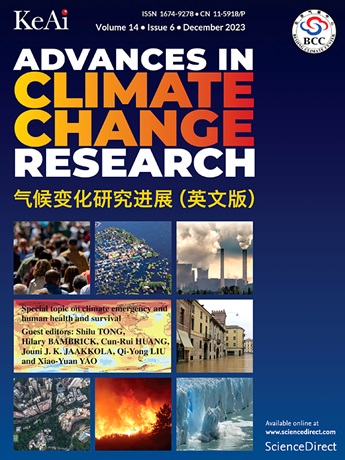
Advances in Climate Change Research
Earth and Planetary Sciences-Atmospheric Science
CiteScore
9.80
自引率
4.10%
发文量
424
审稿时长
107 days
期刊介绍:
Advances in Climate Change Research publishes scientific research and analyses on climate change and the interactions of climate change with society. This journal encompasses basic science and economic, social, and policy research, including studies on mitigation and adaptation to climate change.
Advances in Climate Change Research attempts to promote research in climate change and provide an impetus for the application of research achievements in numerous aspects, such as socioeconomic sustainable development, responses to the adaptation and mitigation of climate change, diplomatic negotiations of climate and environment policies, and the protection and exploitation of natural resources.
 求助内容:
求助内容: 应助结果提醒方式:


