Predicting and evaluating slope stability in permafrost regions of the central Qinghai‒Tibetan Plateau
IF 5.2
1区 地球科学
Q1 ENVIRONMENTAL SCIENCES
引用次数: 0
Abstract
Thermokarst landslides have frequently occurred in the central Qinghai‒Tibetan Plateau (QTP), endangering infrastructure and the environment. However, there have been no adequate methods to predict thermokarst landslides until now. Therefore, establishing a reliable slope stability evaluation method is paramount for hazard forewarning and prevention. In this study, we analyzed the distribution characteristics of thermokarst landslides based on historical landslide data from the central QTP. By applying threshold values for these distribution characteristics, non-thermokarst landslide areas were identified and masked. We then assessed and predicted the slope stability of permafrost regions using a permafrost slope stability calculation model combined with GIS software. The stability assessment results indicate that most of the masked study area is unstable. Compared to the initial state, the areas of unstable regions increased by 7.7%, 19.0%, and 29.5% for SSP126; 6.3%, 23.5%, and 37.3% for SSP245; and 14.1%, 32.6%, and 51.2% for SSP585 during the periods 2020–2040, 2040–2060, and 2060–2080, respectively. This increasing trend in unstable areas becomes even more pronounced when temperature and rainfall changes are considered. Under the SSP585 precipitation scenario, the areas of unstable regions from 2060 to 2080 increased by 52.9%, 52.5%, and 51.9% compared to only considering temperature variation scenarios. Additionally, we cross-validated the slope stability results from 2000 to 2020 with the thermokarst landslide susceptibility results. The overall distribution trends of unstable areas from both methods were broadly consistent, with a difference of only 7% in unstable area size. The correlation between the slope stability and landslide susceptibility evaluation results reached 0.76 (p < 0.05). These cross-validation findings support the reliability of this paper's regional slope stability evaluation method.
青藏高原中部多年冻土区边坡稳定性预测与评价
青藏高原中部地区热岩溶滑坡频繁发生,对基础设施和环境造成严重危害。然而,目前还没有足够的热岩溶滑坡预测方法。因此,建立可靠的边坡稳定性评价方法对于灾害预警和预防至关重要。本文基于青藏高原中部地区的历史滑坡资料,分析了热岩溶滑坡的分布特征。通过应用这些分布特征的阈值,可以识别和屏蔽非热岩溶滑坡区。利用多年冻土边坡稳定性计算模型结合GIS软件对多年冻土边坡稳定性进行了评估和预测。稳定性评价结果表明,掩蔽研究区大部分区域不稳定。与初始状态相比,SSP126的不稳定区面积分别增加了7.7%、19.0%和29.5%;SSP245分别为6.3%、23.5%和37.3%;2020 ~ 2040年、2040 ~ 2060年和2060 ~ 2080年,SSP585的年代率分别为14.1%、32.6%和51.2%。在不稳定地区,如果考虑到温度和降雨量的变化,这种增加趋势就更加明显。在SSP585降水情景下,2060 ~ 2080年不稳定区面积比仅考虑温度变化情景增加了52.9%、52.5%和51.9%。此外,我们将2000 - 2020年的边坡稳定性结果与热岩溶滑坡敏感性结果进行了交叉验证。两种方法的不稳定区总体分布趋势基本一致,不稳定区大小仅相差7%。边坡稳定性与滑坡易感性评价结果的相关性达到0.76 (p <;0.05)。这些交叉验证结果支持了本文区域边坡稳定性评价方法的可靠性。
本文章由计算机程序翻译,如有差异,请以英文原文为准。
求助全文
约1分钟内获得全文
求助全文
来源期刊

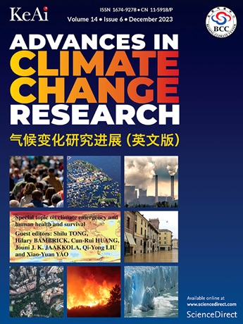
Advances in Climate Change Research
Earth and Planetary Sciences-Atmospheric Science
CiteScore
9.80
自引率
4.10%
发文量
424
审稿时长
107 days
期刊介绍:
Advances in Climate Change Research publishes scientific research and analyses on climate change and the interactions of climate change with society. This journal encompasses basic science and economic, social, and policy research, including studies on mitigation and adaptation to climate change.
Advances in Climate Change Research attempts to promote research in climate change and provide an impetus for the application of research achievements in numerous aspects, such as socioeconomic sustainable development, responses to the adaptation and mitigation of climate change, diplomatic negotiations of climate and environment policies, and the protection and exploitation of natural resources.
 求助内容:
求助内容: 应助结果提醒方式:


