Detection of tree destruction induced by heavy rainfall in the afforested loess catchment of China
IF 5.7
1区 农林科学
Q1 GEOSCIENCES, MULTIDISCIPLINARY
引用次数: 0
Abstract
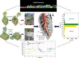
Rainstorm events are becoming increasingly frequent due to the impacts of global warming, which results in widespread erosion disasters and related tree destruction. However, previous corresponding studies of forest damage have focused on typhoons or wildfires, ignoring the increasing risk of rainstorm erosion-induced tree destruction. It is unclear what scale of tree destruction can be caused by heavy rainfall. In this study, we used a tree segmentation method based on airborne light detection and ranging (LiDAR) technology to accurately quantify the tree destruction during heavy rainfall in a representative afforested catchment on the Chinese Loess Plateau. Additionally, topographic changes were calculated using pre- and post-heavy rainfall LiDAR datasets, and tree destruction was assessed by combining terrain information and tree structural parameters. The results showed that 3253 trees in the catchment (0.9 km2) were destroyed due to rainstorm erosion, among which 2845 trees were located on gully slope landform, accounting for 87.4 % of all destroyed trees. Tree destruction on steep gully slope (slope: 45.5°-50.5°) was mainly induced by rainstorm erosion, while that on both sides of the gully bed (altitude: 1137 m-1147 m) was mainly induced by sediment deposition. In the catchment, the deposition area that resulted in tree destruction (21265 m2) was greater than the erosion area (20020 m2). However, the damage caused by erosion was more destructive than that caused by deposition. There was a significant linear relationship between tree structural parameters and terrain in the forestland catchment. Our study provides a reference methodology for studies of forest damage due to extreme weather events worldwide, and has significant implications for ecosystem management and reforestation in the context of global change.

中国黄土造林流域强降雨对树木破坏的探测
受全球气候变暖的影响,暴雨事件日益频繁,造成了广泛的侵蚀灾害和与之相关的树木破坏。然而,以往对森林破坏的相应研究主要集中在台风或野火上,忽视了暴雨侵蚀引起的树木破坏风险的增加。目前还不清楚强降雨会造成多大程度的树木破坏。在本研究中,我们采用基于机载光探测和测距(LiDAR)技术的树木分割方法,对中国黄土高原代表性绿化流域强降雨期间的树木破坏进行了精确量化。此外,利用强降雨前后的激光雷达数据计算地形变化,并结合地形信息和树木结构参数评估树木破坏情况。结果表明:该流域(0.9 km2)共被暴雨侵蚀破坏树木3253棵,其中位于沟壑区坡面地貌的树木2845棵,占被破坏树木的87.4%;坡度为45.5°~ 50.5°的陡沟坡上的树木破坏主要是由暴雨侵蚀引起的,而沟床两侧海拔1137 m ~ 1147 m的树木破坏主要是由泥沙淤积引起的。在流域中,导致树木破坏的沉积面积(21265 m2)大于侵蚀面积(20020 m2)。然而,侵蚀造成的破坏比沉积造成的破坏更具有破坏性。林地流域树木结构参数与地形之间存在显著的线性关系。本研究为全球极端天气事件对森林的破坏研究提供了参考方法,并对全球变化背景下的生态系统管理和再造林具有重要意义。
本文章由计算机程序翻译,如有差异,请以英文原文为准。
求助全文
约1分钟内获得全文
求助全文
来源期刊

Catena
环境科学-地球科学综合
CiteScore
10.50
自引率
9.70%
发文量
816
审稿时长
54 days
期刊介绍:
Catena publishes papers describing original field and laboratory investigations and reviews on geoecology and landscape evolution with emphasis on interdisciplinary aspects of soil science, hydrology and geomorphology. It aims to disseminate new knowledge and foster better understanding of the physical environment, of evolutionary sequences that have resulted in past and current landscapes, and of the natural processes that are likely to determine the fate of our terrestrial environment.
Papers within any one of the above topics are welcome provided they are of sufficiently wide interest and relevance.
 求助内容:
求助内容: 应助结果提醒方式:


