A review of geospatial exposure models and approaches for health data integration

IF 4.1 3区 医学 Q2 ENVIRONMENTAL SCIENCES
Lara P. Clark, Daniel Zilber, Charles Schmitt, David C. Fargo, David M. Reif, Alison A. Motsinger-Reif, Kyle P. Messier
{"title":"A review of geospatial exposure models and approaches for health data integration","authors":"Lara P. Clark, Daniel Zilber, Charles Schmitt, David C. Fargo, David M. Reif, Alison A. Motsinger-Reif, Kyle P. Messier","doi":"10.1038/s41370-024-00712-8","DOIUrl":null,"url":null,"abstract":"<h3 data-test=\"abstract-sub-heading\">Background</h3><p>Geospatial methods are common in environmental exposure assessments and increasingly integrated with health data to generate comprehensive models of environmental impacts on public health.</p><h3 data-test=\"abstract-sub-heading\">Objective</h3><p>Our objective is to review geospatial exposure models and approaches for health data integration in environmental health applications.</p><h3 data-test=\"abstract-sub-heading\">Methods</h3><p>We conduct a literature review and synthesis.</p><h3 data-test=\"abstract-sub-heading\">Results</h3><p>First, we discuss key concepts and terminology for geospatial exposure data and models. Second, we provide an overview of workflows in geospatial exposure model development and health data integration. Third, we review modeling approaches, including proximity-based, statistical, and mechanistic approaches, across diverse exposure types, such as air quality, water quality, climate, and socioeconomic factors. For each model type, we provide descriptions, general equations, and example applications for environmental exposure assessment. Fourth, we discuss the approaches used to integrate geospatial exposure data and health data, such as methods to link data sources with disparate spatial and temporal scales. Fifth, we describe the landscape of open-source tools supporting these workflows.</p>","PeriodicalId":15684,"journal":{"name":"Journal of Exposure Science and Environmental Epidemiology","volume":"10 1","pages":""},"PeriodicalIF":4.1000,"publicationDate":"2024-09-06","publicationTypes":"Journal Article","fieldsOfStudy":null,"isOpenAccess":false,"openAccessPdf":"","citationCount":"0","resultStr":null,"platform":"Semanticscholar","paperid":null,"PeriodicalName":"Journal of Exposure Science and Environmental Epidemiology","FirstCategoryId":"3","ListUrlMain":"https://doi.org/10.1038/s41370-024-00712-8","RegionNum":3,"RegionCategory":"医学","ArticlePicture":[],"TitleCN":null,"AbstractTextCN":null,"PMCID":null,"EPubDate":"","PubModel":"","JCR":"Q2","JCRName":"ENVIRONMENTAL SCIENCES","Score":null,"Total":0}
引用次数: 0

Abstract

Background

Geospatial methods are common in environmental exposure assessments and increasingly integrated with health data to generate comprehensive models of environmental impacts on public health.

Objective

Our objective is to review geospatial exposure models and approaches for health data integration in environmental health applications.

Methods

We conduct a literature review and synthesis.

Results

First, we discuss key concepts and terminology for geospatial exposure data and models. Second, we provide an overview of workflows in geospatial exposure model development and health data integration. Third, we review modeling approaches, including proximity-based, statistical, and mechanistic approaches, across diverse exposure types, such as air quality, water quality, climate, and socioeconomic factors. For each model type, we provide descriptions, general equations, and example applications for environmental exposure assessment. Fourth, we discuss the approaches used to integrate geospatial exposure data and health data, such as methods to link data sources with disparate spatial and temporal scales. Fifth, we describe the landscape of open-source tools supporting these workflows.

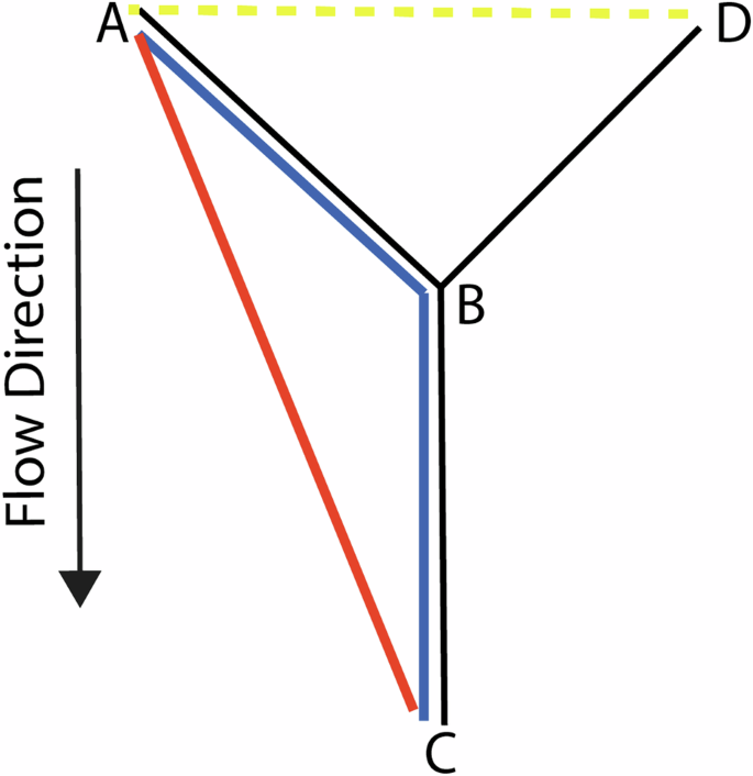
Abstract Image

地理空间暴露模型和健康数据整合方法综述
背景地理空间方法在环境暴露评估中很常见,并越来越多地与健康数据相结合,以生成环境对公众健康影响的综合模型。方法我们进行了文献综述和归纳。结果首先,我们讨论了地理空间暴露数据和模型的关键概念和术语。其次,我们概述了地理空间暴露模型开发和健康数据整合的工作流程。第三,我们回顾了不同暴露类型(如空气质量、水质、气候和社会经济因素)的建模方法,包括基于邻近性的方法、统计方法和机理方法。对于每种模型类型,我们都提供了说明、一般公式以及环境暴露评估的应用实例。第四,我们讨论了用于整合地理空间暴露数据和健康数据的方法,例如将不同空间和时间尺度的数据源联系起来的方法。第五,我们介绍了支持这些工作流程的开源工具。
本文章由计算机程序翻译,如有差异,请以英文原文为准。
求助全文
约1分钟内获得全文 求助全文
来源期刊
CiteScore
8.90
自引率
6.70%
发文量
93
审稿时长
3 months
期刊介绍: Journal of Exposure Science and Environmental Epidemiology (JESEE) aims to be the premier and authoritative source of information on advances in exposure science for professionals in a wide range of environmental and public health disciplines. JESEE publishes original peer-reviewed research presenting significant advances in exposure science and exposure analysis, including development and application of the latest technologies for measuring exposures, and innovative computational approaches for translating novel data streams to characterize and predict exposures. The types of papers published in the research section of JESEE are original research articles, translation studies, and correspondence. Reported results should further understanding of the relationship between environmental exposure and human health, describe evaluated novel exposure science tools, or demonstrate potential of exposure science to enable decisions and actions that promote and protect human health.
×
引用
GB/T 7714-2015
复制
MLA
复制
APA
复制
导出至
BibTeX EndNote RefMan NoteFirst NoteExpress
×
提示
您的信息不完整,为了账户安全,请先补充。
现在去补充
×
提示
您因"违规操作"
具体请查看互助需知
我知道了
×
提示
确定
请完成安全验证×
copy
已复制链接
快去分享给好友吧!
我知道了
右上角分享
点击右上角分享
0
联系我们:info@booksci.cn Book学术提供免费学术资源搜索服务,方便国内外学者检索中英文文献。致力于提供最便捷和优质的服务体验。 Copyright © 2023 布克学术 All rights reserved.
京ICP备2023020795号-1
ghs 京公网安备 11010802042870号
Book学术文献互助
Book学术文献互助群
群 号:481959085
Book学术官方微信