William Paul Chilton, Robert Weiss, Jennifer L. Irish
{"title":"Historical analysis of tropical and non-tropical induced flooding within the James River Basin, Virginia","authors":"William Paul Chilton, Robert Weiss, Jennifer L. Irish","doi":"10.1111/jfr3.12998","DOIUrl":null,"url":null,"abstract":"<p>The development of a basin-specific comprehensive flood record using publicly available data for the James River Basin, Virginia. Using mixed surface analysis maps (NOAA, NWS), historical hurricane records (IBTrACS, HURDAT2), and flood and river gauge records (NWS, USGS), a database is created for analysis. Related to creating this database, a novel classification of six unique weather systems (non-tropical and tropical) responsible for flooding is presented. The analysis includes Two-Way tables with observed marginal and joint probabilities in various potential flood, storm, and regional combinations. Results show 233 tropical systems passed within the 500-km study area, with 12.4%, or 29 systems of those systems causing flooding within the basin. An additional 713 events were non-tropical, composing the majority of flood sources in the basin. Non-tropical systems are responsible for 84% of the worst floods recorded, leading to an increased frequency of 6% yearly since 1941 and nearly 770% between 2014 and 2018. The findings of this study will be the basis for assessing land use and population patterns in the area, along with a future compound flooding model for the lower James River Basin.</p>","PeriodicalId":49294,"journal":{"name":"Journal of Flood Risk Management","volume":"17 3","pages":""},"PeriodicalIF":3.0000,"publicationDate":"2024-04-28","publicationTypes":"Journal Article","fieldsOfStudy":null,"isOpenAccess":false,"openAccessPdf":"https://onlinelibrary.wiley.com/doi/epdf/10.1111/jfr3.12998","citationCount":"0","resultStr":null,"platform":"Semanticscholar","paperid":null,"PeriodicalName":"Journal of Flood Risk Management","FirstCategoryId":"93","ListUrlMain":"https://onlinelibrary.wiley.com/doi/10.1111/jfr3.12998","RegionNum":3,"RegionCategory":"环境科学与生态学","ArticlePicture":[],"TitleCN":null,"AbstractTextCN":null,"PMCID":null,"EPubDate":"","PubModel":"","JCR":"Q2","JCRName":"ENVIRONMENTAL SCIENCES","Score":null,"Total":0}
引用次数: 0
Abstract
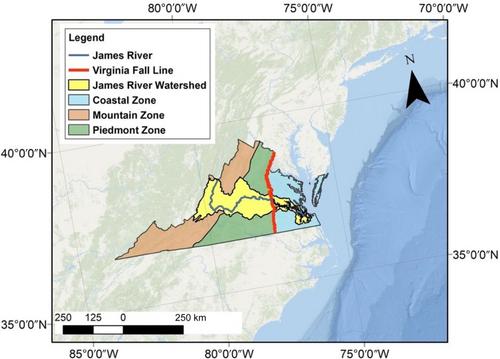
The development of a basin-specific comprehensive flood record using publicly available data for the James River Basin, Virginia. Using mixed surface analysis maps (NOAA, NWS), historical hurricane records (IBTrACS, HURDAT2), and flood and river gauge records (NWS, USGS), a database is created for analysis. Related to creating this database, a novel classification of six unique weather systems (non-tropical and tropical) responsible for flooding is presented. The analysis includes Two-Way tables with observed marginal and joint probabilities in various potential flood, storm, and regional combinations. Results show 233 tropical systems passed within the 500-km study area, with 12.4%, or 29 systems of those systems causing flooding within the basin. An additional 713 events were non-tropical, composing the majority of flood sources in the basin. Non-tropical systems are responsible for 84% of the worst floods recorded, leading to an increased frequency of 6% yearly since 1941 and nearly 770% between 2014 and 2018. The findings of this study will be the basis for assessing land use and population patterns in the area, along with a future compound flooding model for the lower James River Basin.
期刊介绍:
Journal of Flood Risk Management provides an international platform for knowledge sharing in all areas related to flood risk. Its explicit aim is to disseminate ideas across the range of disciplines where flood related research is carried out and it provides content ranging from leading edge academic papers to applied content with the practitioner in mind.
Readers and authors come from a wide background and include hydrologists, meteorologists, geographers, geomorphologists, conservationists, civil engineers, social scientists, policy makers, insurers and practitioners. They share an interest in managing the complex interactions between the many skills and disciplines that underpin the management of flood risk across the world.

 求助内容:
求助内容: 应助结果提醒方式:


