A satellite-derived baseline of photosynthetic life across Antarctica
IF 15.7
1区 地球科学
Q1 GEOSCIENCES, MULTIDISCIPLINARY
引用次数: 0
Abstract
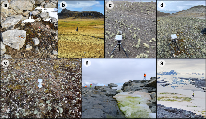
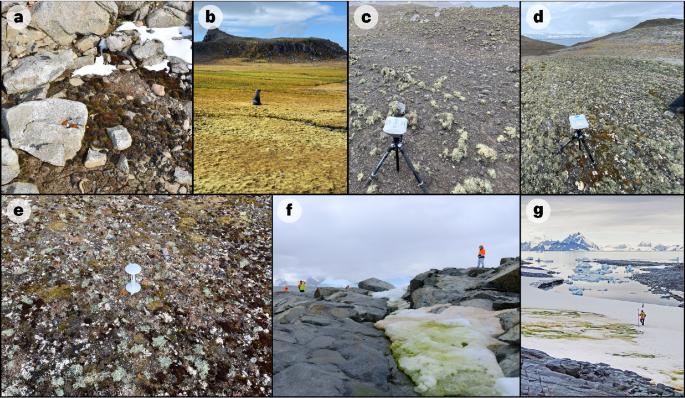
Terrestrial vegetation communities across Antarctica are characteristically sparse, presenting a challenge for mapping their occurrence using remote sensing at the continent scale. At present there is no continent-wide baseline record of Antarctic vegetation, and large-scale area estimates remain unquantified. With local vegetation distribution shifts now apparent and further predicted in response to environmental change across Antarctica, it is critical to establish a baseline to document these changes. Here we present a 10 m-resolution map of photosynthetic life in terrestrial and cryospheric habitats across the entire Antarctic continent, maritime archipelagos and islands south of 60° S. Using Sentinel-2 imagery (2017–2023) and spectral indices, we detected terrestrial green vegetation (vascular plants, bryophytes, green algae) and lichens across ice-free areas, and cryospheric green snow algae across coastal snowpacks. The detected vegetation occupies a total area of 44.2 km2, with over half contained in the South Shetland Islands, altogether contributing just 0.12% of the total ice-free area included in the analysis. Due to methodological constraints, dark-coloured lichens and cyanobacterial mats were excluded from the study. This vegetation map improves the geospatial data available for vegetation across Antarctica, and provides a tool for future conservation planning and large-scale biogeographic assessments. Satellite-based mapping of vegetation shows that photosynthetic life occupies a total area of 44.2 km2 across Antarctica.


南极洲光合作用生命的卫星基准线
整个南极洲的陆地植被群落非常稀疏,这给利用遥感技术绘制南极洲范围内的植被分布图带来了挑战。目前还没有全大陆范围的南极植被基线记录,大尺度的面积估算仍未量化。随着南极洲局部植被分布的明显变化以及对环境变化的进一步预测,建立一个记录这些变化的基线至关重要。在这里,我们展示了南极大陆、海洋群岛和南纬 60 度以南岛屿陆地和冰冻层栖息地光合生物的 10 米分辨率地图。利用哨兵-2 图像(2017-2023 年)和光谱指数,我们探测到了无冰地区的陆地绿色植被(维管束植物、苔藓植物、绿藻)和地衣,以及沿岸雪堆的冰冻层绿雪藻。检测到的植被总面积为 44.2 平方公里,其中一半以上位于南设得兰群岛,总共只占分析中无冰区总面积的 0.12%。由于研究方法的限制,深色地衣和蓝藻垫不在研究范围内。该植被图改进了南极洲植被的地理空间数据,为未来的保护规划和大规模生物地理评估提供了工具。
本文章由计算机程序翻译,如有差异,请以英文原文为准。
求助全文
约1分钟内获得全文
求助全文
来源期刊

Nature Geoscience
地学-地球科学综合
CiteScore
26.70
自引率
1.60%
发文量
187
审稿时长
3.3 months
期刊介绍:
Nature Geoscience is a monthly interdisciplinary journal that gathers top-tier research spanning Earth Sciences and related fields.
The journal covers all geoscience disciplines, including fieldwork, modeling, and theoretical studies.
Topics include atmospheric science, biogeochemistry, climate science, geobiology, geochemistry, geoinformatics, remote sensing, geology, geomagnetism, paleomagnetism, geomorphology, geophysics, glaciology, hydrology, limnology, mineralogy, oceanography, paleontology, paleoclimatology, paleoceanography, petrology, planetary science, seismology, space physics, tectonics, and volcanology.
Nature Geoscience upholds its commitment to publishing significant, high-quality Earth Sciences research through fair, rapid, and rigorous peer review, overseen by a team of full-time professional editors.
 求助内容:
求助内容: 应助结果提醒方式:


