{"title":"Application of pseudo-3D sub-bottom profile imaging technology in small submarine target detection","authors":"Tianguang Li, Zhiqing Huang, Xiaobo Zhang, Fansheng Meng, Yifan Pei, Jiali Guo","doi":"10.1007/s11600-024-01343-1","DOIUrl":null,"url":null,"abstract":"<div><p>The sub-bottom profiler is a valuable tool for obtaining high-resolution shallow stratigraphic data in marine geological and geophysical surveys. To detect and acquire the structural characteristics of small submarine objects, we developed a data processing method that utilizes 2D data to construct a 3D structural model. We conducted application experiments using sub-bottom profile detection data from Chuanshan Islands, which were explored using China’s most advanced unmanned exploration platform and commercial shallow formation profiling system. To create high-resolution 3D seafloor structure models from recorded 2D sub-bottom profile datasets, an optimized data processing sequence was devised, comprising two stages: 2D data processing and 3D data processing. The 2D data processing stage involved spectrum analysis, band-pass filtering, matching filtering, time-varying gain, and surge correction. The subsequent 3D data processing stage encompassed ping location reallocation, static correction, and extraction of feature layer information. Notably, the final pseudo-3D sub-bottom profile time slice exhibited significant amplitude variations near the target body. This methodology represents an extension of the application of 2D sub-bottom profile data, enhancing the target recognition capabilities of such data. To further improve the precision of target body characterization, we used ArcScene 10.0 to create a 3D sub-bottom profile formation model spatial database. We constructed a submarine 3D formation structure model to show the 3D structural characteristics of the target body in detail and identified a seabed target body measuring 6.4 × 9.2 × 10 m.</p></div>","PeriodicalId":6988,"journal":{"name":"Acta Geophysica","volume":"73 1","pages":"393 - 405"},"PeriodicalIF":2.3000,"publicationDate":"2024-06-22","publicationTypes":"Journal Article","fieldsOfStudy":null,"isOpenAccess":false,"openAccessPdf":"","citationCount":"0","resultStr":null,"platform":"Semanticscholar","paperid":null,"PeriodicalName":"Acta Geophysica","FirstCategoryId":"89","ListUrlMain":"https://link.springer.com/article/10.1007/s11600-024-01343-1","RegionNum":4,"RegionCategory":"地球科学","ArticlePicture":[],"TitleCN":null,"AbstractTextCN":null,"PMCID":null,"EPubDate":"","PubModel":"","JCR":"","JCRName":"","Score":null,"Total":0}
引用次数: 0
Abstract
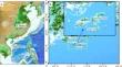
The sub-bottom profiler is a valuable tool for obtaining high-resolution shallow stratigraphic data in marine geological and geophysical surveys. To detect and acquire the structural characteristics of small submarine objects, we developed a data processing method that utilizes 2D data to construct a 3D structural model. We conducted application experiments using sub-bottom profile detection data from Chuanshan Islands, which were explored using China’s most advanced unmanned exploration platform and commercial shallow formation profiling system. To create high-resolution 3D seafloor structure models from recorded 2D sub-bottom profile datasets, an optimized data processing sequence was devised, comprising two stages: 2D data processing and 3D data processing. The 2D data processing stage involved spectrum analysis, band-pass filtering, matching filtering, time-varying gain, and surge correction. The subsequent 3D data processing stage encompassed ping location reallocation, static correction, and extraction of feature layer information. Notably, the final pseudo-3D sub-bottom profile time slice exhibited significant amplitude variations near the target body. This methodology represents an extension of the application of 2D sub-bottom profile data, enhancing the target recognition capabilities of such data. To further improve the precision of target body characterization, we used ArcScene 10.0 to create a 3D sub-bottom profile formation model spatial database. We constructed a submarine 3D formation structure model to show the 3D structural characteristics of the target body in detail and identified a seabed target body measuring 6.4 × 9.2 × 10 m.
期刊介绍:
Acta Geophysica is open to all kinds of manuscripts including research and review articles, short communications, comments to published papers, letters to the Editor as well as book reviews. Some of the issues are fully devoted to particular topics; we do encourage proposals for such topical issues. We accept submissions from scientists world-wide, offering high scientific and editorial standard and comprehensive treatment of the discussed topics.


 求助内容:
求助内容: 应助结果提醒方式:


