Amna Al Ruheili, Said Al Ismaily, Malik Al Wardy, Zan Rubin, Khalid Al Hashmi, Hamed Al Busaidi
{"title":"Dam impacts on plant communities based on sediment delivery ratio (InVEST-SDR): Wadi Ma’awil catchment of Oman","authors":"Amna Al Ruheili, Said Al Ismaily, Malik Al Wardy, Zan Rubin, Khalid Al Hashmi, Hamed Al Busaidi","doi":"10.1007/s12517-024-11952-1","DOIUrl":null,"url":null,"abstract":"<p>Dams cause loss of habitat due to the interception of sediment transport downstream. The impact of the Wadi Ma’awil watershed dam in Oman on the distribution and pattern of plant communities has not been fully investigated. Identifying and prioritizing critical erosion and trapped sediment areas are important aspects for policymakers. The aim of this study was to assess the impact of the Wadi Ma’awil watershed dam on sediment transport across the watershed and its consequences on the pattern and distribution of plant communities. This study used the integrated valuation of environmental services and the tradeoffs sediment delivery ratio (InVEST-SDR) model to provide spatially explicit estimates of soil loss and sediment yield. The results showed that Sub-watershed 10 after the dam area exhibited the lowest sediment export, with a value of 0.36 ton/ha, while Sub-watershed 2 at the dam area had sediment retention of 1.02 ton/ha among the top five sub-watersheds. Around 1.51 ton/ha of sediments was trapped inside the dam at Sub-watershed 2 and did not reach the downstream area at Sub-watershed 10. The dam had a significant effect on the distribution, density, and communities of the small plant. The area downstream of the dam Sub-watershed 10 showed the lowest mean plant density (3.15) compared to the area upstream of the dam Sub-watershed s 3, 4, and 5 (19.65) or the dam area Sub-watershed 2 (42.9). These findings suggest a need to evaluate dam capacity, as sediment traps could hold risks that could decrease dam functionality and life span, jeopardizing dam storage and flood protection capacity.</p>","PeriodicalId":476,"journal":{"name":"Arabian Journal of Geosciences","volume":null,"pages":null},"PeriodicalIF":1.8270,"publicationDate":"2024-04-16","publicationTypes":"Journal Article","fieldsOfStudy":null,"isOpenAccess":false,"openAccessPdf":"","citationCount":"0","resultStr":null,"platform":"Semanticscholar","paperid":null,"PeriodicalName":"Arabian Journal of Geosciences","FirstCategoryId":"1085","ListUrlMain":"https://doi.org/10.1007/s12517-024-11952-1","RegionNum":0,"RegionCategory":null,"ArticlePicture":[],"TitleCN":null,"AbstractTextCN":null,"PMCID":null,"EPubDate":"","PubModel":"","JCR":"Q2","JCRName":"Earth and Planetary Sciences","Score":null,"Total":0}
引用次数: 0
Abstract
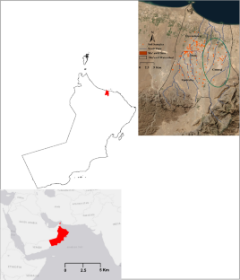
Dams cause loss of habitat due to the interception of sediment transport downstream. The impact of the Wadi Ma’awil watershed dam in Oman on the distribution and pattern of plant communities has not been fully investigated. Identifying and prioritizing critical erosion and trapped sediment areas are important aspects for policymakers. The aim of this study was to assess the impact of the Wadi Ma’awil watershed dam on sediment transport across the watershed and its consequences on the pattern and distribution of plant communities. This study used the integrated valuation of environmental services and the tradeoffs sediment delivery ratio (InVEST-SDR) model to provide spatially explicit estimates of soil loss and sediment yield. The results showed that Sub-watershed 10 after the dam area exhibited the lowest sediment export, with a value of 0.36 ton/ha, while Sub-watershed 2 at the dam area had sediment retention of 1.02 ton/ha among the top five sub-watersheds. Around 1.51 ton/ha of sediments was trapped inside the dam at Sub-watershed 2 and did not reach the downstream area at Sub-watershed 10. The dam had a significant effect on the distribution, density, and communities of the small plant. The area downstream of the dam Sub-watershed 10 showed the lowest mean plant density (3.15) compared to the area upstream of the dam Sub-watershed s 3, 4, and 5 (19.65) or the dam area Sub-watershed 2 (42.9). These findings suggest a need to evaluate dam capacity, as sediment traps could hold risks that could decrease dam functionality and life span, jeopardizing dam storage and flood protection capacity.
期刊介绍:
The Arabian Journal of Geosciences is the official journal of the Saudi Society for Geosciences and publishes peer-reviewed original and review articles on the entire range of Earth Science themes, focused on, but not limited to, those that have regional significance to the Middle East and the Euro-Mediterranean Zone.
Key topics therefore include; geology, hydrogeology, earth system science, petroleum sciences, geophysics, seismology and crustal structures, tectonics, sedimentology, palaeontology, metamorphic and igneous petrology, natural hazards, environmental sciences and sustainable development, geoarchaeology, geomorphology, paleo-environment studies, oceanography, atmospheric sciences, GIS and remote sensing, geodesy, mineralogy, volcanology, geochemistry and metallogenesis.

 求助内容:
求助内容: 应助结果提醒方式:


