恒河三角洲红树林生境的变化与现状:以孙德尔本斯印度地区为例

Q4 Agricultural and Biological Sciences
M. Pramanik
{"title":"恒河三角洲红树林生境的变化与现状:以孙德尔本斯印度地区为例","authors":"M. Pramanik","doi":"10.4172/2168-9776.1000153","DOIUrl":null,"url":null,"abstract":"This paper quantifies the changes and present status of mangrove forest in Indian part of Sundarban from 1975 to 2014 using Landsat MSS (1975), TM (1990), ETM (2002) and OLM (2014) satellite imageries. The study used two image processing techniques: Maximum Likelihood Classification for the Land use and land cover analysis and NDVI for the vegetation characteristics and their temporal changes. The research found that the area of mangrove gradually decreases from 203752 hector (44%) to 132723 hector (31 %) and the barren land increases from 15078 hector (2.86 %) to 37247 hector (7.12%) due to natural ( sea level rise, salinization etc.) and anthropogenic (livelihood collection and shrimp farming etc.) disturbances and continuous land reclamation. Other land use categories like agriculture, water body, and sand deposition have approximately remained constant. The NDVI values were changed significantly only in 1990 due to the landward migration and defragmentation of mangrove forest. However, the paper signifies that the forest cover is constantly evolving due to deforestation, aggradation, erosion and forest rehabilitation programs in the Indian Sundarban.","PeriodicalId":35920,"journal":{"name":"林业科学研究","volume":"10 1","pages":"1-7"},"PeriodicalIF":0.0000,"publicationDate":"2017-04-05","publicationTypes":"Journal Article","fieldsOfStudy":null,"isOpenAccess":false,"openAccessPdf":"","citationCount":"9","resultStr":"{\"title\":\"CHANGES AND STATUS OF MANGROVE HABITAT IN GANGES DELTA: CASE STUDY IN INDIAN PART OF SUNDARBANS\",\"authors\":\"M. Pramanik\",\"doi\":\"10.4172/2168-9776.1000153\",\"DOIUrl\":null,\"url\":null,\"abstract\":\"This paper quantifies the changes and present status of mangrove forest in Indian part of Sundarban from 1975 to 2014 using Landsat MSS (1975), TM (1990), ETM (2002) and OLM (2014) satellite imageries. The study used two image processing techniques: Maximum Likelihood Classification for the Land use and land cover analysis and NDVI for the vegetation characteristics and their temporal changes. The research found that the area of mangrove gradually decreases from 203752 hector (44%) to 132723 hector (31 %) and the barren land increases from 15078 hector (2.86 %) to 37247 hector (7.12%) due to natural ( sea level rise, salinization etc.) and anthropogenic (livelihood collection and shrimp farming etc.) disturbances and continuous land reclamation. Other land use categories like agriculture, water body, and sand deposition have approximately remained constant. The NDVI values were changed significantly only in 1990 due to the landward migration and defragmentation of mangrove forest. However, the paper signifies that the forest cover is constantly evolving due to deforestation, aggradation, erosion and forest rehabilitation programs in the Indian Sundarban.\",\"PeriodicalId\":35920,\"journal\":{\"name\":\"林业科学研究\",\"volume\":\"10 1\",\"pages\":\"1-7\"},\"PeriodicalIF\":0.0000,\"publicationDate\":\"2017-04-05\",\"publicationTypes\":\"Journal Article\",\"fieldsOfStudy\":null,\"isOpenAccess\":false,\"openAccessPdf\":\"\",\"citationCount\":\"9\",\"resultStr\":null,\"platform\":\"Semanticscholar\",\"paperid\":null,\"PeriodicalName\":\"林业科学研究\",\"FirstCategoryId\":\"1087\",\"ListUrlMain\":\"https://doi.org/10.4172/2168-9776.1000153\",\"RegionNum\":0,\"RegionCategory\":null,\"ArticlePicture\":[],\"TitleCN\":null,\"AbstractTextCN\":null,\"PMCID\":null,\"EPubDate\":\"\",\"PubModel\":\"\",\"JCR\":\"Q4\",\"JCRName\":\"Agricultural and Biological Sciences\",\"Score\":null,\"Total\":0}","platform":"Semanticscholar","paperid":null,"PeriodicalName":"林业科学研究","FirstCategoryId":"1087","ListUrlMain":"https://doi.org/10.4172/2168-9776.1000153","RegionNum":0,"RegionCategory":null,"ArticlePicture":[],"TitleCN":null,"AbstractTextCN":null,"PMCID":null,"EPubDate":"","PubModel":"","JCR":"Q4","JCRName":"Agricultural and Biological Sciences","Score":null,"Total":0}
引用次数: 9

摘要

本文利用Landsat MSS(1975)、TM(1990)、ETM(2002)和OLM(2014)卫星影像,量化了1975 - 2014年孙德班印度部分红树林的变化和现状。该研究使用了两种图像处理技术:土地利用和土地覆盖的最大似然分类和植被特征及其时间变化的NDVI。研究发现,由于自然因素(海平面上升、盐渍化等)和人为因素(生计采集、养虾等)的干扰和不断的土地开垦,红树林面积从203752赫克(44%)逐渐减少到132723赫克(31%),荒地面积从15078赫克(2.86%)增加到37247赫克(7.12%)。其他土地利用类别,如农业、水体和沙沉积,大致保持不变。NDVI值仅在1990年发生显著变化,主要原因是红树林向陆地迁移和碎片化。然而,本文表明,由于森林砍伐、退化、侵蚀和森林恢复计划,印度孙德班的森林覆盖正在不断变化。
本文章由计算机程序翻译,如有差异,请以英文原文为准。
CHANGES AND STATUS OF MANGROVE HABITAT IN GANGES DELTA: CASE STUDY IN INDIAN PART OF SUNDARBANS
This paper quantifies the changes and present status of mangrove forest in Indian part of Sundarban from 1975 to 2014 using Landsat MSS (1975), TM (1990), ETM (2002) and OLM (2014) satellite imageries. The study used two image processing techniques: Maximum Likelihood Classification for the Land use and land cover analysis and NDVI for the vegetation characteristics and their temporal changes. The research found that the area of mangrove gradually decreases from 203752 hector (44%) to 132723 hector (31 %) and the barren land increases from 15078 hector (2.86 %) to 37247 hector (7.12%) due to natural ( sea level rise, salinization etc.) and anthropogenic (livelihood collection and shrimp farming etc.) disturbances and continuous land reclamation. Other land use categories like agriculture, water body, and sand deposition have approximately remained constant. The NDVI values were changed significantly only in 1990 due to the landward migration and defragmentation of mangrove forest. However, the paper signifies that the forest cover is constantly evolving due to deforestation, aggradation, erosion and forest rehabilitation programs in the Indian Sundarban.
求助全文
通过发布文献求助,成功后即可免费获取论文全文。 去求助
来源期刊
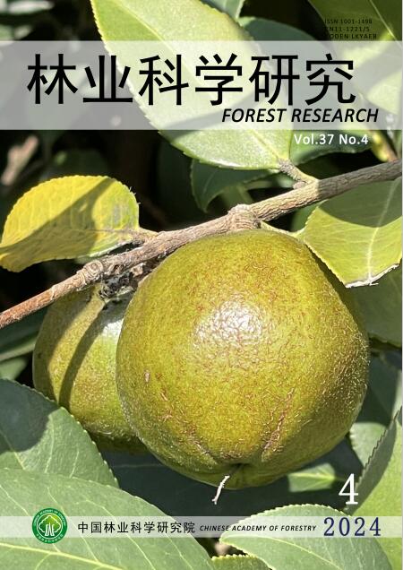
林业科学研究
林业科学研究 Environmental Science-Ecology
CiteScore
0.90
自引率
0.00%
发文量
4834
期刊介绍: Forestry Research is a comprehensive academic journal of forestry science organized by the Chinese Academy of Forestry. The main task is to reflect the latest research results, academic papers and research reports, scientific and technological developments and information on forestry science mainly organized by the Chinese Academy of Forestry, to promote academic exchanges at home and abroad, to carry out academic discussions, to flourish forestry science, and to better serve China's forestry construction. The main contents are: forest seeds, seedling afforestation, forest plants, forest genetic breeding, tree physiology and biochemistry, forest insects, resource insects, forest pathology, forest microorganisms, forest birds and animals, forest soil, forest ecology, forest management, forest manager, forestry remote sensing, forestry biotechnology and other new technologies, new methods, and to increase the development strategy of forestry, the trend of development of disciplines, technology policies and strategies, etc., and to increase the forestry development strategy, the trend of development of disciplines, technology policies and strategies. It is suitable for scientists and technicians of forestry and related disciplines, teachers and students of colleges and universities, leaders and managers, and grassroots forestry workers.
×
引用
GB/T 7714-2015
复制
MLA
复制
APA
复制
导出至
BibTeX EndNote RefMan NoteFirst NoteExpress
×
提示
您的信息不完整,为了账户安全,请先补充。
现在去补充
×
提示
您因"违规操作"
具体请查看互助需知
我知道了
×
提示
确定
请完成安全验证×
copy
已复制链接
快去分享给好友吧!
我知道了
右上角分享
点击右上角分享
0
联系我们:info@booksci.cn Book学术提供免费学术资源搜索服务,方便国内外学者检索中英文文献。致力于提供最便捷和优质的服务体验。 Copyright © 2023 布克学术 All rights reserved.
京ICP备2023020795号-1
ghs 京公网安备 11010802042870号
Book学术文献互助
Book学术文献互助群
群 号:481959085
Book学术官方微信