利用机载POLDER数据反演不同生物群系的LAI和fAPAR

P. Bicheron, M. Leroy, O. Hautecoeur
{"title":"利用机载POLDER数据反演不同生物群系的LAI和fAPAR","authors":"P. Bicheron, M. Leroy, O. Hautecoeur","doi":"10.1109/IGARSS.1997.615941","DOIUrl":null,"url":null,"abstract":"The objectives of the paper is to study a method of retrieval of LAI and fAPAR parameters based on the inversion of a BRDF model against remote sensing data from forthcoming wide field of view optical satellite sensors such as POLDER/ADEOS, VGT/SPOT4, MODIS/EOS, MISR/EOS. The model used is that of Kuusk (1994). The evaluation of this approach is made with field data and airborne POLDER acquired during BOREAS 94 and HAPEX 92. The results show that the LAI is restituted with an accuracy higher than that obtained with a semi-empirical relationship LAI-vegetation index. The daily fAPAR is also very well restituted. It is concluded that the retrieval of biophysical parameters from inversion of a BRDF model is promising in the perspective of a quantitative characterization of the terrestrial biosphere.","PeriodicalId":64877,"journal":{"name":"遥感信息","volume":"64 1","pages":"556-558 vol.1"},"PeriodicalIF":0.0000,"publicationDate":"1997-08-03","publicationTypes":"Journal Article","fieldsOfStudy":null,"isOpenAccess":false,"openAccessPdf":"","citationCount":"0","resultStr":"{\"title\":\"Retrieving of LAI and fAPAR with airborne POLDER data over various biomes\",\"authors\":\"P. Bicheron, M. Leroy, O. Hautecoeur\",\"doi\":\"10.1109/IGARSS.1997.615941\",\"DOIUrl\":null,\"url\":null,\"abstract\":\"The objectives of the paper is to study a method of retrieval of LAI and fAPAR parameters based on the inversion of a BRDF model against remote sensing data from forthcoming wide field of view optical satellite sensors such as POLDER/ADEOS, VGT/SPOT4, MODIS/EOS, MISR/EOS. The model used is that of Kuusk (1994). The evaluation of this approach is made with field data and airborne POLDER acquired during BOREAS 94 and HAPEX 92. The results show that the LAI is restituted with an accuracy higher than that obtained with a semi-empirical relationship LAI-vegetation index. The daily fAPAR is also very well restituted. It is concluded that the retrieval of biophysical parameters from inversion of a BRDF model is promising in the perspective of a quantitative characterization of the terrestrial biosphere.\",\"PeriodicalId\":64877,\"journal\":{\"name\":\"遥感信息\",\"volume\":\"64 1\",\"pages\":\"556-558 vol.1\"},\"PeriodicalIF\":0.0000,\"publicationDate\":\"1997-08-03\",\"publicationTypes\":\"Journal Article\",\"fieldsOfStudy\":null,\"isOpenAccess\":false,\"openAccessPdf\":\"\",\"citationCount\":\"0\",\"resultStr\":null,\"platform\":\"Semanticscholar\",\"paperid\":null,\"PeriodicalName\":\"遥感信息\",\"FirstCategoryId\":\"1087\",\"ListUrlMain\":\"https://doi.org/10.1109/IGARSS.1997.615941\",\"RegionNum\":0,\"RegionCategory\":null,\"ArticlePicture\":[],\"TitleCN\":null,\"AbstractTextCN\":null,\"PMCID\":null,\"EPubDate\":\"\",\"PubModel\":\"\",\"JCR\":\"\",\"JCRName\":\"\",\"Score\":null,\"Total\":0}","platform":"Semanticscholar","paperid":null,"PeriodicalName":"遥感信息","FirstCategoryId":"1087","ListUrlMain":"https://doi.org/10.1109/IGARSS.1997.615941","RegionNum":0,"RegionCategory":null,"ArticlePicture":[],"TitleCN":null,"AbstractTextCN":null,"PMCID":null,"EPubDate":"","PubModel":"","JCR":"","JCRName":"","Score":null,"Total":0}
引用次数: 0

摘要

本文的目的是研究一种基于BRDF模型对即将到来的大视场光学卫星传感器(如POLDER/ADEOS, VGT/SPOT4, MODIS/EOS, MISR/EOS)遥感数据的反演反演LAI和fAPAR参数的方法。使用的模型是Kuusk(1994)的模型。利用BOREAS 94和HAPEX 92期间获得的现场数据和机载POLDER对该方法进行了评估。结果表明,该方法恢复的LAI精度高于半经验关系LAI-植被指数恢复的精度。每日的fAPAR也得到了很好的恢复。从陆地生物圈定量表征的角度来看,利用BRDF模型反演生物物理参数是有前景的。
本文章由计算机程序翻译,如有差异,请以英文原文为准。
Retrieving of LAI and fAPAR with airborne POLDER data over various biomes
The objectives of the paper is to study a method of retrieval of LAI and fAPAR parameters based on the inversion of a BRDF model against remote sensing data from forthcoming wide field of view optical satellite sensors such as POLDER/ADEOS, VGT/SPOT4, MODIS/EOS, MISR/EOS. The model used is that of Kuusk (1994). The evaluation of this approach is made with field data and airborne POLDER acquired during BOREAS 94 and HAPEX 92. The results show that the LAI is restituted with an accuracy higher than that obtained with a semi-empirical relationship LAI-vegetation index. The daily fAPAR is also very well restituted. It is concluded that the retrieval of biophysical parameters from inversion of a BRDF model is promising in the perspective of a quantitative characterization of the terrestrial biosphere.
求助全文
通过发布文献求助,成功后即可免费获取论文全文。 去求助
来源期刊
自引率
0.00%
发文量
3984
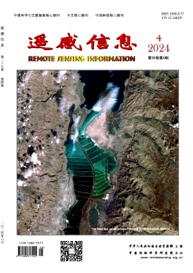
期刊介绍: Remote Sensing Information is a bimonthly academic journal supervised by the Ministry of Natural Resources of the People's Republic of China and sponsored by China Academy of Surveying and Mapping Science. Since its inception in 1986, it has been one of the authoritative journals in the field of remote sensing in China.In 2014, it was recognised as one of the first batch of national academic journals, and was awarded the honours of Core Journals of China Science Citation Database, Chinese Core Journals, and Core Journals of Science and Technology of China. The journal won the Excellence Award (First Prize) of the National Excellent Surveying, Mapping and Geographic Information Journal Award in 2011 and 2017 respectively. Remote Sensing Information is dedicated to reporting the cutting-edge theoretical and applied results of remote sensing science and technology, promoting academic exchanges at home and abroad, and promoting the application of remote sensing science and technology and industrial development. The journal adheres to the principles of openness, fairness and professionalism, abides by the anonymous review system of peer experts, and has good social credibility. The main columns include Review, Theoretical Research, Innovative Applications, Special Reports, International News, Famous Experts' Forum, Geographic National Condition Monitoring, etc., covering various fields such as surveying and mapping, forestry, agriculture, geology, meteorology, ocean, environment, national defence and so on. Remote Sensing Information aims to provide a high-level academic exchange platform for experts and scholars in the field of remote sensing at home and abroad, to enhance academic influence, and to play a role in promoting and supporting the protection of natural resources, green technology innovation, and the construction of ecological civilisation.
×
引用
GB/T 7714-2015
复制
MLA
复制
APA
复制
导出至
BibTeX EndNote RefMan NoteFirst NoteExpress
×
提示
您的信息不完整,为了账户安全,请先补充。
现在去补充
×
提示
您因"违规操作"
具体请查看互助需知
我知道了
×
提示
确定
请完成安全验证×
copy
已复制链接
快去分享给好友吧!
我知道了
右上角分享
点击右上角分享
0
联系我们:info@booksci.cn Book学术提供免费学术资源搜索服务,方便国内外学者检索中英文文献。致力于提供最便捷和优质的服务体验。 Copyright © 2023 布克学术 All rights reserved.
京ICP备2023020795号-1
ghs 京公网安备 11010802042870号
Book学术文献互助
Book学术文献互助群
群 号:481959085
Book学术官方微信