Y. Lou, Y. Kim, J. V. Van Zyl, L. Maldonado, T. Miller, E. O'Leary, G. Romero, W. Skotnicki, V. Taylor
{"title":"1996年NASA/JPL机载合成孔径雷达的PacRim部署","authors":"Y. Lou, Y. Kim, J. V. Van Zyl, L. Maldonado, T. Miller, E. O'Leary, G. Romero, W. Skotnicki, V. Taylor","doi":"10.1109/IGARSS.1997.606460","DOIUrl":null,"url":null,"abstract":"In November and December 1996, the NASA/JPL Airborne Synthetic Aperture Radar System (AIRSAR) embarked on a seven-week campaign to several Pacific Rim countries. This mission was jointly organized by NASA, Australia's Office of Space Science and Application, and University of New South Wales. The major purpose of the mission is to establish a collaborative effort in the area of radar remote sensing application between the United States and the Pacific Rim countries. SAR data were acquired for both U.S. researchers as well as the participating countries. In addition to Hawaii, the authors imaged areas of interest in New Zealand, Australia, Papua New Guinea, Malaysia, Brunei, the Philippines, Taiwan, Thailand, and Cambodia including coastal regions of some countries. The target areas of this multi-frequency, polarimetric and interferometric SAR system included volcanoes, sites for studies in geology, hydrology, and land use mapping, and forested mountains to generate height maps of rugged and inaccessible areas.","PeriodicalId":64877,"journal":{"name":"遥感信息","volume":null,"pages":null},"PeriodicalIF":0.0000,"publicationDate":"1997-08-03","publicationTypes":"Journal Article","fieldsOfStudy":null,"isOpenAccess":false,"openAccessPdf":"","citationCount":"3","resultStr":"{\"title\":\"The NASA/JPL Airborne Synthetic Aperture Radar's 1996 PacRim deployment\",\"authors\":\"Y. Lou, Y. Kim, J. V. Van Zyl, L. Maldonado, T. Miller, E. O'Leary, G. Romero, W. Skotnicki, V. Taylor\",\"doi\":\"10.1109/IGARSS.1997.606460\",\"DOIUrl\":null,\"url\":null,\"abstract\":\"In November and December 1996, the NASA/JPL Airborne Synthetic Aperture Radar System (AIRSAR) embarked on a seven-week campaign to several Pacific Rim countries. This mission was jointly organized by NASA, Australia's Office of Space Science and Application, and University of New South Wales. The major purpose of the mission is to establish a collaborative effort in the area of radar remote sensing application between the United States and the Pacific Rim countries. SAR data were acquired for both U.S. researchers as well as the participating countries. In addition to Hawaii, the authors imaged areas of interest in New Zealand, Australia, Papua New Guinea, Malaysia, Brunei, the Philippines, Taiwan, Thailand, and Cambodia including coastal regions of some countries. The target areas of this multi-frequency, polarimetric and interferometric SAR system included volcanoes, sites for studies in geology, hydrology, and land use mapping, and forested mountains to generate height maps of rugged and inaccessible areas.\",\"PeriodicalId\":64877,\"journal\":{\"name\":\"遥感信息\",\"volume\":null,\"pages\":null},\"PeriodicalIF\":0.0000,\"publicationDate\":\"1997-08-03\",\"publicationTypes\":\"Journal Article\",\"fieldsOfStudy\":null,\"isOpenAccess\":false,\"openAccessPdf\":\"\",\"citationCount\":\"3\",\"resultStr\":null,\"platform\":\"Semanticscholar\",\"paperid\":null,\"PeriodicalName\":\"遥感信息\",\"FirstCategoryId\":\"1087\",\"ListUrlMain\":\"https://doi.org/10.1109/IGARSS.1997.606460\",\"RegionNum\":0,\"RegionCategory\":null,\"ArticlePicture\":[],\"TitleCN\":null,\"AbstractTextCN\":null,\"PMCID\":null,\"EPubDate\":\"\",\"PubModel\":\"\",\"JCR\":\"\",\"JCRName\":\"\",\"Score\":null,\"Total\":0}","platform":"Semanticscholar","paperid":null,"PeriodicalName":"遥感信息","FirstCategoryId":"1087","ListUrlMain":"https://doi.org/10.1109/IGARSS.1997.606460","RegionNum":0,"RegionCategory":null,"ArticlePicture":[],"TitleCN":null,"AbstractTextCN":null,"PMCID":null,"EPubDate":"","PubModel":"","JCR":"","JCRName":"","Score":null,"Total":0}
The NASA/JPL Airborne Synthetic Aperture Radar's 1996 PacRim deployment
In November and December 1996, the NASA/JPL Airborne Synthetic Aperture Radar System (AIRSAR) embarked on a seven-week campaign to several Pacific Rim countries. This mission was jointly organized by NASA, Australia's Office of Space Science and Application, and University of New South Wales. The major purpose of the mission is to establish a collaborative effort in the area of radar remote sensing application between the United States and the Pacific Rim countries. SAR data were acquired for both U.S. researchers as well as the participating countries. In addition to Hawaii, the authors imaged areas of interest in New Zealand, Australia, Papua New Guinea, Malaysia, Brunei, the Philippines, Taiwan, Thailand, and Cambodia including coastal regions of some countries. The target areas of this multi-frequency, polarimetric and interferometric SAR system included volcanoes, sites for studies in geology, hydrology, and land use mapping, and forested mountains to generate height maps of rugged and inaccessible areas.
期刊介绍:
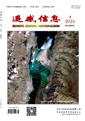
Remote Sensing Information is a bimonthly academic journal supervised by the Ministry of Natural Resources of the People's Republic of China and sponsored by China Academy of Surveying and Mapping Science. Since its inception in 1986, it has been one of the authoritative journals in the field of remote sensing in China.In 2014, it was recognised as one of the first batch of national academic journals, and was awarded the honours of Core Journals of China Science Citation Database, Chinese Core Journals, and Core Journals of Science and Technology of China. The journal won the Excellence Award (First Prize) of the National Excellent Surveying, Mapping and Geographic Information Journal Award in 2011 and 2017 respectively.
Remote Sensing Information is dedicated to reporting the cutting-edge theoretical and applied results of remote sensing science and technology, promoting academic exchanges at home and abroad, and promoting the application of remote sensing science and technology and industrial development. The journal adheres to the principles of openness, fairness and professionalism, abides by the anonymous review system of peer experts, and has good social credibility. The main columns include Review, Theoretical Research, Innovative Applications, Special Reports, International News, Famous Experts' Forum, Geographic National Condition Monitoring, etc., covering various fields such as surveying and mapping, forestry, agriculture, geology, meteorology, ocean, environment, national defence and so on.
Remote Sensing Information aims to provide a high-level academic exchange platform for experts and scholars in the field of remote sensing at home and abroad, to enhance academic influence, and to play a role in promoting and supporting the protection of natural resources, green technology innovation, and the construction of ecological civilisation.