机载干涉SAR系统联合三维定位算法

Q2 Physics and Astronomy
Y. Mao, Xiao-jie Wang, M. Xiang
{"title":"机载干涉SAR系统联合三维定位算法","authors":"Y. Mao, Xiao-jie Wang, M. Xiang","doi":"10.3724/SP.J.1300.2013.20107","DOIUrl":null,"url":null,"abstract":": Joint three-dimensional location algorithms aim to simultaneously obtain the north, east, and height coordinates of each pixel in several adjacent Interferometric Synthetic Aperture Radar (InSAR) scenes. Joint calibration is a key procedure used to achieve an accurate three-dimensional location. It can ensure the continuity of three-dimensional locations among adjacent scenes, and achieve the location of large areas with few Ground Control Points (GCPs) using Tie Points (TPs). In this paper, a new joint calibration algorithm for airborne interferometric SAR that simultaneously calibrates north, east, and height coordinates is proposed. It employs a weighted optimization method to carry out calibration, and introduces weights to calibration to discriminate GCPs and TPs with different coherences and locations. The experimental results for airborne InSAR data show that the three-dimensional location accuracy obtained using the proposed calibration algorithm is better than that obtained using the traditional method.","PeriodicalId":37701,"journal":{"name":"雷达学报","volume":"1 1","pages":""},"PeriodicalIF":0.0000,"publicationDate":"2013-02-01","publicationTypes":"Journal Article","fieldsOfStudy":null,"isOpenAccess":false,"openAccessPdf":"","citationCount":"1","resultStr":"{\"title\":\"Joint Three-dimensional Location Algorithm for Airborne Interferometric SAR System\",\"authors\":\"Y. Mao, Xiao-jie Wang, M. Xiang\",\"doi\":\"10.3724/SP.J.1300.2013.20107\",\"DOIUrl\":null,\"url\":null,\"abstract\":\": Joint three-dimensional location algorithms aim to simultaneously obtain the north, east, and height coordinates of each pixel in several adjacent Interferometric Synthetic Aperture Radar (InSAR) scenes. Joint calibration is a key procedure used to achieve an accurate three-dimensional location. It can ensure the continuity of three-dimensional locations among adjacent scenes, and achieve the location of large areas with few Ground Control Points (GCPs) using Tie Points (TPs). In this paper, a new joint calibration algorithm for airborne interferometric SAR that simultaneously calibrates north, east, and height coordinates is proposed. It employs a weighted optimization method to carry out calibration, and introduces weights to calibration to discriminate GCPs and TPs with different coherences and locations. The experimental results for airborne InSAR data show that the three-dimensional location accuracy obtained using the proposed calibration algorithm is better than that obtained using the traditional method.\",\"PeriodicalId\":37701,\"journal\":{\"name\":\"雷达学报\",\"volume\":\"1 1\",\"pages\":\"\"},\"PeriodicalIF\":0.0000,\"publicationDate\":\"2013-02-01\",\"publicationTypes\":\"Journal Article\",\"fieldsOfStudy\":null,\"isOpenAccess\":false,\"openAccessPdf\":\"\",\"citationCount\":\"1\",\"resultStr\":null,\"platform\":\"Semanticscholar\",\"paperid\":null,\"PeriodicalName\":\"雷达学报\",\"FirstCategoryId\":\"1093\",\"ListUrlMain\":\"https://doi.org/10.3724/SP.J.1300.2013.20107\",\"RegionNum\":0,\"RegionCategory\":null,\"ArticlePicture\":[],\"TitleCN\":null,\"AbstractTextCN\":null,\"PMCID\":null,\"EPubDate\":\"\",\"PubModel\":\"\",\"JCR\":\"Q2\",\"JCRName\":\"Physics and Astronomy\",\"Score\":null,\"Total\":0}","platform":"Semanticscholar","paperid":null,"PeriodicalName":"雷达学报","FirstCategoryId":"1093","ListUrlMain":"https://doi.org/10.3724/SP.J.1300.2013.20107","RegionNum":0,"RegionCategory":null,"ArticlePicture":[],"TitleCN":null,"AbstractTextCN":null,"PMCID":null,"EPubDate":"","PubModel":"","JCR":"Q2","JCRName":"Physics and Astronomy","Score":null,"Total":0}
引用次数: 1

摘要

:联合三维定位算法旨在同时获取多个相邻干涉合成孔径雷达(InSAR)场景中每个像素点的北坐标、东坐标和高度坐标。联合校准是实现精确三维定位的关键步骤。它可以保证相邻场景之间三维位置的连续性,并利用Tie Points (TPs)实现较少地面控制点(gcp)的大面积定位。本文提出了一种同时标定北坐标、东坐标和高度坐标的机载干涉SAR联合标定算法。采用加权优化方法进行标定,并引入权重进行标定,区分不同相干和位置的gcp和TPs。机载InSAR数据的实验结果表明,采用该方法获得的三维定位精度优于传统方法。
本文章由计算机程序翻译,如有差异,请以英文原文为准。
Joint Three-dimensional Location Algorithm for Airborne Interferometric SAR System
: Joint three-dimensional location algorithms aim to simultaneously obtain the north, east, and height coordinates of each pixel in several adjacent Interferometric Synthetic Aperture Radar (InSAR) scenes. Joint calibration is a key procedure used to achieve an accurate three-dimensional location. It can ensure the continuity of three-dimensional locations among adjacent scenes, and achieve the location of large areas with few Ground Control Points (GCPs) using Tie Points (TPs). In this paper, a new joint calibration algorithm for airborne interferometric SAR that simultaneously calibrates north, east, and height coordinates is proposed. It employs a weighted optimization method to carry out calibration, and introduces weights to calibration to discriminate GCPs and TPs with different coherences and locations. The experimental results for airborne InSAR data show that the three-dimensional location accuracy obtained using the proposed calibration algorithm is better than that obtained using the traditional method.
求助全文
通过发布文献求助,成功后即可免费获取论文全文。 去求助
来源期刊
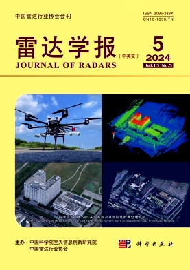
雷达学报
雷达学报 Physics and Astronomy-Instrumentation
CiteScore
4.10
自引率
0.00%
发文量
882
期刊介绍: Information not localized
×
引用
GB/T 7714-2015
复制
MLA
复制
APA
复制
导出至
BibTeX EndNote RefMan NoteFirst NoteExpress
×
提示
您的信息不完整,为了账户安全,请先补充。
现在去补充
×
提示
您因"违规操作"
具体请查看互助需知
我知道了
×
提示
确定
请完成安全验证×
copy
已复制链接
快去分享给好友吧!
我知道了
右上角分享
点击右上角分享
0
联系我们:info@booksci.cn Book学术提供免费学术资源搜索服务,方便国内外学者检索中英文文献。致力于提供最便捷和优质的服务体验。 Copyright © 2023 布克学术 All rights reserved.
京ICP备2023020795号-1
ghs 京公网安备 11010802042870号
Book学术文献互助
Book学术文献互助群
群 号:481959085
Book学术官方微信