基于多频InSAR数据的地表形变模拟预测2017年浦项地震震源

M. Fadhillah, Chang-Wook Lee
{"title":"基于多频InSAR数据的地表形变模拟预测2017年浦项地震震源","authors":"M. Fadhillah, Chang-Wook Lee","doi":"10.7780/KJRS.2021.37.1.5","DOIUrl":null,"url":null,"abstract":"An earthquake occurred on 17 November 2017 in Pohang, South Korea with a strength of 5.4 Mw. This is the second strongest earthquake recorded by local authorities since the equipment was first installed. In order to improve understanding of earthquakes and surface deformation, many studies have been conducted according to these phenomena. In this research, we will estimate the surface deformation using the Okada model equation. The SAR images of three satellites with different wavelengths (ALOS-2, Cosmo SkyMed and Sentinel-1) were used to produce the interferogram pairs. The interferogram is used as a reference for surface deformation changes by using Okada to determine the source of surface deformation that occurs during an earthquake. The Non-linear optimization (Levemberg-Marquadrt algorithm) and Monte Carlo restart was applied to optimize the fault parameter on modeling process. Based on the modeling results of each satellite data, the fault geometry is ~6 km length, ~2 km width and ~5 km depth. The root mean square error values in the surface deformation model results for Sentinel, CSK and ALOS are 0.37 cm, 0.79 cm and 1.47 cm, respectively. Furthermore, the results of this modeling can be used as learning material in understanding about seismic activity to minimize the impacts that arise in the future.","PeriodicalId":38304,"journal":{"name":"遥感学报","volume":"37 1","pages":"57-67"},"PeriodicalIF":0.0000,"publicationDate":"2021-02-01","publicationTypes":"Journal Article","fieldsOfStudy":null,"isOpenAccess":false,"openAccessPdf":"","citationCount":"1","resultStr":"{\"title\":\"The Estimated Source of 2017 Pohang Earthquake Using Surface Deformation Modeling Based on Multi-Frequency InSAR Data\",\"authors\":\"M. Fadhillah, Chang-Wook Lee\",\"doi\":\"10.7780/KJRS.2021.37.1.5\",\"DOIUrl\":null,\"url\":null,\"abstract\":\"An earthquake occurred on 17 November 2017 in Pohang, South Korea with a strength of 5.4 Mw. This is the second strongest earthquake recorded by local authorities since the equipment was first installed. In order to improve understanding of earthquakes and surface deformation, many studies have been conducted according to these phenomena. In this research, we will estimate the surface deformation using the Okada model equation. The SAR images of three satellites with different wavelengths (ALOS-2, Cosmo SkyMed and Sentinel-1) were used to produce the interferogram pairs. The interferogram is used as a reference for surface deformation changes by using Okada to determine the source of surface deformation that occurs during an earthquake. The Non-linear optimization (Levemberg-Marquadrt algorithm) and Monte Carlo restart was applied to optimize the fault parameter on modeling process. Based on the modeling results of each satellite data, the fault geometry is ~6 km length, ~2 km width and ~5 km depth. The root mean square error values in the surface deformation model results for Sentinel, CSK and ALOS are 0.37 cm, 0.79 cm and 1.47 cm, respectively. Furthermore, the results of this modeling can be used as learning material in understanding about seismic activity to minimize the impacts that arise in the future.\",\"PeriodicalId\":38304,\"journal\":{\"name\":\"遥感学报\",\"volume\":\"37 1\",\"pages\":\"57-67\"},\"PeriodicalIF\":0.0000,\"publicationDate\":\"2021-02-01\",\"publicationTypes\":\"Journal Article\",\"fieldsOfStudy\":null,\"isOpenAccess\":false,\"openAccessPdf\":\"\",\"citationCount\":\"1\",\"resultStr\":null,\"platform\":\"Semanticscholar\",\"paperid\":null,\"PeriodicalName\":\"遥感学报\",\"FirstCategoryId\":\"1089\",\"ListUrlMain\":\"https://doi.org/10.7780/KJRS.2021.37.1.5\",\"RegionNum\":0,\"RegionCategory\":null,\"ArticlePicture\":[],\"TitleCN\":null,\"AbstractTextCN\":null,\"PMCID\":null,\"EPubDate\":\"\",\"PubModel\":\"\",\"JCR\":\"\",\"JCRName\":\"\",\"Score\":null,\"Total\":0}","platform":"Semanticscholar","paperid":null,"PeriodicalName":"遥感学报","FirstCategoryId":"1089","ListUrlMain":"https://doi.org/10.7780/KJRS.2021.37.1.5","RegionNum":0,"RegionCategory":null,"ArticlePicture":[],"TitleCN":null,"AbstractTextCN":null,"PMCID":null,"EPubDate":"","PubModel":"","JCR":"","JCRName":"","Score":null,"Total":0}
引用次数: 1

摘要

2017年11月17日,韩国浦项发生地震,强度为5.4 Mw。这是自该设备首次安装以来,地方当局记录的第二强烈地震。为了提高对地震和地表变形的认识,人们根据这些现象进行了许多研究。在本研究中,我们将使用Okada模型方程来估计表面变形。使用三颗不同波长卫星(ALOS-2、Cosmo SkyMed和Sentinel-1)的SAR图像生成干涉图对。通过使用Okada来确定地震期间发生的表面变形的来源,干涉图被用作表面变形变化的参考。在建模过程中,应用非线性优化(Levemberg-Marquart算法)和蒙特卡罗重启算法对故障参数进行了优化。根据每颗卫星数据的建模结果,断层几何结构长约6km,宽约2km,深约5km。Sentinel、CSK和ALOS的表面变形模型结果的均方根误差值分别为0.37cm、0.79cm和1.47cm。此外,该建模的结果可作为了解地震活动的学习材料,以最大限度地减少未来产生的影响。
本文章由计算机程序翻译,如有差异,请以英文原文为准。
The Estimated Source of 2017 Pohang Earthquake Using Surface Deformation Modeling Based on Multi-Frequency InSAR Data
An earthquake occurred on 17 November 2017 in Pohang, South Korea with a strength of 5.4 Mw. This is the second strongest earthquake recorded by local authorities since the equipment was first installed. In order to improve understanding of earthquakes and surface deformation, many studies have been conducted according to these phenomena. In this research, we will estimate the surface deformation using the Okada model equation. The SAR images of three satellites with different wavelengths (ALOS-2, Cosmo SkyMed and Sentinel-1) were used to produce the interferogram pairs. The interferogram is used as a reference for surface deformation changes by using Okada to determine the source of surface deformation that occurs during an earthquake. The Non-linear optimization (Levemberg-Marquadrt algorithm) and Monte Carlo restart was applied to optimize the fault parameter on modeling process. Based on the modeling results of each satellite data, the fault geometry is ~6 km length, ~2 km width and ~5 km depth. The root mean square error values in the surface deformation model results for Sentinel, CSK and ALOS are 0.37 cm, 0.79 cm and 1.47 cm, respectively. Furthermore, the results of this modeling can be used as learning material in understanding about seismic activity to minimize the impacts that arise in the future.
求助全文
通过发布文献求助,成功后即可免费获取论文全文。 去求助
来源期刊
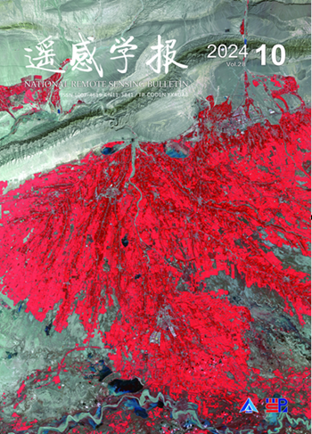
遥感学报
遥感学报 Social Sciences-Geography, Planning and Development
CiteScore
3.60
自引率
0.00%
发文量
3200
期刊介绍: The predecessor of Journal of Remote Sensing is Remote Sensing of Environment, which was founded in 1986. It was born in the beginning of China's remote sensing career and is the first remote sensing journal that has grown up with the development of China's remote sensing career. Since its inception, the Journal of Remote Sensing has published a large number of the latest scientific research results in China and the results of nationally-supported research projects in the light of the priorities and needs of China's remote sensing endeavours at different times, playing a great role in the development of remote sensing science and technology and the cultivation of talents in China, and becoming the most influential academic journal in the field of remote sensing and geographic information science in China. As the only national comprehensive academic journal in the field of remote sensing in China, Journal of Remote Sensing is dedicated to reporting the research reports, stage-by-stage research briefs and high-level reviews in the field of remote sensing and its related disciplines with international and domestic advanced level. It focuses on new concepts, results and progress in this field. It covers the basic theories of remote sensing, the development of remote sensing technology and the application of remote sensing in the fields of agriculture, forestry, hydrology, geology, mining, oceanography, mapping and other resource and environmental fields as well as in disaster monitoring, research on geographic information systems (GIS), and the integration of remote sensing with GIS and the Global Navigation Satellite System (GNSS) and its applications.
×
引用
GB/T 7714-2015
复制
MLA
复制
APA
复制
导出至
BibTeX EndNote RefMan NoteFirst NoteExpress
×
提示
您的信息不完整,为了账户安全,请先补充。
现在去补充
×
提示
您因"违规操作"
具体请查看互助需知
我知道了
×
提示
确定
请完成安全验证×
copy
已复制链接
快去分享给好友吧!
我知道了
右上角分享
点击右上角分享
0
联系我们:info@booksci.cn Book学术提供免费学术资源搜索服务,方便国内外学者检索中英文文献。致力于提供最便捷和优质的服务体验。 Copyright © 2023 布克学术 All rights reserved.
京ICP备2023020795号-1
ghs 京公网安备 11010802042870号
Book学术文献互助
Book学术文献互助群
群 号:481959085
Book学术官方微信