利用无人机测绘阿拉斯加和加拿大西北部冻土带生态系统植物功能类型覆盖、高度和地上生物量

IF 2.7 3区 地球科学 Q2 ECOLOGY
K. Orndahl, Libby Ehlers, J. Herriges, Rachel E. Pernick, M. Hebblewhite, S. Goetz
{"title":"利用无人机测绘阿拉斯加和加拿大西北部冻土带生态系统植物功能类型覆盖、高度和地上生物量","authors":"K. Orndahl, Libby Ehlers, J. Herriges, Rachel E. Pernick, M. Hebblewhite, S. Goetz","doi":"10.1139/as-2021-0044","DOIUrl":null,"url":null,"abstract":"Arctic vegetation communities are rapidly changing with climate warming, which impacts wildlife, carbon cycling and climate feedbacks. Accurately monitoring vegetation change is thus crucial, but scale mismatches between field and satellite-based monitoring cause challenges. Remote sensing from unmanned aerial vehicles (UAVs) has emerged as a bridge between field data and satellite-based mapping. We assess the viability of using high resolution UAV imagery and UAV-derived Structure from Motion (SfM) to predict cover, height and aboveground biomass (henceforth biomass) of Arctic plant functional types (PFTs) across a range of vegetation community types. We classified imagery by PFT, estimated cover and height, and modeled biomass from UAV-derived volume estimates. Predicted values were compared to field estimates to assess results. Cover was estimated with root-mean-square error (RMSE) 6.29-14.2% and height was estimated with RMSE 3.29-10.5 cm, depending on the PFT. Total aboveground biomass was predicted with RMSE 220.5 g m-2, and per-PFT RMSE ranged from 17.14-164.3 g m-2. Deciduous and evergreen shrub biomass was predicted most accurately, followed by lichen, graminoid, and forb biomass. Our results demonstrate the effectiveness of using UAVs to map PFT biomass, which provides a link towards improved mapping of PFTs across large areas using earth observation satellite imagery.","PeriodicalId":48575,"journal":{"name":"Arctic Science","volume":" ","pages":""},"PeriodicalIF":2.7000,"publicationDate":"2022-04-12","publicationTypes":"Journal Article","fieldsOfStudy":null,"isOpenAccess":false,"openAccessPdf":"","citationCount":"1","resultStr":"{\"title\":\"Mapping tundra ecosystem plant functional type cover, height and aboveground biomass in Alaska and northwest Canada using unmanned aerial vehicles\",\"authors\":\"K. Orndahl, Libby Ehlers, J. Herriges, Rachel E. Pernick, M. Hebblewhite, S. Goetz\",\"doi\":\"10.1139/as-2021-0044\",\"DOIUrl\":null,\"url\":null,\"abstract\":\"Arctic vegetation communities are rapidly changing with climate warming, which impacts wildlife, carbon cycling and climate feedbacks. Accurately monitoring vegetation change is thus crucial, but scale mismatches between field and satellite-based monitoring cause challenges. Remote sensing from unmanned aerial vehicles (UAVs) has emerged as a bridge between field data and satellite-based mapping. We assess the viability of using high resolution UAV imagery and UAV-derived Structure from Motion (SfM) to predict cover, height and aboveground biomass (henceforth biomass) of Arctic plant functional types (PFTs) across a range of vegetation community types. We classified imagery by PFT, estimated cover and height, and modeled biomass from UAV-derived volume estimates. Predicted values were compared to field estimates to assess results. Cover was estimated with root-mean-square error (RMSE) 6.29-14.2% and height was estimated with RMSE 3.29-10.5 cm, depending on the PFT. Total aboveground biomass was predicted with RMSE 220.5 g m-2, and per-PFT RMSE ranged from 17.14-164.3 g m-2. Deciduous and evergreen shrub biomass was predicted most accurately, followed by lichen, graminoid, and forb biomass. Our results demonstrate the effectiveness of using UAVs to map PFT biomass, which provides a link towards improved mapping of PFTs across large areas using earth observation satellite imagery.\",\"PeriodicalId\":48575,\"journal\":{\"name\":\"Arctic Science\",\"volume\":\" \",\"pages\":\"\"},\"PeriodicalIF\":2.7000,\"publicationDate\":\"2022-04-12\",\"publicationTypes\":\"Journal Article\",\"fieldsOfStudy\":null,\"isOpenAccess\":false,\"openAccessPdf\":\"\",\"citationCount\":\"1\",\"resultStr\":null,\"platform\":\"Semanticscholar\",\"paperid\":null,\"PeriodicalName\":\"Arctic Science\",\"FirstCategoryId\":\"89\",\"ListUrlMain\":\"https://doi.org/10.1139/as-2021-0044\",\"RegionNum\":3,\"RegionCategory\":\"地球科学\",\"ArticlePicture\":[],\"TitleCN\":null,\"AbstractTextCN\":null,\"PMCID\":null,\"EPubDate\":\"\",\"PubModel\":\"\",\"JCR\":\"Q2\",\"JCRName\":\"ECOLOGY\",\"Score\":null,\"Total\":0}","platform":"Semanticscholar","paperid":null,"PeriodicalName":"Arctic Science","FirstCategoryId":"89","ListUrlMain":"https://doi.org/10.1139/as-2021-0044","RegionNum":3,"RegionCategory":"地球科学","ArticlePicture":[],"TitleCN":null,"AbstractTextCN":null,"PMCID":null,"EPubDate":"","PubModel":"","JCR":"Q2","JCRName":"ECOLOGY","Score":null,"Total":0}
引用次数: 1

摘要

随着气候变暖,北极植被群落正在迅速变化,这影响了野生动物、碳循环和气候反馈。因此,准确监测植被变化至关重要,但野外监测和卫星监测之间的尺度不匹配带来了挑战。无人驾驶飞行器(uav)遥感已经成为野外数据和卫星测绘之间的桥梁。我们评估了利用高分辨率无人机图像和无人机衍生的运动结构(SfM)来预测北极植物功能类型(PFTs)在一系列植被群落类型中的覆盖、高度和地上生物量(以下简称生物量)的可行性。我们通过PFT对图像进行分类,估算覆盖和高度,并根据无人机估算的体积对生物量进行建模。将预测值与现场估计值进行比较,以评估结果。覆盖度估计的均方根误差(RMSE)为6.29-14.2%,高度估计的RMSE为3.29-10.5 cm,具体取决于PFT。地上总生物量RMSE为220.5 g m-2,每pft RMSE为17.14 ~ 164.3 g m-2。对落叶灌木和常绿灌木生物量的预测最准确,其次是地衣、禾本科植物和草本植物生物量。我们的研究结果证明了使用无人机绘制PFT生物量的有效性,这为使用地球观测卫星图像改进大面积PFT的绘制提供了联系。
本文章由计算机程序翻译,如有差异,请以英文原文为准。
Mapping tundra ecosystem plant functional type cover, height and aboveground biomass in Alaska and northwest Canada using unmanned aerial vehicles
Arctic vegetation communities are rapidly changing with climate warming, which impacts wildlife, carbon cycling and climate feedbacks. Accurately monitoring vegetation change is thus crucial, but scale mismatches between field and satellite-based monitoring cause challenges. Remote sensing from unmanned aerial vehicles (UAVs) has emerged as a bridge between field data and satellite-based mapping. We assess the viability of using high resolution UAV imagery and UAV-derived Structure from Motion (SfM) to predict cover, height and aboveground biomass (henceforth biomass) of Arctic plant functional types (PFTs) across a range of vegetation community types. We classified imagery by PFT, estimated cover and height, and modeled biomass from UAV-derived volume estimates. Predicted values were compared to field estimates to assess results. Cover was estimated with root-mean-square error (RMSE) 6.29-14.2% and height was estimated with RMSE 3.29-10.5 cm, depending on the PFT. Total aboveground biomass was predicted with RMSE 220.5 g m-2, and per-PFT RMSE ranged from 17.14-164.3 g m-2. Deciduous and evergreen shrub biomass was predicted most accurately, followed by lichen, graminoid, and forb biomass. Our results demonstrate the effectiveness of using UAVs to map PFT biomass, which provides a link towards improved mapping of PFTs across large areas using earth observation satellite imagery.
求助全文
通过发布文献求助,成功后即可免费获取论文全文。 去求助
来源期刊
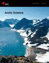
Arctic Science
Arctic Science Agricultural and Biological Sciences-General Agricultural and Biological Sciences
CiteScore
5.00
自引率
12.10%
发文量
81
期刊介绍: Arctic Science is an interdisciplinary journal that publishes original peer-reviewed research from all areas of natural science and applied science & engineering related to northern Polar Regions. The focus on basic and applied science includes the traditional knowledge and observations of the indigenous peoples of the region as well as cutting-edge developments in biological, chemical, physical and engineering science in all northern environments. Reports on interdisciplinary research are encouraged. Special issues and sections dealing with important issues in northern polar science are also considered.
×
引用
GB/T 7714-2015
复制
MLA
复制
APA
复制
导出至
BibTeX EndNote RefMan NoteFirst NoteExpress
×
提示
您的信息不完整,为了账户安全,请先补充。
现在去补充
×
提示
您因"违规操作"
具体请查看互助需知
我知道了
×
提示
确定
请完成安全验证×
copy
已复制链接
快去分享给好友吧!
我知道了
右上角分享
点击右上角分享
0
联系我们:info@booksci.cn Book学术提供免费学术资源搜索服务,方便国内外学者检索中英文文献。致力于提供最便捷和优质的服务体验。 Copyright © 2023 布克学术 All rights reserved.
京ICP备2023020795号-1
ghs 京公网安备 11010802042870号
Book学术文献互助
Book学术文献互助群
群 号:481959085
Book学术官方微信