A. G. Goev, S. I. Oreshin, D. V. Kostilev, N. V. Kostileva
{"title":"从转换波看库页岛地幔过渡带的特征","authors":"A. G. Goev, S. I. Oreshin, D. V. Kostilev, N. V. Kostileva","doi":"10.1134/S1069351325700168","DOIUrl":null,"url":null,"abstract":"<p><b>Abstract</b>—The research presents estimates for the topography of the boundaries of the phase transition zone at depths of 410 and 660 km based on the data set obtained by Sakhalin island seismic stations using the receiver function method. The data set we analyzed incorporates a total of 2500 PRF functions. We revealed a depression at the 660 km boundary in the central and northern parts of the island. The 410 km boundary is significantly elevated in the southern Sahalin, while within the rest of the island, it is depressed (especially in the northern part) compared to the expected standard depth. We hypothesize that the depression in the 410 km boundary is related to the presence of the hot lower mantle melts within the mantle transition zone under the northern part of the island.</p>","PeriodicalId":602,"journal":{"name":"Izvestiya, Physics of the Solid Earth","volume":"61 2","pages":"189 - 194"},"PeriodicalIF":1.0000,"publicationDate":"2025-07-23","publicationTypes":"Journal Article","fieldsOfStudy":null,"isOpenAccess":false,"openAccessPdf":"","citationCount":"0","resultStr":"{\"title\":\"Features of the Sakhalin Mantle Transition Zone from the Converted Waves\",\"authors\":\"A. G. Goev, S. I. Oreshin, D. V. Kostilev, N. V. Kostileva\",\"doi\":\"10.1134/S1069351325700168\",\"DOIUrl\":null,\"url\":null,\"abstract\":\"<p><b>Abstract</b>—The research presents estimates for the topography of the boundaries of the phase transition zone at depths of 410 and 660 km based on the data set obtained by Sakhalin island seismic stations using the receiver function method. The data set we analyzed incorporates a total of 2500 PRF functions. We revealed a depression at the 660 km boundary in the central and northern parts of the island. The 410 km boundary is significantly elevated in the southern Sahalin, while within the rest of the island, it is depressed (especially in the northern part) compared to the expected standard depth. We hypothesize that the depression in the 410 km boundary is related to the presence of the hot lower mantle melts within the mantle transition zone under the northern part of the island.</p>\",\"PeriodicalId\":602,\"journal\":{\"name\":\"Izvestiya, Physics of the Solid Earth\",\"volume\":\"61 2\",\"pages\":\"189 - 194\"},\"PeriodicalIF\":1.0000,\"publicationDate\":\"2025-07-23\",\"publicationTypes\":\"Journal Article\",\"fieldsOfStudy\":null,\"isOpenAccess\":false,\"openAccessPdf\":\"\",\"citationCount\":\"0\",\"resultStr\":null,\"platform\":\"Semanticscholar\",\"paperid\":null,\"PeriodicalName\":\"Izvestiya, Physics of the Solid Earth\",\"FirstCategoryId\":\"89\",\"ListUrlMain\":\"https://link.springer.com/article/10.1134/S1069351325700168\",\"RegionNum\":4,\"RegionCategory\":\"地球科学\",\"ArticlePicture\":[],\"TitleCN\":null,\"AbstractTextCN\":null,\"PMCID\":null,\"EPubDate\":\"\",\"PubModel\":\"\",\"JCR\":\"Q4\",\"JCRName\":\"GEOCHEMISTRY & GEOPHYSICS\",\"Score\":null,\"Total\":0}","platform":"Semanticscholar","paperid":null,"PeriodicalName":"Izvestiya, Physics of the Solid Earth","FirstCategoryId":"89","ListUrlMain":"https://link.springer.com/article/10.1134/S1069351325700168","RegionNum":4,"RegionCategory":"地球科学","ArticlePicture":[],"TitleCN":null,"AbstractTextCN":null,"PMCID":null,"EPubDate":"","PubModel":"","JCR":"Q4","JCRName":"GEOCHEMISTRY & GEOPHYSICS","Score":null,"Total":0}
Features of the Sakhalin Mantle Transition Zone from the Converted Waves
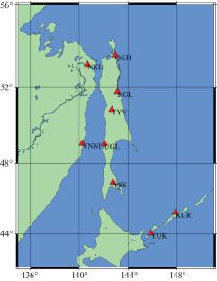
Abstract—The research presents estimates for the topography of the boundaries of the phase transition zone at depths of 410 and 660 km based on the data set obtained by Sakhalin island seismic stations using the receiver function method. The data set we analyzed incorporates a total of 2500 PRF functions. We revealed a depression at the 660 km boundary in the central and northern parts of the island. The 410 km boundary is significantly elevated in the southern Sahalin, while within the rest of the island, it is depressed (especially in the northern part) compared to the expected standard depth. We hypothesize that the depression in the 410 km boundary is related to the presence of the hot lower mantle melts within the mantle transition zone under the northern part of the island.
期刊介绍:
Izvestiya, Physics of the Solid Earth is an international peer reviewed journal that publishes results of original theoretical and experimental research in relevant areas of the physics of the Earth''s interior and applied geophysics. The journal welcomes manuscripts from all countries in the English or Russian language.

 求助内容:
求助内容: 应助结果提醒方式:


