3D-M2C-ResNet:城市森林细尺度树种分类的多尺度特征增强与融合模型

IF 8.6 Q1 REMOTE SENSING
Jushuang Qin , Zhibo Chen , Hao Lu , Xiaohui Cui , Zhenyao Wang , Chao Mou , Guangpeng Fan
{"title":"3D-M2C-ResNet:城市森林细尺度树种分类的多尺度特征增强与融合模型","authors":"Jushuang Qin ,&nbsp;Zhibo Chen ,&nbsp;Hao Lu ,&nbsp;Xiaohui Cui ,&nbsp;Zhenyao Wang ,&nbsp;Chao Mou ,&nbsp;Guangpeng Fan","doi":"10.1016/j.jag.2025.104874","DOIUrl":null,"url":null,"abstract":"<div><div>Forests play a crucial role in global carbon sequestration, and the varying carbon storage capacities of tree species underscore the need for accurate vegetation classification. This study introduces 3D-M<sup>2</sup>C-ResNet, a deep learning model for high-resolution, fine-scale tree species classification. The model leverages fused remote sensing inputs, combining Zhuhai-1 hyperspectral imagery with phenological parameters derived from Sentinel-2 time-series data. A Multi-Scale Cascaded Dilated Convolution (MCDC) module was developed to expand the receptive field through a three-branch architecture, enabling comprehensive spectral–spatial feature extraction. Additionally, a Multi-level Feature Enhancement Strategy (MFES) adaptively refines shallow and deep features, enhancing semantic–spatial integration across layers. The model was evaluated against support vector machine (SVM), VGG16, and ResNet50 on a test set of 22,380 pixels. 3D-M<sup>2</sup>C-ResNet achieved an overall accuracy of 98.08% and a Kappa coefficient of 97.88%, outperforming baseline methods. Ablation experiments confirmed the effectiveness of the MCDC and MFES modules. Notably, incorporating phenological information substantially improved classification performance, particularly for spectrally similar tree species. This approach provides a robust and scalable solution for detailed urban forest mapping, supporting ecological monitoring, carbon accounting, and sustainable forest management. Data and code are publicly available at: <span><span>https://github.com/qinjs123/3D-M2C-ResNet</span><svg><path></path></svg></span>.</div></div>","PeriodicalId":73423,"journal":{"name":"International journal of applied earth observation and geoinformation : ITC journal","volume":"144 ","pages":"Article 104874"},"PeriodicalIF":8.6000,"publicationDate":"2025-09-24","publicationTypes":"Journal Article","fieldsOfStudy":null,"isOpenAccess":false,"openAccessPdf":"","citationCount":"0","resultStr":"{\"title\":\"3D-M2C-ResNet: A Multi-Scale feature enhancement and fusion model for Fine-Scale tree species classification in urban forests\",\"authors\":\"Jushuang Qin ,&nbsp;Zhibo Chen ,&nbsp;Hao Lu ,&nbsp;Xiaohui Cui ,&nbsp;Zhenyao Wang ,&nbsp;Chao Mou ,&nbsp;Guangpeng Fan\",\"doi\":\"10.1016/j.jag.2025.104874\",\"DOIUrl\":null,\"url\":null,\"abstract\":\"<div><div>Forests play a crucial role in global carbon sequestration, and the varying carbon storage capacities of tree species underscore the need for accurate vegetation classification. This study introduces 3D-M<sup>2</sup>C-ResNet, a deep learning model for high-resolution, fine-scale tree species classification. The model leverages fused remote sensing inputs, combining Zhuhai-1 hyperspectral imagery with phenological parameters derived from Sentinel-2 time-series data. A Multi-Scale Cascaded Dilated Convolution (MCDC) module was developed to expand the receptive field through a three-branch architecture, enabling comprehensive spectral–spatial feature extraction. Additionally, a Multi-level Feature Enhancement Strategy (MFES) adaptively refines shallow and deep features, enhancing semantic–spatial integration across layers. The model was evaluated against support vector machine (SVM), VGG16, and ResNet50 on a test set of 22,380 pixels. 3D-M<sup>2</sup>C-ResNet achieved an overall accuracy of 98.08% and a Kappa coefficient of 97.88%, outperforming baseline methods. Ablation experiments confirmed the effectiveness of the MCDC and MFES modules. Notably, incorporating phenological information substantially improved classification performance, particularly for spectrally similar tree species. This approach provides a robust and scalable solution for detailed urban forest mapping, supporting ecological monitoring, carbon accounting, and sustainable forest management. Data and code are publicly available at: <span><span>https://github.com/qinjs123/3D-M2C-ResNet</span><svg><path></path></svg></span>.</div></div>\",\"PeriodicalId\":73423,\"journal\":{\"name\":\"International journal of applied earth observation and geoinformation : ITC journal\",\"volume\":\"144 \",\"pages\":\"Article 104874\"},\"PeriodicalIF\":8.6000,\"publicationDate\":\"2025-09-24\",\"publicationTypes\":\"Journal Article\",\"fieldsOfStudy\":null,\"isOpenAccess\":false,\"openAccessPdf\":\"\",\"citationCount\":\"0\",\"resultStr\":null,\"platform\":\"Semanticscholar\",\"paperid\":null,\"PeriodicalName\":\"International journal of applied earth observation and geoinformation : ITC journal\",\"FirstCategoryId\":\"1085\",\"ListUrlMain\":\"https://www.sciencedirect.com/science/article/pii/S1569843225005217\",\"RegionNum\":0,\"RegionCategory\":null,\"ArticlePicture\":[],\"TitleCN\":null,\"AbstractTextCN\":null,\"PMCID\":null,\"EPubDate\":\"\",\"PubModel\":\"\",\"JCR\":\"Q1\",\"JCRName\":\"REMOTE SENSING\",\"Score\":null,\"Total\":0}","platform":"Semanticscholar","paperid":null,"PeriodicalName":"International journal of applied earth observation and geoinformation : ITC journal","FirstCategoryId":"1085","ListUrlMain":"https://www.sciencedirect.com/science/article/pii/S1569843225005217","RegionNum":0,"RegionCategory":null,"ArticlePicture":[],"TitleCN":null,"AbstractTextCN":null,"PMCID":null,"EPubDate":"","PubModel":"","JCR":"Q1","JCRName":"REMOTE SENSING","Score":null,"Total":0}
引用次数: 0

摘要

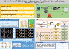
森林在全球固碳中发挥着至关重要的作用,而不同树种的碳储存能力强调了准确的植被分类的必要性。本研究引入了3D-M2C-ResNet,这是一种用于高分辨率、精细尺度树种分类的深度学习模型。该模型利用融合遥感输入,将珠海一号高光谱图像与Sentinel-2时间序列数据得出的物候参数相结合。开发了一个多尺度级联扩展卷积(MCDC)模块,通过三分支架构扩展感受野,实现全面的光谱空间特征提取。此外,多层次特征增强策略(MFES)自适应细化浅层和深层特征,增强跨层的语义空间集成。在22,380像素的测试集上,对该模型进行了支持向量机(SVM)、VGG16和ResNet50的评估。3D-M2C-ResNet的总体准确率为98.08%,Kappa系数为97.88%,优于基线方法。烧蚀实验证实了MCDC和MFES模块的有效性。值得注意的是,结合物候信息大大提高了分类性能,特别是对于光谱相似的树种。该方法为详细的城市森林测绘提供了强大且可扩展的解决方案,支持生态监测、碳核算和可持续森林管理。数据和代码可在https://github.com/qinjs123/3D-M2C-ResNet上公开获取。
本文章由计算机程序翻译,如有差异,请以英文原文为准。

3D-M2C-ResNet: A Multi-Scale feature enhancement and fusion model for Fine-Scale tree species classification in urban forests

3D-M2C-ResNet: A Multi-Scale feature enhancement and fusion model for Fine-Scale tree species classification in urban forests
Forests play a crucial role in global carbon sequestration, and the varying carbon storage capacities of tree species underscore the need for accurate vegetation classification. This study introduces 3D-M2C-ResNet, a deep learning model for high-resolution, fine-scale tree species classification. The model leverages fused remote sensing inputs, combining Zhuhai-1 hyperspectral imagery with phenological parameters derived from Sentinel-2 time-series data. A Multi-Scale Cascaded Dilated Convolution (MCDC) module was developed to expand the receptive field through a three-branch architecture, enabling comprehensive spectral–spatial feature extraction. Additionally, a Multi-level Feature Enhancement Strategy (MFES) adaptively refines shallow and deep features, enhancing semantic–spatial integration across layers. The model was evaluated against support vector machine (SVM), VGG16, and ResNet50 on a test set of 22,380 pixels. 3D-M2C-ResNet achieved an overall accuracy of 98.08% and a Kappa coefficient of 97.88%, outperforming baseline methods. Ablation experiments confirmed the effectiveness of the MCDC and MFES modules. Notably, incorporating phenological information substantially improved classification performance, particularly for spectrally similar tree species. This approach provides a robust and scalable solution for detailed urban forest mapping, supporting ecological monitoring, carbon accounting, and sustainable forest management. Data and code are publicly available at: https://github.com/qinjs123/3D-M2C-ResNet.
求助全文
通过发布文献求助,成功后即可免费获取论文全文。 去求助
来源期刊
International journal of applied earth observation and geoinformation : ITC journal
International journal of applied earth observation and geoinformation : ITC journal Global and Planetary Change, Management, Monitoring, Policy and Law, Earth-Surface Processes, Computers in Earth Sciences
CiteScore
12.00
自引率
0.00%
发文量
0
审稿时长
77 days
期刊介绍: The International Journal of Applied Earth Observation and Geoinformation publishes original papers that utilize earth observation data for natural resource and environmental inventory and management. These data primarily originate from remote sensing platforms, including satellites and aircraft, supplemented by surface and subsurface measurements. Addressing natural resources such as forests, agricultural land, soils, and water, as well as environmental concerns like biodiversity, land degradation, and hazards, the journal explores conceptual and data-driven approaches. It covers geoinformation themes like capturing, databasing, visualization, interpretation, data quality, and spatial uncertainty.
×
引用
GB/T 7714-2015
复制
MLA
复制
APA
复制
导出至
BibTeX EndNote RefMan NoteFirst NoteExpress
×
提示
您的信息不完整,为了账户安全,请先补充。
现在去补充
×
提示
您因"违规操作"
具体请查看互助需知
我知道了
×
提示
确定
请完成安全验证×
copy
已复制链接
快去分享给好友吧!
我知道了
右上角分享
点击右上角分享
0
联系我们:info@booksci.cn Book学术提供免费学术资源搜索服务,方便国内外学者检索中英文文献。致力于提供最便捷和优质的服务体验。 Copyright © 2023 布克学术 All rights reserved.
京ICP备2023020795号-1
ghs 京公网安备 11010802042870号
Book学术文献互助
Book学术文献互助群
群 号:604180095
Book学术官方微信