城市热浪中提高弱势群体热舒适度的绿色基础设施和累积效应评估:以大不里士大都市区为例

IF 4.5 Q2 ENVIRONMENTAL SCIENCES
Firouz Aghazadeh , Akbar Rahimi , Mahsa Tarashkar , Mohammad Karimi Firozjaei , Cristian Ioja , Vladimir Ondrejicka , Maros Finka
{"title":"城市热浪中提高弱势群体热舒适度的绿色基础设施和累积效应评估:以大不里士大都市区为例","authors":"Firouz Aghazadeh ,&nbsp;Akbar Rahimi ,&nbsp;Mahsa Tarashkar ,&nbsp;Mohammad Karimi Firozjaei ,&nbsp;Cristian Ioja ,&nbsp;Vladimir Ondrejicka ,&nbsp;Maros Finka","doi":"10.1016/j.rsase.2025.101671","DOIUrl":null,"url":null,"abstract":"<div><div>This study examines the combined effects of heat waves and surface urban heat island (SUHI) intensity on the thermal comfort of vulnerable social groups in Tabriz, Iran. The primary objective is to evaluate the roles of green infrastructure and built-up areas in enhancing thermal comfort for at-risk populations during urban heat waves. By integrating satellite imagery, microclimate measurements, and municipal data, the study assesses heat-related risks and environmental factors across key heatwave (HW) days in 2023. The results indicate a notable temperature variation of up to 9 °C across the city, highlighting elevated heat-related risks. These risks are especially pronounced among males in childhood and old age, and females during adolescence and adulthood, within nine high-risk urban areas. A slight positive correlation is observed between the energy budget (EB) and environmental indicators. In contrast, SUHI demonstrates a weak direct correlation with vegetation metrics but a strong inverse relationship with urban development density, particularly in OTC-SUHI zones. These findings underscore the importance of incorporating green spaces into urban planning. Although the correlation with vegetation is modest, green infrastructure plays a critical role in improving thermal comfort and mitigating the effects of urban heat islands.</div></div>","PeriodicalId":53227,"journal":{"name":"Remote Sensing Applications-Society and Environment","volume":"39 ","pages":"Article 101671"},"PeriodicalIF":4.5000,"publicationDate":"2025-07-23","publicationTypes":"Journal Article","fieldsOfStudy":null,"isOpenAccess":false,"openAccessPdf":"","citationCount":"0","resultStr":"{\"title\":\"Assessing the green infrastructure and built up effects in enhancing thermal comfort for vulnerable populations in urban heat waves: A case study of Tabriz metropolitan\",\"authors\":\"Firouz Aghazadeh ,&nbsp;Akbar Rahimi ,&nbsp;Mahsa Tarashkar ,&nbsp;Mohammad Karimi Firozjaei ,&nbsp;Cristian Ioja ,&nbsp;Vladimir Ondrejicka ,&nbsp;Maros Finka\",\"doi\":\"10.1016/j.rsase.2025.101671\",\"DOIUrl\":null,\"url\":null,\"abstract\":\"<div><div>This study examines the combined effects of heat waves and surface urban heat island (SUHI) intensity on the thermal comfort of vulnerable social groups in Tabriz, Iran. The primary objective is to evaluate the roles of green infrastructure and built-up areas in enhancing thermal comfort for at-risk populations during urban heat waves. By integrating satellite imagery, microclimate measurements, and municipal data, the study assesses heat-related risks and environmental factors across key heatwave (HW) days in 2023. The results indicate a notable temperature variation of up to 9 °C across the city, highlighting elevated heat-related risks. These risks are especially pronounced among males in childhood and old age, and females during adolescence and adulthood, within nine high-risk urban areas. A slight positive correlation is observed between the energy budget (EB) and environmental indicators. In contrast, SUHI demonstrates a weak direct correlation with vegetation metrics but a strong inverse relationship with urban development density, particularly in OTC-SUHI zones. These findings underscore the importance of incorporating green spaces into urban planning. Although the correlation with vegetation is modest, green infrastructure plays a critical role in improving thermal comfort and mitigating the effects of urban heat islands.</div></div>\",\"PeriodicalId\":53227,\"journal\":{\"name\":\"Remote Sensing Applications-Society and Environment\",\"volume\":\"39 \",\"pages\":\"Article 101671\"},\"PeriodicalIF\":4.5000,\"publicationDate\":\"2025-07-23\",\"publicationTypes\":\"Journal Article\",\"fieldsOfStudy\":null,\"isOpenAccess\":false,\"openAccessPdf\":\"\",\"citationCount\":\"0\",\"resultStr\":null,\"platform\":\"Semanticscholar\",\"paperid\":null,\"PeriodicalName\":\"Remote Sensing Applications-Society and Environment\",\"FirstCategoryId\":\"1085\",\"ListUrlMain\":\"https://www.sciencedirect.com/science/article/pii/S2352938525002241\",\"RegionNum\":0,\"RegionCategory\":null,\"ArticlePicture\":[],\"TitleCN\":null,\"AbstractTextCN\":null,\"PMCID\":null,\"EPubDate\":\"\",\"PubModel\":\"\",\"JCR\":\"Q2\",\"JCRName\":\"ENVIRONMENTAL SCIENCES\",\"Score\":null,\"Total\":0}","platform":"Semanticscholar","paperid":null,"PeriodicalName":"Remote Sensing Applications-Society and Environment","FirstCategoryId":"1085","ListUrlMain":"https://www.sciencedirect.com/science/article/pii/S2352938525002241","RegionNum":0,"RegionCategory":null,"ArticlePicture":[],"TitleCN":null,"AbstractTextCN":null,"PMCID":null,"EPubDate":"","PubModel":"","JCR":"Q2","JCRName":"ENVIRONMENTAL SCIENCES","Score":null,"Total":0}
引用次数: 0

摘要

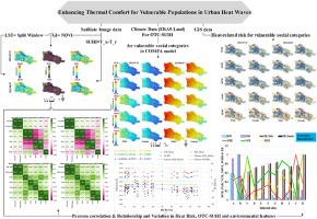
本研究探讨了热浪和地表城市热岛(SUHI)强度对伊朗大不里士弱势社会群体热舒适的综合影响。主要目标是评估绿色基础设施和建成区在城市热浪期间提高高危人群热舒适方面的作用。通过整合卫星图像、小气候测量和市政数据,该研究评估了2023年关键热浪(HW)天数的热相关风险和环境因素。结果表明,整个城市的温度变化高达9°C,突出了与热相关的风险升高。在9个高风险城市地区,这些风险在儿童期和老年期男性以及青春期和成年期女性中尤为明显。能源收支(EB)与环境指标之间存在轻微的正相关关系。相比之下,SUHI与植被指标的直接相关性较弱,但与城市发展密度呈强烈的负相关关系,特别是在OTC-SUHI地区。这些发现强调了将绿色空间纳入城市规划的重要性。尽管与植被的相关性不大,但绿色基础设施在改善城市热舒适和缓解城市热岛效应方面发挥着关键作用。
本文章由计算机程序翻译,如有差异,请以英文原文为准。

Assessing the green infrastructure and built up effects in enhancing thermal comfort for vulnerable populations in urban heat waves: A case study of Tabriz metropolitan

Assessing the green infrastructure and built up effects in enhancing thermal comfort for vulnerable populations in urban heat waves: A case study of Tabriz metropolitan
This study examines the combined effects of heat waves and surface urban heat island (SUHI) intensity on the thermal comfort of vulnerable social groups in Tabriz, Iran. The primary objective is to evaluate the roles of green infrastructure and built-up areas in enhancing thermal comfort for at-risk populations during urban heat waves. By integrating satellite imagery, microclimate measurements, and municipal data, the study assesses heat-related risks and environmental factors across key heatwave (HW) days in 2023. The results indicate a notable temperature variation of up to 9 °C across the city, highlighting elevated heat-related risks. These risks are especially pronounced among males in childhood and old age, and females during adolescence and adulthood, within nine high-risk urban areas. A slight positive correlation is observed between the energy budget (EB) and environmental indicators. In contrast, SUHI demonstrates a weak direct correlation with vegetation metrics but a strong inverse relationship with urban development density, particularly in OTC-SUHI zones. These findings underscore the importance of incorporating green spaces into urban planning. Although the correlation with vegetation is modest, green infrastructure plays a critical role in improving thermal comfort and mitigating the effects of urban heat islands.
求助全文
通过发布文献求助,成功后即可免费获取论文全文。 去求助
来源期刊
CiteScore
8.00
自引率
8.50%
发文量
204
审稿时长
65 days
期刊介绍: The journal ''Remote Sensing Applications: Society and Environment'' (RSASE) focuses on remote sensing studies that address specific topics with an emphasis on environmental and societal issues - regional / local studies with global significance. Subjects are encouraged to have an interdisciplinary approach and include, but are not limited by: " -Global and climate change studies addressing the impact of increasing concentrations of greenhouse gases, CO2 emission, carbon balance and carbon mitigation, energy system on social and environmental systems -Ecological and environmental issues including biodiversity, ecosystem dynamics, land degradation, atmospheric and water pollution, urban footprint, ecosystem management and natural hazards (e.g. earthquakes, typhoons, floods, landslides) -Natural resource studies including land-use in general, biomass estimation, forests, agricultural land, plantation, soils, coral reefs, wetland and water resources -Agriculture, food production systems and food security outcomes -Socio-economic issues including urban systems, urban growth, public health, epidemics, land-use transition and land use conflicts -Oceanography and coastal zone studies, including sea level rise projections, coastlines changes and the ocean-land interface -Regional challenges for remote sensing application techniques, monitoring and analysis, such as cloud screening and atmospheric correction for tropical regions -Interdisciplinary studies combining remote sensing, household survey data, field measurements and models to address environmental, societal and sustainability issues -Quantitative and qualitative analysis that documents the impact of using remote sensing studies in social, political, environmental or economic systems
×
引用
GB/T 7714-2015
复制
MLA
复制
APA
复制
导出至
BibTeX EndNote RefMan NoteFirst NoteExpress
×
提示
您的信息不完整,为了账户安全,请先补充。
现在去补充
×
提示
您因"违规操作"
具体请查看互助需知
我知道了
×
提示
确定
请完成安全验证×
copy
已复制链接
快去分享给好友吧!
我知道了
右上角分享
点击右上角分享
0
联系我们:info@booksci.cn Book学术提供免费学术资源搜索服务,方便国内外学者检索中英文文献。致力于提供最便捷和优质的服务体验。 Copyright © 2023 布克学术 All rights reserved.
京ICP备2023020795号-1
ghs 京公网安备 11010802042870号
Book学术文献互助
Book学术文献互助群
群 号:604180095
Book学术官方微信