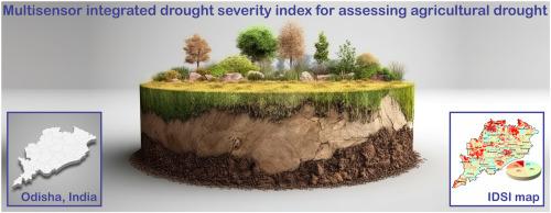
用于评估印度奥迪沙农业干旱的多传感器综合干旱严重程度指数(IDSI)

IF 3.8 Q2 ENVIRONMENTAL SCIENCES
Rajkumar Guria , Manoranjan Mishra , Richarde Marques da Silva , Carlos Antonio Costa dos Santos , Celso Augusto Guimarães Santos
{"title":"用于评估印度奥迪沙农业干旱的多传感器综合干旱严重程度指数(IDSI)","authors":"Rajkumar Guria ,&nbsp;Manoranjan Mishra ,&nbsp;Richarde Marques da Silva ,&nbsp;Carlos Antonio Costa dos Santos ,&nbsp;Celso Augusto Guimarães Santos","doi":"10.1016/j.rsase.2024.101399","DOIUrl":null,"url":null,"abstract":"<div><div>Recurrent droughts in India have severely impacted the economy and the quality of life. The agricultural drought from June to October 2023 in Odisha (the Kharif season), India, highlighted the urgent need for precise monitoring and assessment due to its significant effects on crop yield and food security. This study develops and validates the multisensor Integrated Drought Severity Index (IDSI) to accurately assess agricultural drought severity using multiple remote sensing indices, including optical, thermal, and microwave sensors. Ten indices were computed and combined using the Analytic Hierarchy Process (AHP) to assign weights, aiming to establish a new agricultural drought index that can monitor severity, identify critical indices, and assess uncertainties in affected areas. Validation results from ROC-AUC indicate that the IDSI model achieved a precision exceeding 85% using empirical weights. The study area's mapping shows that approximately 8.91% experience extreme drought conditions, with significant impacts in specific districts of Odisha. This comprehensive tool provides critical insights for policymakers and farmers, enhancing global drought preparedness and response strategies through its adaptable methodology.</div></div>","PeriodicalId":53227,"journal":{"name":"Remote Sensing Applications-Society and Environment","volume":"37 ","pages":"Article 101399"},"PeriodicalIF":3.8000,"publicationDate":"2024-11-13","publicationTypes":"Journal Article","fieldsOfStudy":null,"isOpenAccess":false,"openAccessPdf":"","citationCount":"0","resultStr":"{\"title\":\"Multisensor Integrated Drought Severity Index (IDSI) for assessing agricultural drought in Odisha, India\",\"authors\":\"Rajkumar Guria ,&nbsp;Manoranjan Mishra ,&nbsp;Richarde Marques da Silva ,&nbsp;Carlos Antonio Costa dos Santos ,&nbsp;Celso Augusto Guimarães Santos\",\"doi\":\"10.1016/j.rsase.2024.101399\",\"DOIUrl\":null,\"url\":null,\"abstract\":\"<div><div>Recurrent droughts in India have severely impacted the economy and the quality of life. The agricultural drought from June to October 2023 in Odisha (the Kharif season), India, highlighted the urgent need for precise monitoring and assessment due to its significant effects on crop yield and food security. This study develops and validates the multisensor Integrated Drought Severity Index (IDSI) to accurately assess agricultural drought severity using multiple remote sensing indices, including optical, thermal, and microwave sensors. Ten indices were computed and combined using the Analytic Hierarchy Process (AHP) to assign weights, aiming to establish a new agricultural drought index that can monitor severity, identify critical indices, and assess uncertainties in affected areas. Validation results from ROC-AUC indicate that the IDSI model achieved a precision exceeding 85% using empirical weights. The study area's mapping shows that approximately 8.91% experience extreme drought conditions, with significant impacts in specific districts of Odisha. This comprehensive tool provides critical insights for policymakers and farmers, enhancing global drought preparedness and response strategies through its adaptable methodology.</div></div>\",\"PeriodicalId\":53227,\"journal\":{\"name\":\"Remote Sensing Applications-Society and Environment\",\"volume\":\"37 \",\"pages\":\"Article 101399\"},\"PeriodicalIF\":3.8000,\"publicationDate\":\"2024-11-13\",\"publicationTypes\":\"Journal Article\",\"fieldsOfStudy\":null,\"isOpenAccess\":false,\"openAccessPdf\":\"\",\"citationCount\":\"0\",\"resultStr\":null,\"platform\":\"Semanticscholar\",\"paperid\":null,\"PeriodicalName\":\"Remote Sensing Applications-Society and Environment\",\"FirstCategoryId\":\"1085\",\"ListUrlMain\":\"https://www.sciencedirect.com/science/article/pii/S2352938524002635\",\"RegionNum\":0,\"RegionCategory\":null,\"ArticlePicture\":[],\"TitleCN\":null,\"AbstractTextCN\":null,\"PMCID\":null,\"EPubDate\":\"\",\"PubModel\":\"\",\"JCR\":\"Q2\",\"JCRName\":\"ENVIRONMENTAL SCIENCES\",\"Score\":null,\"Total\":0}","platform":"Semanticscholar","paperid":null,"PeriodicalName":"Remote Sensing Applications-Society and Environment","FirstCategoryId":"1085","ListUrlMain":"https://www.sciencedirect.com/science/article/pii/S2352938524002635","RegionNum":0,"RegionCategory":null,"ArticlePicture":[],"TitleCN":null,"AbstractTextCN":null,"PMCID":null,"EPubDate":"","PubModel":"","JCR":"Q2","JCRName":"ENVIRONMENTAL SCIENCES","Score":null,"Total":0}
引用次数: 0

摘要

印度一再发生的干旱严重影响了经济和生活质量。2023 年 6 月至 10 月,印度奥迪沙邦(哈里发季节)发生农业干旱,由于干旱对作物产量和粮食安全造成重大影响,因此迫切需要进行精确的监测和评估。本研究开发并验证了多传感器综合干旱严重程度指数(IDSI),以利用光学、热学和微波传感器等多种遥感指数准确评估农业干旱严重程度。利用层次分析法(AHP)对十个指数进行计算和组合以分配权重,旨在建立一个新的农业干旱指数,该指数可监测严重程度、识别关键指数并评估受灾地区的不确定性。ROC-AUC 验证结果表明,利用经验权重,IDSI 模型的精确度超过了 85%。研究地区的地图显示,约有 8.91% 的地区经历了极端干旱,在奥迪沙的特定地区造成了严重影响。这一综合工具为政策制定者和农民提供了重要的见解,并通过其适应性强的方法加强了全球干旱准备和应对战略。
本文章由计算机程序翻译,如有差异,请以英文原文为准。

Multisensor Integrated Drought Severity Index (IDSI) for assessing agricultural drought in Odisha, India

Multisensor Integrated Drought Severity Index (IDSI) for assessing agricultural drought in Odisha, India
Recurrent droughts in India have severely impacted the economy and the quality of life. The agricultural drought from June to October 2023 in Odisha (the Kharif season), India, highlighted the urgent need for precise monitoring and assessment due to its significant effects on crop yield and food security. This study develops and validates the multisensor Integrated Drought Severity Index (IDSI) to accurately assess agricultural drought severity using multiple remote sensing indices, including optical, thermal, and microwave sensors. Ten indices were computed and combined using the Analytic Hierarchy Process (AHP) to assign weights, aiming to establish a new agricultural drought index that can monitor severity, identify critical indices, and assess uncertainties in affected areas. Validation results from ROC-AUC indicate that the IDSI model achieved a precision exceeding 85% using empirical weights. The study area's mapping shows that approximately 8.91% experience extreme drought conditions, with significant impacts in specific districts of Odisha. This comprehensive tool provides critical insights for policymakers and farmers, enhancing global drought preparedness and response strategies through its adaptable methodology.
求助全文
通过发布文献求助,成功后即可免费获取论文全文。 去求助
来源期刊
CiteScore
8.00
自引率
8.50%
发文量
204
审稿时长
65 days
期刊介绍: The journal ''Remote Sensing Applications: Society and Environment'' (RSASE) focuses on remote sensing studies that address specific topics with an emphasis on environmental and societal issues - regional / local studies with global significance. Subjects are encouraged to have an interdisciplinary approach and include, but are not limited by: " -Global and climate change studies addressing the impact of increasing concentrations of greenhouse gases, CO2 emission, carbon balance and carbon mitigation, energy system on social and environmental systems -Ecological and environmental issues including biodiversity, ecosystem dynamics, land degradation, atmospheric and water pollution, urban footprint, ecosystem management and natural hazards (e.g. earthquakes, typhoons, floods, landslides) -Natural resource studies including land-use in general, biomass estimation, forests, agricultural land, plantation, soils, coral reefs, wetland and water resources -Agriculture, food production systems and food security outcomes -Socio-economic issues including urban systems, urban growth, public health, epidemics, land-use transition and land use conflicts -Oceanography and coastal zone studies, including sea level rise projections, coastlines changes and the ocean-land interface -Regional challenges for remote sensing application techniques, monitoring and analysis, such as cloud screening and atmospheric correction for tropical regions -Interdisciplinary studies combining remote sensing, household survey data, field measurements and models to address environmental, societal and sustainability issues -Quantitative and qualitative analysis that documents the impact of using remote sensing studies in social, political, environmental or economic systems
×
引用
GB/T 7714-2015
复制
MLA
复制
APA
复制
导出至
BibTeX EndNote RefMan NoteFirst NoteExpress
×
提示
您的信息不完整,为了账户安全,请先补充。
现在去补充
×
提示
您因"违规操作"
具体请查看互助需知
我知道了
×
提示
确定
请完成安全验证×
copy
已复制链接
快去分享给好友吧!
我知道了
右上角分享
点击右上角分享
0
联系我们:info@booksci.cn Book学术提供免费学术资源搜索服务,方便国内外学者检索中英文文献。致力于提供最便捷和优质的服务体验。 Copyright © 2023 布克学术 All rights reserved.
京ICP备2023020795号-1
ghs 京公网安备 11010802042870号
Book学术文献互助
Book学术文献互助群
群 号:481959085
Book学术官方微信