第三维度的选择:使用激光雷达衍生的冠层指标来评估豹猫、山猫和土狼的个体和种群水平的栖息地划分

IF 3.9 2区 环境科学与生态学 Q1 ECOLOGY
Maksim Sergeyev, Daniel A. Crawford, Joseph D. Holbrook, Jason V. Lombardi, Michael E. Tewes, Tyler A. Campbell
{"title":"第三维度的选择:使用激光雷达衍生的冠层指标来评估豹猫、山猫和土狼的个体和种群水平的栖息地划分","authors":"Maksim Sergeyev, Daniel A. Crawford, Joseph D. Holbrook, Jason V. Lombardi, Michael E. Tewes, Tyler A. Campbell","doi":"10.1002/rse2.369","DOIUrl":null,"url":null,"abstract":"Wildlife depends on specific landscape features to persist. Thus, characterizing the vegetation available in an area can be essential for management. The ocelot (<i>Leopardus pardalis</i>) is a federally endangered, medium-sized felid adapted to woody vegetation. Quantifying the characteristics of vegetation most suitable for ocelots is essential for their conservation. Furthermore, understanding differences in the selection of sympatric bobcats (<i>Lynx rufus</i>) and coyotes (<i>Canis latrans</i>) can provide insight into the mechanisms of coexistence between species. Because of differences in hunting strategy (cursorial vs. ambush) and differences in use of land cover types between species, these three carnivores may be partitioning their landscape as a function of vegetation structure. Light detection and ranging (LiDAR) is a remote sensing platform capable of quantifying the sub-canopy structure of vegetation. Using LiDAR data, we quantified the horizontal and vertical structure of vegetation cover to assess habitat selection by ocelots, bobcats, and coyotes. We captured and collared 8 ocelots, 13 bobcats, and 5 coyotes in southern Texas from 2017 to 2021. We used step selection functions to determine the selection of vegetation cover at the population and individual level for each species. Ocelots selected for vertical canopy cover and dense vegetation 0–2 m in height. Bobcats selected cover to a lesser extent and had a broader selection, while coyotes avoided under-story vegetation and selected areas with dense high canopies and relatively open understories. We observed a high degree of variation among individuals that may aid in facilitating intraspecific and interspecific coexistence. Management for ocelots should prioritize vegetation below 2 m and vertical canopy cover. We provide evidence that fine-scale habitat partitioning may facilitate coexistence between sympatric carnivores. Differences among individuals may enhance coexistence among species, as increased behavioral plasticity of individuals can reduce competition for resources. By combining accurate, fine-scale measurements derived from LiDAR data with high-frequency global positioning system locations, we provide a more thorough understanding of the habitat use of ocelots and two sympatric carnivores.","PeriodicalId":21132,"journal":{"name":"Remote Sensing in Ecology and Conservation","volume":null,"pages":null},"PeriodicalIF":3.9000,"publicationDate":"2023-11-15","publicationTypes":"Journal Article","fieldsOfStudy":null,"isOpenAccess":false,"openAccessPdf":"","citationCount":"0","resultStr":"{\"title\":\"Selection in the third dimension: Using LiDAR derived canopy metrics to assess individual and population-level habitat partitioning of ocelots, bobcats, and coyotes\",\"authors\":\"Maksim Sergeyev, Daniel A. Crawford, Joseph D. Holbrook, Jason V. Lombardi, Michael E. Tewes, Tyler A. Campbell\",\"doi\":\"10.1002/rse2.369\",\"DOIUrl\":null,\"url\":null,\"abstract\":\"Wildlife depends on specific landscape features to persist. Thus, characterizing the vegetation available in an area can be essential for management. The ocelot (<i>Leopardus pardalis</i>) is a federally endangered, medium-sized felid adapted to woody vegetation. Quantifying the characteristics of vegetation most suitable for ocelots is essential for their conservation. Furthermore, understanding differences in the selection of sympatric bobcats (<i>Lynx rufus</i>) and coyotes (<i>Canis latrans</i>) can provide insight into the mechanisms of coexistence between species. Because of differences in hunting strategy (cursorial vs. ambush) and differences in use of land cover types between species, these three carnivores may be partitioning their landscape as a function of vegetation structure. Light detection and ranging (LiDAR) is a remote sensing platform capable of quantifying the sub-canopy structure of vegetation. Using LiDAR data, we quantified the horizontal and vertical structure of vegetation cover to assess habitat selection by ocelots, bobcats, and coyotes. We captured and collared 8 ocelots, 13 bobcats, and 5 coyotes in southern Texas from 2017 to 2021. We used step selection functions to determine the selection of vegetation cover at the population and individual level for each species. Ocelots selected for vertical canopy cover and dense vegetation 0–2 m in height. Bobcats selected cover to a lesser extent and had a broader selection, while coyotes avoided under-story vegetation and selected areas with dense high canopies and relatively open understories. We observed a high degree of variation among individuals that may aid in facilitating intraspecific and interspecific coexistence. Management for ocelots should prioritize vegetation below 2 m and vertical canopy cover. We provide evidence that fine-scale habitat partitioning may facilitate coexistence between sympatric carnivores. Differences among individuals may enhance coexistence among species, as increased behavioral plasticity of individuals can reduce competition for resources. By combining accurate, fine-scale measurements derived from LiDAR data with high-frequency global positioning system locations, we provide a more thorough understanding of the habitat use of ocelots and two sympatric carnivores.\",\"PeriodicalId\":21132,\"journal\":{\"name\":\"Remote Sensing in Ecology and Conservation\",\"volume\":null,\"pages\":null},\"PeriodicalIF\":3.9000,\"publicationDate\":\"2023-11-15\",\"publicationTypes\":\"Journal Article\",\"fieldsOfStudy\":null,\"isOpenAccess\":false,\"openAccessPdf\":\"\",\"citationCount\":\"0\",\"resultStr\":null,\"platform\":\"Semanticscholar\",\"paperid\":null,\"PeriodicalName\":\"Remote Sensing in Ecology and Conservation\",\"FirstCategoryId\":\"93\",\"ListUrlMain\":\"https://doi.org/10.1002/rse2.369\",\"RegionNum\":2,\"RegionCategory\":\"环境科学与生态学\",\"ArticlePicture\":[],\"TitleCN\":null,\"AbstractTextCN\":null,\"PMCID\":null,\"EPubDate\":\"\",\"PubModel\":\"\",\"JCR\":\"Q1\",\"JCRName\":\"ECOLOGY\",\"Score\":null,\"Total\":0}","platform":"Semanticscholar","paperid":null,"PeriodicalName":"Remote Sensing in Ecology and Conservation","FirstCategoryId":"93","ListUrlMain":"https://doi.org/10.1002/rse2.369","RegionNum":2,"RegionCategory":"环境科学与生态学","ArticlePicture":[],"TitleCN":null,"AbstractTextCN":null,"PMCID":null,"EPubDate":"","PubModel":"","JCR":"Q1","JCRName":"ECOLOGY","Score":null,"Total":0}
引用次数: 0

摘要

野生动物的生存依赖于特定的景观特征。因此,描述一个地区可用植被的特征对管理是至关重要的。豹猫(Leopardus pardalis)是一种联邦濒危的中型猫科动物,适应木本植被。确定最适合豹猫生长的植被特征是豹猫保护的重要内容。此外,了解同域山猫(Lynx rufus)和土狼(Canis latrans)在选择上的差异,可以深入了解物种之间共存的机制。由于不同物种之间狩猎策略的差异(游猎vs伏击)和土地覆盖类型的差异,这三种食肉动物可能会根据植被结构划分其景观。光探测与测距(LiDAR)是一种能够量化植被冠层亚结构的遥感平台。利用激光雷达数据,我们量化了植被覆盖的水平和垂直结构,以评估豹猫、山猫和土狼的栖息地选择。从2017年到2021年,我们在德克萨斯州南部捕获并捕获了8只豹猫、13只山猫和5只土狼。利用步进选择函数确定了种群和个体水平上植被覆盖度的选择。豹猫选择垂直冠层覆盖和0-2 m高度的茂密植被。山猫选择覆盖物的程度较小,选择范围更广,而土狼避开下层植被,选择茂密的高冠层和相对开阔的林下植被。我们观察到个体之间的高度差异可能有助于促进种内和种间共存。豹猫的管理应优先考虑2米以下的植被和垂直树冠覆盖。我们提供的证据表明,精细尺度的栖息地划分可能促进同域食肉动物之间的共存。个体间的差异可以促进物种间的共存,因为个体行为可塑性的增强可以减少对资源的竞争。通过结合激光雷达数据和高频全球定位系统的精确、精细测量,我们对豹猫和两种同域食肉动物的栖息地使用有了更全面的了解。
本文章由计算机程序翻译,如有差异,请以英文原文为准。

Selection in the third dimension: Using LiDAR derived canopy metrics to assess individual and population-level habitat partitioning of ocelots, bobcats, and coyotes

Selection in the third dimension: Using LiDAR derived canopy metrics to assess individual and population-level habitat partitioning of ocelots, bobcats, and coyotes
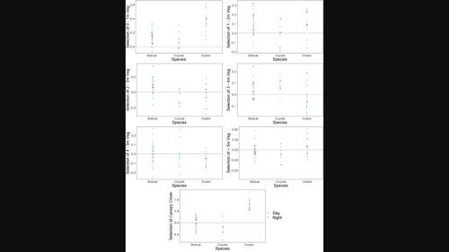
Wildlife depends on specific landscape features to persist. Thus, characterizing the vegetation available in an area can be essential for management. The ocelot (Leopardus pardalis) is a federally endangered, medium-sized felid adapted to woody vegetation. Quantifying the characteristics of vegetation most suitable for ocelots is essential for their conservation. Furthermore, understanding differences in the selection of sympatric bobcats (Lynx rufus) and coyotes (Canis latrans) can provide insight into the mechanisms of coexistence between species. Because of differences in hunting strategy (cursorial vs. ambush) and differences in use of land cover types between species, these three carnivores may be partitioning their landscape as a function of vegetation structure. Light detection and ranging (LiDAR) is a remote sensing platform capable of quantifying the sub-canopy structure of vegetation. Using LiDAR data, we quantified the horizontal and vertical structure of vegetation cover to assess habitat selection by ocelots, bobcats, and coyotes. We captured and collared 8 ocelots, 13 bobcats, and 5 coyotes in southern Texas from 2017 to 2021. We used step selection functions to determine the selection of vegetation cover at the population and individual level for each species. Ocelots selected for vertical canopy cover and dense vegetation 0–2 m in height. Bobcats selected cover to a lesser extent and had a broader selection, while coyotes avoided under-story vegetation and selected areas with dense high canopies and relatively open understories. We observed a high degree of variation among individuals that may aid in facilitating intraspecific and interspecific coexistence. Management for ocelots should prioritize vegetation below 2 m and vertical canopy cover. We provide evidence that fine-scale habitat partitioning may facilitate coexistence between sympatric carnivores. Differences among individuals may enhance coexistence among species, as increased behavioral plasticity of individuals can reduce competition for resources. By combining accurate, fine-scale measurements derived from LiDAR data with high-frequency global positioning system locations, we provide a more thorough understanding of the habitat use of ocelots and two sympatric carnivores.
求助全文
通过发布文献求助,成功后即可免费获取论文全文。 去求助
来源期刊
Remote Sensing in Ecology and Conservation
Remote Sensing in Ecology and Conservation Earth and Planetary Sciences-Computers in Earth Sciences
CiteScore
9.80
自引率
5.50%
发文量
69
审稿时长
18 weeks
期刊介绍: emote Sensing in Ecology and Conservation provides a forum for rapid, peer-reviewed publication of novel, multidisciplinary research at the interface between remote sensing science and ecology and conservation. The journal prioritizes findings that advance the scientific basis of ecology and conservation, promoting the development of remote-sensing based methods relevant to the management of land use and biological systems at all levels, from populations and species to ecosystems and biomes. The journal defines remote sensing in its broadest sense, including data acquisition by hand-held and fixed ground-based sensors, such as camera traps and acoustic recorders, and sensors on airplanes and satellites. The intended journal’s audience includes ecologists, conservation scientists, policy makers, managers of terrestrial and aquatic systems, remote sensing scientists, and students. Remote Sensing in Ecology and Conservation is a fully open access journal from Wiley and the Zoological Society of London. Remote sensing has enormous potential as to provide information on the state of, and pressures on, biological diversity and ecosystem services, at multiple spatial and temporal scales. This new publication provides a forum for multidisciplinary research in remote sensing science, ecological research and conservation science.
×
引用
GB/T 7714-2015
复制
MLA
复制
APA
复制
导出至
BibTeX EndNote RefMan NoteFirst NoteExpress
×
提示
您的信息不完整,为了账户安全,请先补充。
现在去补充
×
提示
您因"违规操作"
具体请查看互助需知
我知道了
×
提示
确定
请完成安全验证×
copy
已复制链接
快去分享给好友吧!
我知道了
右上角分享
点击右上角分享
0
联系我们:info@booksci.cn Book学术提供免费学术资源搜索服务,方便国内外学者检索中英文文献。致力于提供最便捷和优质的服务体验。 Copyright © 2023 布克学术 All rights reserved.
京ICP备2023020795号-1
ghs 京公网安备 11010802042870号
Book学术文献互助
Book学术文献互助群
群 号:481959085
Book学术官方微信