Ondřej Kaas, Jakub Šilhavý, Ivana Kolingerová, Václav Čada
{"title":"加速多山影分层聚类的自动轮廓提取","authors":"Ondřej Kaas, Jakub Šilhavý, Ivana Kolingerová, Václav Čada","doi":"10.1007/s10109-023-00423-y","DOIUrl":null,"url":null,"abstract":"Abstract The lineaments are linear features reflecting mountain ridges or discontinuities in the geological structure. Lineament extraction is not an easy problem. Recently, an automatic approach based on multi-hillshade hierarchic clustering (MHHC) has been developed; the approach is based on line extraction from a raster image. An essential part of this approach is spatial line segment clustering, a powerful but relatively slow tool. This paper presents a modification of MHHC, which solves the spatial line segment clustering as a facility location problem. The proposed modification is faster than MHHC while not changing the method’s core.","PeriodicalId":47245,"journal":{"name":"Journal of Geographical Systems","volume":"76 1","pages":"0"},"PeriodicalIF":2.8000,"publicationDate":"2023-09-30","publicationTypes":"Journal Article","fieldsOfStudy":null,"isOpenAccess":false,"openAccessPdf":"","citationCount":"0","resultStr":"{\"title\":\"Accelerated multi-hillshade hierarchic clustering for automatic lineament extraction\",\"authors\":\"Ondřej Kaas, Jakub Šilhavý, Ivana Kolingerová, Václav Čada\",\"doi\":\"10.1007/s10109-023-00423-y\",\"DOIUrl\":null,\"url\":null,\"abstract\":\"Abstract The lineaments are linear features reflecting mountain ridges or discontinuities in the geological structure. Lineament extraction is not an easy problem. Recently, an automatic approach based on multi-hillshade hierarchic clustering (MHHC) has been developed; the approach is based on line extraction from a raster image. An essential part of this approach is spatial line segment clustering, a powerful but relatively slow tool. This paper presents a modification of MHHC, which solves the spatial line segment clustering as a facility location problem. The proposed modification is faster than MHHC while not changing the method’s core.\",\"PeriodicalId\":47245,\"journal\":{\"name\":\"Journal of Geographical Systems\",\"volume\":\"76 1\",\"pages\":\"0\"},\"PeriodicalIF\":2.8000,\"publicationDate\":\"2023-09-30\",\"publicationTypes\":\"Journal Article\",\"fieldsOfStudy\":null,\"isOpenAccess\":false,\"openAccessPdf\":\"\",\"citationCount\":\"0\",\"resultStr\":null,\"platform\":\"Semanticscholar\",\"paperid\":null,\"PeriodicalName\":\"Journal of Geographical Systems\",\"FirstCategoryId\":\"1085\",\"ListUrlMain\":\"https://doi.org/10.1007/s10109-023-00423-y\",\"RegionNum\":3,\"RegionCategory\":\"地球科学\",\"ArticlePicture\":[],\"TitleCN\":null,\"AbstractTextCN\":null,\"PMCID\":null,\"EPubDate\":\"\",\"PubModel\":\"\",\"JCR\":\"Q1\",\"JCRName\":\"GEOGRAPHY\",\"Score\":null,\"Total\":0}","platform":"Semanticscholar","paperid":null,"PeriodicalName":"Journal of Geographical Systems","FirstCategoryId":"1085","ListUrlMain":"https://doi.org/10.1007/s10109-023-00423-y","RegionNum":3,"RegionCategory":"地球科学","ArticlePicture":[],"TitleCN":null,"AbstractTextCN":null,"PMCID":null,"EPubDate":"","PubModel":"","JCR":"Q1","JCRName":"GEOGRAPHY","Score":null,"Total":0}
Accelerated multi-hillshade hierarchic clustering for automatic lineament extraction
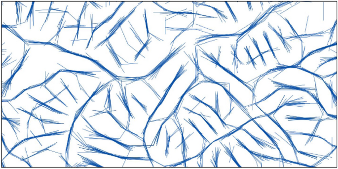
Abstract The lineaments are linear features reflecting mountain ridges or discontinuities in the geological structure. Lineament extraction is not an easy problem. Recently, an automatic approach based on multi-hillshade hierarchic clustering (MHHC) has been developed; the approach is based on line extraction from a raster image. An essential part of this approach is spatial line segment clustering, a powerful but relatively slow tool. This paper presents a modification of MHHC, which solves the spatial line segment clustering as a facility location problem. The proposed modification is faster than MHHC while not changing the method’s core.
期刊介绍:
The Journal of Geographical Systems (JGS) is an interdisciplinary peer-reviewed academic journal that aims to encourage and promote high-quality scholarship on new theoretical or empirical results, models and methods in the social sciences. It solicits original papers with a spatial dimension that can be of interest to social scientists. Coverage includes regional science, economic geography, spatial economics, regional and urban economics, GIScience and GeoComputation, big data and machine learning. Spatial analysis, spatial econometrics and statistics are strongly represented.
One of the distinctive features of the journal is its concern for the interface between modeling, statistical techniques and spatial issues in a wide spectrum of related fields. An important goal of the journal is to encourage a spatial perspective in the social sciences that emphasizes geographical space as a relevant dimension to our understanding of socio-economic phenomena.
Contributions should be of high-quality, be technically well-crafted, make a substantial contribution to the subject and contain a spatial dimension. The journal also aims to publish, review and survey articles that make recent theoretical and methodological developments more readily accessible to the audience of the journal.
All papers of this journal have undergone rigorous double-blind peer-review, based on initial editor screening and with at least two peer reviewers.
Officially cited as J Geogr Syst