广场与高峰之间:秘鲁高地垂直与城市化的一元视角

IF 2.3 3区 环境科学与生态学 Q3 ENVIRONMENTAL SCIENCES
Andreas Haller, Domenico Branca, Deyvis Cano
{"title":"广场与高峰之间:秘鲁高地垂直与城市化的一元视角","authors":"Andreas Haller, Domenico Branca, Deyvis Cano","doi":"10.1007/s11629-023-8118-2","DOIUrl":null,"url":null,"abstract":"Abstract Under the influence of concentrated and extended urbanization, Andean cities and the different altitudinal zones of their “hinterlands” are experiencing profound changes in land cover — from the central plazas up to the highest peaks. The complex regional-geographic characteristics of these socioecological systems, such as the vertical complementarity of land use, require a montological perspective on verticality and urbanization: it transcends disciplinary approaches and can be crucial to properly interpret the trajectories of land cover change and formulate hypotheses for future practice-oriented research. Which trajectories of land cover change characterized altitudinal zones of Andean cities and their surroundings over the last three decades? Are there similarities that allow for the formulation of more general hypotheses? Using the Peruvian cases of Cusco and Huaraz, and combining a traditional altitudinal zonation model of land use in Peru with direct field observations and GIS-based analyses of remotely sensed data from 1991, 2001, 2011, and 2021, this study identifies the main trajectories of land cover change in the Quechua (>2300–3500 m), Suni (>3500–4000 m), and Puna (>4000–4800 m) regions — and finds insightful similarities between Cusco and Huaraz: (1) an impressive area of built-up land substitutes grassland in the Quechua, which, following regional altitudinal zonation models, is characterized by irrigated and rain-fed cropland; (2) an unexpected expansion of irrigated cropland takes place in the Suni, which, in theory, often lacks irrigation infrastructure and is mostly used for rain-fed tuber cultivation; and (3) a clear change from “other land” to grassland occurs in the Puna — where grassland is thought to predominate, anyway, since pre-Hispanic times. Hypothesizing that these changes reflect the interplay between speculative fallow, agricultural intensification, and ecological restoration, the results can be read as vertically complementary, local manifestations of concentrated and extended urbanization in a formerly peripheral mountain region of the Global South — and they underscore the need to overcome mental city-mountain dichotomies for a socially inclusive and ecologically balanced Andean development between plaza and peak.","PeriodicalId":16412,"journal":{"name":"Journal of Mountain Science","volume":"20 1","pages":"0"},"PeriodicalIF":2.3000,"publicationDate":"2023-10-01","publicationTypes":"Journal Article","fieldsOfStudy":null,"isOpenAccess":false,"openAccessPdf":"","citationCount":"0","resultStr":"{\"title\":\"Between plaza and peak: a montological perspective on verticality and urbanization in highland Peru\",\"authors\":\"Andreas Haller, Domenico Branca, Deyvis Cano\",\"doi\":\"10.1007/s11629-023-8118-2\",\"DOIUrl\":null,\"url\":null,\"abstract\":\"Abstract Under the influence of concentrated and extended urbanization, Andean cities and the different altitudinal zones of their “hinterlands” are experiencing profound changes in land cover — from the central plazas up to the highest peaks. The complex regional-geographic characteristics of these socioecological systems, such as the vertical complementarity of land use, require a montological perspective on verticality and urbanization: it transcends disciplinary approaches and can be crucial to properly interpret the trajectories of land cover change and formulate hypotheses for future practice-oriented research. Which trajectories of land cover change characterized altitudinal zones of Andean cities and their surroundings over the last three decades? Are there similarities that allow for the formulation of more general hypotheses? Using the Peruvian cases of Cusco and Huaraz, and combining a traditional altitudinal zonation model of land use in Peru with direct field observations and GIS-based analyses of remotely sensed data from 1991, 2001, 2011, and 2021, this study identifies the main trajectories of land cover change in the Quechua (>2300–3500 m), Suni (>3500–4000 m), and Puna (>4000–4800 m) regions — and finds insightful similarities between Cusco and Huaraz: (1) an impressive area of built-up land substitutes grassland in the Quechua, which, following regional altitudinal zonation models, is characterized by irrigated and rain-fed cropland; (2) an unexpected expansion of irrigated cropland takes place in the Suni, which, in theory, often lacks irrigation infrastructure and is mostly used for rain-fed tuber cultivation; and (3) a clear change from “other land” to grassland occurs in the Puna — where grassland is thought to predominate, anyway, since pre-Hispanic times. Hypothesizing that these changes reflect the interplay between speculative fallow, agricultural intensification, and ecological restoration, the results can be read as vertically complementary, local manifestations of concentrated and extended urbanization in a formerly peripheral mountain region of the Global South — and they underscore the need to overcome mental city-mountain dichotomies for a socially inclusive and ecologically balanced Andean development between plaza and peak.\",\"PeriodicalId\":16412,\"journal\":{\"name\":\"Journal of Mountain Science\",\"volume\":\"20 1\",\"pages\":\"0\"},\"PeriodicalIF\":2.3000,\"publicationDate\":\"2023-10-01\",\"publicationTypes\":\"Journal Article\",\"fieldsOfStudy\":null,\"isOpenAccess\":false,\"openAccessPdf\":\"\",\"citationCount\":\"0\",\"resultStr\":null,\"platform\":\"Semanticscholar\",\"paperid\":null,\"PeriodicalName\":\"Journal of Mountain Science\",\"FirstCategoryId\":\"1085\",\"ListUrlMain\":\"https://doi.org/10.1007/s11629-023-8118-2\",\"RegionNum\":3,\"RegionCategory\":\"环境科学与生态学\",\"ArticlePicture\":[],\"TitleCN\":null,\"AbstractTextCN\":null,\"PMCID\":null,\"EPubDate\":\"\",\"PubModel\":\"\",\"JCR\":\"Q3\",\"JCRName\":\"ENVIRONMENTAL SCIENCES\",\"Score\":null,\"Total\":0}","platform":"Semanticscholar","paperid":null,"PeriodicalName":"Journal of Mountain Science","FirstCategoryId":"1085","ListUrlMain":"https://doi.org/10.1007/s11629-023-8118-2","RegionNum":3,"RegionCategory":"环境科学与生态学","ArticlePicture":[],"TitleCN":null,"AbstractTextCN":null,"PMCID":null,"EPubDate":"","PubModel":"","JCR":"Q3","JCRName":"ENVIRONMENTAL SCIENCES","Score":null,"Total":0}
引用次数: 0

摘要

在集中式和延伸式城市化的影响下,安第斯山脉城市及其“腹地”的不同海拔带正经历着从中心广场到最高山峰的土地覆盖的深刻变化。这些社会生态系统复杂的区域地理特征,如土地利用的垂直互补性,需要对垂直性和城市化进行一个单一的观点:它超越了学科方法,对于正确解释土地覆盖变化的轨迹和为未来的实践导向研究制定假设至关重要。在过去的30年里,安第斯山脉城市及其周边地区地表覆盖变化的轨迹特征是什么?是否有相似之处使得我们可以提出更一般的假设?本研究以秘鲁库斯科和瓦拉斯为例,结合秘鲁土地利用的传统垂直地带性模型,结合1991年、2001年、2011年和2021年的直接实地观测和基于gis的遥感数据分析,确定了克丘亚(2300-3500米)、苏尼(3500-4000米)和普纳(4000-4800米)地区土地覆盖变化的主要轨迹,并发现了库斯科和瓦拉斯之间深刻的相似之处:(1)盖丘亚地区有大面积的建设用地取代了草地,按照区域海拔分异模式,其特征是灌溉和雨养农田;(2)苏尼地区的灌溉农田出现了意想不到的扩张,从理论上讲,苏尼地区往往缺乏灌溉基础设施,主要用于雨养块茎种植;(3)从“其他土地”到草原的明显变化发生在普纳——无论如何,自前西班牙时代以来,草原被认为占主导地位。假设这些变化反映了投机性休耕、农业集约化和生态恢复之间的相互作用,结果可以被解读为垂直互补、集中和扩展的城市化在全球南部以前外围山区的地方表现——它们强调了克服城市-山区二元对立的必要性,以实现广场和高峰之间的社会包容和生态平衡的安第斯发展。
本文章由计算机程序翻译,如有差异,请以英文原文为准。
Between plaza and peak: a montological perspective on verticality and urbanization in highland Peru
Abstract Under the influence of concentrated and extended urbanization, Andean cities and the different altitudinal zones of their “hinterlands” are experiencing profound changes in land cover — from the central plazas up to the highest peaks. The complex regional-geographic characteristics of these socioecological systems, such as the vertical complementarity of land use, require a montological perspective on verticality and urbanization: it transcends disciplinary approaches and can be crucial to properly interpret the trajectories of land cover change and formulate hypotheses for future practice-oriented research. Which trajectories of land cover change characterized altitudinal zones of Andean cities and their surroundings over the last three decades? Are there similarities that allow for the formulation of more general hypotheses? Using the Peruvian cases of Cusco and Huaraz, and combining a traditional altitudinal zonation model of land use in Peru with direct field observations and GIS-based analyses of remotely sensed data from 1991, 2001, 2011, and 2021, this study identifies the main trajectories of land cover change in the Quechua (>2300–3500 m), Suni (>3500–4000 m), and Puna (>4000–4800 m) regions — and finds insightful similarities between Cusco and Huaraz: (1) an impressive area of built-up land substitutes grassland in the Quechua, which, following regional altitudinal zonation models, is characterized by irrigated and rain-fed cropland; (2) an unexpected expansion of irrigated cropland takes place in the Suni, which, in theory, often lacks irrigation infrastructure and is mostly used for rain-fed tuber cultivation; and (3) a clear change from “other land” to grassland occurs in the Puna — where grassland is thought to predominate, anyway, since pre-Hispanic times. Hypothesizing that these changes reflect the interplay between speculative fallow, agricultural intensification, and ecological restoration, the results can be read as vertically complementary, local manifestations of concentrated and extended urbanization in a formerly peripheral mountain region of the Global South — and they underscore the need to overcome mental city-mountain dichotomies for a socially inclusive and ecologically balanced Andean development between plaza and peak.
求助全文
通过发布文献求助,成功后即可免费获取论文全文。 去求助
来源期刊
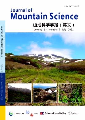
Journal of Mountain Science
Journal of Mountain Science 环境科学-环境科学
CiteScore
4.20
自引率
8.00%
发文量
182
审稿时长
4.3 months
期刊介绍: The Journal of Mountain Science (JMS) is devoted to mountains and their surrounding lowlands - ecoregions of particular global importance, with a particular emphasis on the important highlands/ mountains in the world, such as the Tibetan Plateau, the Himalayas, the Alps, the Andes, the Rockies and many other mountain ranges of our planet. JMS mainly publishes academic and technical papers concerning environmental changes and sustainable development in mountain areas under natural conditions or / and with the influence of human activities. It also accepts book reviews and reports on mountain research and introductions to mountain research organizations. This journal pays particular attention to the relationships between mountain environment changes and human activities, including the processes, characteristics and restoration of mountain ecosystem degradation; dynamic processes, and the theory and methods of controlling mountain hazards, such as debris, landslides and soil erosion; the protection and development of special mountain resources; culture diversity and local economic development in mountain regions; and ethnic issues and social welfare in mountain areas. Academic papers should display universal, strategic and innovative characteristics in both theory and practice. Technical papers should report on development programmes, project planning and community actions. We especially welcome papers which emphasize the application of new technologies, such as GIS and remote sensing, in mountain research and development, and the papers on new concepts and new methods deriving from disciplinary, interdisciplinary and transdisciplinary research in mountains.
×
引用
GB/T 7714-2015
复制
MLA
复制
APA
复制
导出至
BibTeX EndNote RefMan NoteFirst NoteExpress
×
提示
您的信息不完整,为了账户安全,请先补充。
现在去补充
×
提示
您因"违规操作"
具体请查看互助需知
我知道了
×
提示
确定
请完成安全验证×
copy
已复制链接
快去分享给好友吧!
我知道了
右上角分享
点击右上角分享
0
联系我们:info@booksci.cn Book学术提供免费学术资源搜索服务,方便国内外学者检索中英文文献。致力于提供最便捷和优质的服务体验。 Copyright © 2023 布克学术 All rights reserved.
京ICP备2023020795号-1
ghs 京公网安备 11010802042870号
Book学术文献互助
Book学术文献互助群
群 号:481959085
Book学术官方微信