Marcelo de Carvalho Alves, Luciana Sanches, Fortunato Silva de Menezes, Lídia Raiza Sousa Lima Chaves Trindade
{"title":"巴西米纳斯吉拉斯州富尼尔大坝区域环境目标识别的多传感器分析","authors":"Marcelo de Carvalho Alves, Luciana Sanches, Fortunato Silva de Menezes, Lídia Raiza Sousa Lima Chaves Trindade","doi":"10.1007/s12518-023-00523-w","DOIUrl":null,"url":null,"abstract":"<div><p>The use of remote sensing to map land cover and changes in land use has proven to be a practical, reliable, and accessible approach. These images provide precise details about the landscape, utilizing image processing techniques, modeling, and classification algorithms. This study aimed to identify different areas, such as coffee plantations, water bodies, urban areas, forests, exposed soil, and pastures in the Funil reservoir region of Minas Gerais, Brazil. Image data from Landsat-8, Sentinel-1, and Sentinel-2 satellites for June 2021 were used. Different supervised classification algorithms such as rf, rpart1SE, and svmLinear2 were applied based on a large volume of remote sensing data. The analyses and maps were performed using the software RStudio, considering a significance level of 5%. The highest accuracy and kappa index values were found for the rf algorithm, followed by svmLinear2 and rpart1SE. The results showed that the rf algorithm achieved the highest accuracy and kappa index values, followed by svmLinear2 and rpart1SE. However, during the validation phase, the svmLinear2 algorithm outperformed based on the statistical results of the confusion matrix. Therefore, it was considered the most suitable for generating the thematic mapping of the landscape. This is because svmLinear2 identified a more significant number of coffee areas and better-distinguished vegetation areas.</p></div>","PeriodicalId":46286,"journal":{"name":"Applied Geomatics","volume":"15 4","pages":"807 - 827"},"PeriodicalIF":2.3000,"publicationDate":"2023-09-19","publicationTypes":"Journal Article","fieldsOfStudy":null,"isOpenAccess":false,"openAccessPdf":"","citationCount":"0","resultStr":"{\"title\":\"Multisensor analysis for environmental targets identification in the region of Funil dam, state of Minas Gerais, Brazil\",\"authors\":\"Marcelo de Carvalho Alves, Luciana Sanches, Fortunato Silva de Menezes, Lídia Raiza Sousa Lima Chaves Trindade\",\"doi\":\"10.1007/s12518-023-00523-w\",\"DOIUrl\":null,\"url\":null,\"abstract\":\"<div><p>The use of remote sensing to map land cover and changes in land use has proven to be a practical, reliable, and accessible approach. These images provide precise details about the landscape, utilizing image processing techniques, modeling, and classification algorithms. This study aimed to identify different areas, such as coffee plantations, water bodies, urban areas, forests, exposed soil, and pastures in the Funil reservoir region of Minas Gerais, Brazil. Image data from Landsat-8, Sentinel-1, and Sentinel-2 satellites for June 2021 were used. Different supervised classification algorithms such as rf, rpart1SE, and svmLinear2 were applied based on a large volume of remote sensing data. The analyses and maps were performed using the software RStudio, considering a significance level of 5%. The highest accuracy and kappa index values were found for the rf algorithm, followed by svmLinear2 and rpart1SE. The results showed that the rf algorithm achieved the highest accuracy and kappa index values, followed by svmLinear2 and rpart1SE. However, during the validation phase, the svmLinear2 algorithm outperformed based on the statistical results of the confusion matrix. Therefore, it was considered the most suitable for generating the thematic mapping of the landscape. This is because svmLinear2 identified a more significant number of coffee areas and better-distinguished vegetation areas.</p></div>\",\"PeriodicalId\":46286,\"journal\":{\"name\":\"Applied Geomatics\",\"volume\":\"15 4\",\"pages\":\"807 - 827\"},\"PeriodicalIF\":2.3000,\"publicationDate\":\"2023-09-19\",\"publicationTypes\":\"Journal Article\",\"fieldsOfStudy\":null,\"isOpenAccess\":false,\"openAccessPdf\":\"\",\"citationCount\":\"0\",\"resultStr\":null,\"platform\":\"Semanticscholar\",\"paperid\":null,\"PeriodicalName\":\"Applied Geomatics\",\"FirstCategoryId\":\"1085\",\"ListUrlMain\":\"https://link.springer.com/article/10.1007/s12518-023-00523-w\",\"RegionNum\":0,\"RegionCategory\":null,\"ArticlePicture\":[],\"TitleCN\":null,\"AbstractTextCN\":null,\"PMCID\":null,\"EPubDate\":\"\",\"PubModel\":\"\",\"JCR\":\"Q2\",\"JCRName\":\"REMOTE SENSING\",\"Score\":null,\"Total\":0}","platform":"Semanticscholar","paperid":null,"PeriodicalName":"Applied Geomatics","FirstCategoryId":"1085","ListUrlMain":"https://link.springer.com/article/10.1007/s12518-023-00523-w","RegionNum":0,"RegionCategory":null,"ArticlePicture":[],"TitleCN":null,"AbstractTextCN":null,"PMCID":null,"EPubDate":"","PubModel":"","JCR":"Q2","JCRName":"REMOTE SENSING","Score":null,"Total":0}
Multisensor analysis for environmental targets identification in the region of Funil dam, state of Minas Gerais, Brazil
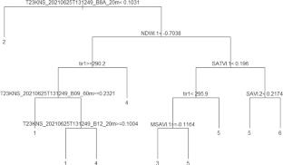
The use of remote sensing to map land cover and changes in land use has proven to be a practical, reliable, and accessible approach. These images provide precise details about the landscape, utilizing image processing techniques, modeling, and classification algorithms. This study aimed to identify different areas, such as coffee plantations, water bodies, urban areas, forests, exposed soil, and pastures in the Funil reservoir region of Minas Gerais, Brazil. Image data from Landsat-8, Sentinel-1, and Sentinel-2 satellites for June 2021 were used. Different supervised classification algorithms such as rf, rpart1SE, and svmLinear2 were applied based on a large volume of remote sensing data. The analyses and maps were performed using the software RStudio, considering a significance level of 5%. The highest accuracy and kappa index values were found for the rf algorithm, followed by svmLinear2 and rpart1SE. The results showed that the rf algorithm achieved the highest accuracy and kappa index values, followed by svmLinear2 and rpart1SE. However, during the validation phase, the svmLinear2 algorithm outperformed based on the statistical results of the confusion matrix. Therefore, it was considered the most suitable for generating the thematic mapping of the landscape. This is because svmLinear2 identified a more significant number of coffee areas and better-distinguished vegetation areas.
期刊介绍:
Applied Geomatics (AGMJ) is the official journal of SIFET the Italian Society of Photogrammetry and Topography and covers all aspects and information on scientific and technical advances in the geomatics sciences. The Journal publishes innovative contributions in geomatics applications ranging from the integration of instruments, methodologies and technologies and their use in the environmental sciences, engineering and other natural sciences.
The areas of interest include many research fields such as: remote sensing, close range and videometric photogrammetry, image analysis, digital mapping, land and geographic information systems, geographic information science, integrated geodesy, spatial data analysis, heritage recording; network adjustment and numerical processes. Furthermore, Applied Geomatics is open to articles from all areas of deformation measurements and analysis, structural engineering, mechanical engineering and all trends in earth and planetary survey science and space technology. The Journal also contains notices of conferences and international workshops, industry news, and information on new products. It provides a useful forum for professional and academic scientists involved in geomatics science and technology.
Information on Open Research Funding and Support may be found here: https://www.springernature.com/gp/open-research/institutional-agreements

 求助内容:
求助内容: 应助结果提醒方式:


