Issues of WWW-based data visualization in the Earth System Science classroom
引用次数: 0
Abstract
Earth system science (ESS) is a holistic study of the Earth. ESS marshals the resources a variety of scientific and technical fields to explore interactions among the Earth's component subsystems in order to understand the Earth as a system, to explain Earth dynamics and Earth evolution, and to address the problem of the affects of human actions on global change. In order to investigate the Earth system, teachers and students need access to expertise in a broad variety of disciplines: chemistry, physics, computer science, biology, mathematics, statistics, and political science. A variety of relatively new skills are also required: networked computing, tools and techniques for retrieving, visualizing, and analyzing remote sensing data, and building dynamic systems models. The question of visualization of remote sensing data became a central issue in curriculum development efforts of the Earth System Science Community (ESSC), a three-year project supported by NASA's Information Infrastructure Technology and Applications and High Performance Computing and Communication programs. The thrust of the curriculum development effort was to enable students and teachers to conduct investigations in global change topics using remote sensing data gathered by NASA and other science agencies. The curriculum was project-based, with the intention of producing an authentic and living sense of understanding and participation in science research. Students and teachers were to collaborate online with their peers in other schools, and with scientists/mentors in universities and government science agencies. In this effort students and teachers become researchers and learn to design and carry out a research strategy, involving the proposal and articulation of a hypothesis, the building of a system model, and the search, retrieval, manipulation, visualization and analysis of appropriate data. Students conclude their research by testing their hypothesis with available data, using visualization software, and information available in print and on-line. Finally, students communicate the results of their research by publishing their reports, data, data products, and systems models.基于www的地球系统科学课堂数据可视化问题
地球系统科学(ESS)是对地球的整体研究。ESS整合了各种科学和技术领域的资源,探索地球组成子系统之间的相互作用,以了解地球作为一个系统,解释地球动力学和地球演化,并解决人类活动对全球变化的影响问题。为了研究地球系统,教师和学生需要接触到各种学科的专业知识:化学、物理、计算机科学、生物学、数学、统计学和政治学。还需要各种相对较新的技能:网络计算、检索、可视化和分析遥感数据的工具和技术,以及建立动态系统模型。遥感数据的可视化问题成为地球系统科学共同体(ESSC)课程开发工作的核心问题,这是一个由美国宇航局信息基础设施技术和应用以及高性能计算和通信项目支持的为期三年的项目。课程开发工作的重点是使学生和教师能够利用美国宇航局和其他科学机构收集的遥感数据对全球变化主题进行调查。课程以项目为基础,旨在培养学生对科学研究的真实和生动的理解和参与意识。学生和教师将与其他学校的同龄人、大学和政府科学机构的科学家/导师进行在线合作。在此过程中,学生和教师成为研究人员,学会设计和实施研究策略,包括提出和阐明假设,建立系统模型,以及对适当数据的搜索、检索、操作、可视化和分析。学生们通过使用可视化软件以及印刷和在线信息,利用现有数据验证他们的假设,从而结束他们的研究。最后,学生通过发布他们的报告、数据、数据产品和系统模型来交流他们的研究结果。
本文章由计算机程序翻译,如有差异,请以英文原文为准。
求助全文
约1分钟内获得全文
求助全文
来源期刊
自引率
0.00%
发文量
3984
期刊介绍:
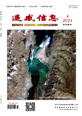
Remote Sensing Information is a bimonthly academic journal supervised by the Ministry of Natural Resources of the People's Republic of China and sponsored by China Academy of Surveying and Mapping Science. Since its inception in 1986, it has been one of the authoritative journals in the field of remote sensing in China.In 2014, it was recognised as one of the first batch of national academic journals, and was awarded the honours of Core Journals of China Science Citation Database, Chinese Core Journals, and Core Journals of Science and Technology of China. The journal won the Excellence Award (First Prize) of the National Excellent Surveying, Mapping and Geographic Information Journal Award in 2011 and 2017 respectively.
Remote Sensing Information is dedicated to reporting the cutting-edge theoretical and applied results of remote sensing science and technology, promoting academic exchanges at home and abroad, and promoting the application of remote sensing science and technology and industrial development. The journal adheres to the principles of openness, fairness and professionalism, abides by the anonymous review system of peer experts, and has good social credibility. The main columns include Review, Theoretical Research, Innovative Applications, Special Reports, International News, Famous Experts' Forum, Geographic National Condition Monitoring, etc., covering various fields such as surveying and mapping, forestry, agriculture, geology, meteorology, ocean, environment, national defence and so on.
Remote Sensing Information aims to provide a high-level academic exchange platform for experts and scholars in the field of remote sensing at home and abroad, to enhance academic influence, and to play a role in promoting and supporting the protection of natural resources, green technology innovation, and the construction of ecological civilisation.

 求助内容:
求助内容: 应助结果提醒方式:


