Detecting forest canopy gaps using unoccupied aerial vehicle RGB imagery in a species‐rich subtropical forest
IF 3.9
2区 环境科学与生态学
Q1 ECOLOGY
引用次数: 0
Abstract
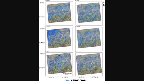
Accurate and efficient detection of canopy gaps is essential for understanding species regeneration and community dynamics in forests. Unoccupied aerial vehicles (UAVs) equipped with visible light (e.g., RGB) cameras have the potential to be one of the most cost‐effective approaches for detecting gaps. However, current gap‐detection methods based on spectral, textural, and/or structural information derived from UAV RGB imagery are unreliable in species‐rich forests with complex terrain due to high spectral complexity and topographic shadowing. Here, we compared the performance of four methods, including pixel‐based supervised classification (PBSC), object‐based classification (OBIA), Canopy Height Model thresholding classification, and HSTAC [a novel method we developed which combines Photographic Height (H), Spectral (S), and Textural (T) information for Automatic Classification (AC)] for characterizing canopy gaps in a 20‐ha permanent subtropical forest plot of eastern China. All classification results were evaluated through a comparison with canopy gaps detected from both field surveys and UAV‐borne LiDAR data. Among the four classification methods, HSTAC performed best in terms of detection efficiency (96% overall accuracy when compared to field data and 85% when compared to the LiDAR data), classification accuracy (3–18% improvement compared to alternative methods), and speed (1–1.5 h faster on the same machine). Of the four topographic factors (elevation, slope, aspect, and convexity), elevation was the one that most affected the accuracy of canopy gap detection. The errors of PBSC classification mainly came from the gaps at low elevations, while OBIA located the position of gaps well but overestimated their sizes. Overall, HSTAC avoids many of the inherent limitations of current state‐of‐the‐art methods and can accurately map canopy gaps in diverse subtropical forests with complex terrain. Our study provides a suitable way for long‐term forest canopy monitoring, real‐time applications, and contributes to a better understanding of forest plant community assembly and succession dynamics.

在物种丰富的亚热带森林中使用无人驾驶飞行器RGB图像检测林冠间隙
本文章由计算机程序翻译,如有差异,请以英文原文为准。
求助全文
约1分钟内获得全文
求助全文
来源期刊

Remote Sensing in Ecology and Conservation
Earth and Planetary Sciences-Computers in Earth Sciences
CiteScore
9.80
自引率
5.50%
发文量
69
审稿时长
18 weeks
期刊介绍:
emote Sensing in Ecology and Conservation provides a forum for rapid, peer-reviewed publication of novel, multidisciplinary research at the interface between remote sensing science and ecology and conservation. The journal prioritizes findings that advance the scientific basis of ecology and conservation, promoting the development of remote-sensing based methods relevant to the management of land use and biological systems at all levels, from populations and species to ecosystems and biomes. The journal defines remote sensing in its broadest sense, including data acquisition by hand-held and fixed ground-based sensors, such as camera traps and acoustic recorders, and sensors on airplanes and satellites. The intended journal’s audience includes ecologists, conservation scientists, policy makers, managers of terrestrial and aquatic systems, remote sensing scientists, and students.
Remote Sensing in Ecology and Conservation is a fully open access journal from Wiley and the Zoological Society of London. Remote sensing has enormous potential as to provide information on the state of, and pressures on, biological diversity and ecosystem services, at multiple spatial and temporal scales. This new publication provides a forum for multidisciplinary research in remote sensing science, ecological research and conservation science.
 求助内容:
求助内容: 应助结果提醒方式:


