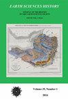
PLATE 6 OF THE GEOLOGY OF RUSSIA: PRODUCT OF A ‘GENIUS OF COMBINATION’
IF 0.3
4区 哲学
Q4 GEOSCIENCES, MULTIDISCIPLINARY
引用次数: 0
Abstract
In 1845, Roderick Murchison, Edouard de Verneuil and Alexander von Keyserling published The Geology of Russia in Europe and the Ural Mountains, reporting on the results of two field seasons in Russia (1840 and 1841) as well as additional fieldwork in Poland (1843) and Scandinavia (1844 and 1845). The book contains 7 plates comprising 5 cross-sections and 2 geologic maps. Plate 6 is a geologic map titled “Russia in Europe and the Ural Mountains . . .” and it is the subject of this paper. Murchison had 600 copies of the large format (quarto) book printed by John Murray in the laborious hand-press manner. He also had the 68 × 84 cm map produced as a copper engraving with water color washes. Plate 6 has been described as “the finest hand coloured map ever produced”. The map was drawn and engraved by John Arrowsmith from a sketch map begun in 1840, expanded after the 1841 field season, and further modified by incorporating work of other geologists, including Keilhau, Hisinger, Zejszner, Boué, Dubois de Montpereux, Hamilton, Ainsworth, and Helmersen. All of these geologists were meticulously acknowledged by Murchison in The Geology of Russia. In addition to the map, Plate 6 contains a stratigraphic column with key locations and characteristic fossils, and a crosssection extending from St. Petersburg to the Sea of Azof. Thus, Plate 6 represents a synthesis of much of what was known in 1845 of the geology of Russia and surrounding territories, clearly demonstrating Murchison’s ‘genius of combination’. Murchison revised the map several times, resulting in 4 ‘states’ of the map.俄罗斯地质板块之六:“天才组合”的产物
1845年,Roderick Murchison、Edouard de Verneuil和Alexander von Keyserling出版了《俄罗斯在欧洲和乌拉尔山脉的地质》,报告了俄罗斯两个野外季节(1840年和1841年)的结果,以及波兰(1843年)和斯堪的纳维亚(1844年和1845年)的额外野外调查结果。该书包含7个板块,包括5个横截面和2张地质图。图版6是一幅题为“俄罗斯在欧洲和乌拉尔山脉…”的地质图,也是本文的主题。默奇森有600本约翰·默里用手工印刷的大幅面(四开本)书。他还制作了一幅68×84厘米的地图,用水洗铜版画。图版6被描述为“有史以来制作的最好的手绘地图”。该地图由约翰·阿罗史密斯根据1840年开始的草图绘制和雕刻,在1841年野外考察季节后进行了扩展,并通过结合其他地质学家的工作进行了进一步修改,包括凯豪、希辛格、泽兹纳、布埃、杜波依·德·蒙佩雷斯、汉密尔顿、安斯沃思和赫尔默森。Murchison在《俄罗斯地质学》一书中对所有这些地质学家都给予了细致的肯定。除地图外,板块6还包含一个地层柱,其中包含关键位置和特征化石,以及从圣彼得堡延伸至亚速海的横截面。因此,板块6代表了1845年已知的俄罗斯及其周边地区地质的大部分综合,清楚地证明了Murchison的“组合天才”。默奇森对地图进行了几次修改,形成了地图的4个“状态”。
本文章由计算机程序翻译,如有差异,请以英文原文为准。
求助全文
约1分钟内获得全文
求助全文
来源期刊

Earth Sciences History
GEOSCIENCES, MULTIDISCIPLINARY-HISTORY & PHILOSOPHY OF SCIENCE
CiteScore
1.00
自引率
0.00%
发文量
1
审稿时长
>12 weeks
期刊介绍:
Earth Sciences History promotes and publishes historical work on all areas of the earth sciences – including geology, geography, geophysics, oceanography, paleontology, meteorology, and climatology.
The journal honors and encourages a variety of approaches to historical study: biography, history of ideas, social history, and histories of institutions, organizations, and techniques.
Articles are peer reviewed.
 求助内容:
求助内容: 应助结果提醒方式:


