Characterizing stratigraphically complex deepwater slope channel reservoirs for production optimization and better field management – A brown field example, offshore West Africa
IF 3.6
引用次数: 0
Abstract
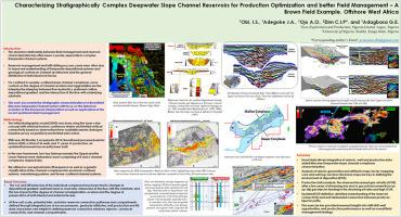
The dynamic relationship between field management and reservoir characterization has often been a puzzle, especially in complex deepwater channel systems. Reservoir management and infill drilling success cases were often due to improved understanding of deepwater depositional systems and geological controls on channel architecture and the general distribution of individual rock facies. For confined to weakly-confined slope channel complexes, some controls on the degree of channel avulsion and aggradation are the interplay between flow hydraulics, sediment calibre, depositional gradient, and the interaction of the flow with underlying substrate. This work aims at documenting the stratigraphic characterization of a Miocene deepwater channel system in a brownfield with focus on the historical evolution of the framework interpretation as well as applications of the recent updates in field management. The initial stratigraphic model (2005) was done using the layer cake concept with minimal incision, continuous shales and limited vertical connectivity based on observations from available seismic data (pre-baseline survey acquisition) and limited well control. This was modified in 2009 following acquisition of a 4D Monitor 1 seismic volume and 3 years production data from 20 wells to a more erosive model with compensationally stacked channel complexes of similar width. With new 4D Monitor 2 acquired in 2014, broadband processed seismic data in 2020, a total of 36 wells and 11 years of production, an updated framework has recently been built. In the new framework, two key fairways namely the Upper and the Lower Fairway were delineated, each comprising of 8 and 6 channel complexes, respectively. A conceptual basin-fill sequence was utilized, as well as a genetic classification of the channel complexes into erosional-confined systems, meandering systems, and levee-confined channel systems. The cut-and-fill behaviors of the individual complexes have been tied to changes in depositional gradient, sediment sand vs mud ratio, interaction of the flow with the substrate, and this has impacted the degree of channel amalgamation, avulsion and the degree of preservation of both internal and external levees. At flow unit scale, potential inter, and intra-reservoir connection pathways and compartments defined through integrated use of excess pressures, geobody attributes, well production and 4D data, have been very helpful in defining reservoir connection windows, injector – producer connectivity, and channel compartments. The implication is that this exercise or study has provided renewed insights into infill drill-well opportunities, well production performance as well as overall field management strategy.
表征地层复杂的深水斜坡河道储层,以优化生产和更好地管理油田——以西非近海棕色油田为例
油田管理与储层特征之间的动态关系一直是一个难题,特别是在复杂的深水水道系统中。储层管理和钻井成功的案例往往是由于对深水沉积体系和对河道结构的地质控制以及单个岩石相的总体分布有了更好的了解。对于受弱约束的斜坡河道复合体,水流水力学、泥沙粒径、沉积梯度以及水流与下垫物的相互作用是控制河道崩解和淤积程度的因素。这项工作旨在记录棕地中新世深水水道系统的地层特征,重点关注框架解释的历史演变以及最近在现场管理中的应用更新。最初的地层模型(2005年)采用了层饼概念,基于现有地震数据(基线前调查采集)和有限的井控,采用了最小切口、连续的页岩和有限的垂直连通性。2009年,在获得了4D Monitor 1地震数据和20口井3年的生产数据后,对该模型进行了修改,该模型具有类似宽度的补补性堆积通道复体。随着2014年获得新的4D Monitor 2,宽带处理了2020年的地震数据,共有36口井和11年的生产,最近建立了一个更新的框架。在新的框架中,划分了两条关键球道,即上球道和下球道,每条球道分别由8个和6个通道组成。利用了一个概念性的盆地-充填序列,并将河道复合体划分为侵蚀约束体系、曲流体系和堤防约束体系。个别复合体的切填行为与沉积梯度、泥沙砂泥比、水流与基质的相互作用有关,这影响了河道合并程度、崩解程度以及内外堤防的保存程度。在流量单位尺度上,通过综合利用超压、地质体属性、井产量和4D数据,确定潜在的储层间和储层内部连接通道和隔室,这对确定储层连接窗口、注入-采油连通性和通道隔室非常有帮助。这意味着,该实践或研究为填充钻井机会、油井生产性能以及整体油田管理策略提供了新的见解。
本文章由计算机程序翻译,如有差异,请以英文原文为准。
求助全文
约1分钟内获得全文
求助全文

 求助内容:
求助内容: 应助结果提醒方式:


