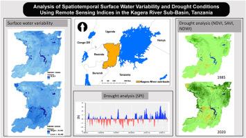
Analysis of spatiotemporal surface water variability and drought conditions using remote sensing indices in the Kagera River Sub-Basin, Tanzania
IF 3.8
Q2 ENVIRONMENTAL SCIENCES
Remote Sensing Applications-Society and Environment
Pub Date : 2024-11-19
DOI:10.1016/j.rsase.2024.101405
引用次数: 0
Abstract
Drought is one of the major challenges affecting water resources, agriculture, and ecosystem resilience in the sub-Saharan region. This study analyzed the spatial and temporal variation of surface water and drought conditions in the Kagera sub-basin using remote sensing indices: the Normalized Difference Water Index (NDWI), Normalized Difference Vegetation Index (NDVI), Soil Adjusted Vegetation Index (SAVI), and Normalized Difference Moisture Index (NDMI). The analysis covered the period from 1985 to 2020 at 5-year intervals. The Standardized Precipitation Index (SPI) was utilized to assess rainfall anomalies, which were then compared with surface water variability and drought intensity indicated by remote-sensing indices. The SPI revealed multiple instances of extreme and severe drought, with higher frequencies observed in the 3-month and 6-month SPI compared to the 12-month SPI. The NDWI revealed significant spatial and temporal variations in surface water area in the Kagera sub-basin. In general, surface water area showed a mixed trend, decreasing from 660 km2 in 1985 to 632 km2 in 2000, and then gradually increasing to 698 km2 in 2020. Additionally, the NDWI exhibited a strong correlation with 3-month and 6-month SPI but a weaker correlation with 12-month SPI. On the other hand, the NDVI indicated significant variations in drought conditions, with areas experiencing severe drought ranging between 446 km2 and 1892 km2. These severe drought events were prevalent from 1990 to 2000. The results also indicated a strong correlation between drought extent and intensity extracted from NDVI and rainfall anomalies, with SPI-3 and SPI-6 showing stronger correlations compared to SPI-12. Moreover, the SAVI results were consistent with those of NDVI, suggesting that the soil brightness effect on the NDVI is not significant in the sub-basin. In contrast, NDMI indicated that severe drought areas generally increased over the analyzed years and exhibited a weak correlation with SPI for all time scales. These findings contribute valuable insights that are important for decision-makers in managing surface water resources and implementing proactive and targeted environmental conservation measures to enhance ecosystem resilience in the Kagera sub-basin.

利用遥感指数分析坦桑尼亚卡盖拉河分流域地表水的时空变化和干旱状况
干旱是影响撒哈拉以南地区水资源、农业和生态系统恢复能力的主要挑战之一。本研究利用遥感指数:归一化差异水指数(NDWI)、归一化差异植被指数(NDVI)、土壤调整植被指数(SAVI)和归一化差异水分指数(NDMI),分析了卡盖拉亚盆地地表水和干旱状况的时空变化。分析时间跨度为 1985 年至 2020 年,间隔为 5 年。利用标准化降水指数(SPI)评估降雨异常,然后与遥感指数显示的地表水变化和干旱强度进行比较。SPI 显示了多种极端和严重干旱的情况,与 12 个月的 SPI 相比,3 个月和 6 个月的 SPI 观察到的频率更高。NDWI 显示,卡盖拉分流域的地表水面积存在显著的时空变化。总体而言,地表水面积呈混合趋势,从 1985 年的 660 平方公里减少到 2000 年的 632 平方公里,然后逐渐增加到 2020 年的 698 平方公里。此外,NDWI 与 3 个月和 6 个月 SPI 的相关性较强,但与 12 个月 SPI 的相关性较弱。另一方面,归一化差异植被指数(NDVI)显示出干旱状况的显著变化,发生严重干旱的面积在 446 平方公里到 1892 平方公里之间。这些严重干旱事件主要发生在 1990 年至 2000 年期间。结果还表明,从 NDVI 和降雨异常中提取的干旱范围和强度之间存在很强的相关性,与 SPI-12 相比,SPI-3 和 SPI-6 显示出更强的相关性。此外,SAVI 的结果与 NDVI 的结果一致,表明该子流域的土壤亮度对 NDVI 的影响不大。相比之下,NDMI 表明严重干旱地区在分析年份普遍增加,并且在所有时间尺度上与 SPI 的相关性较弱。这些发现提供了宝贵的见解,对决策者管理地表水资源、实施积极主动和有针对性的环境保护措施以提高卡盖拉亚流域生态系统的恢复能力非常重要。
本文章由计算机程序翻译,如有差异,请以英文原文为准。
求助全文
约1分钟内获得全文
求助全文
来源期刊
CiteScore
8.00
自引率
8.50%
发文量
204
审稿时长
65 days
期刊介绍:
The journal ''Remote Sensing Applications: Society and Environment'' (RSASE) focuses on remote sensing studies that address specific topics with an emphasis on environmental and societal issues - regional / local studies with global significance. Subjects are encouraged to have an interdisciplinary approach and include, but are not limited by: " -Global and climate change studies addressing the impact of increasing concentrations of greenhouse gases, CO2 emission, carbon balance and carbon mitigation, energy system on social and environmental systems -Ecological and environmental issues including biodiversity, ecosystem dynamics, land degradation, atmospheric and water pollution, urban footprint, ecosystem management and natural hazards (e.g. earthquakes, typhoons, floods, landslides) -Natural resource studies including land-use in general, biomass estimation, forests, agricultural land, plantation, soils, coral reefs, wetland and water resources -Agriculture, food production systems and food security outcomes -Socio-economic issues including urban systems, urban growth, public health, epidemics, land-use transition and land use conflicts -Oceanography and coastal zone studies, including sea level rise projections, coastlines changes and the ocean-land interface -Regional challenges for remote sensing application techniques, monitoring and analysis, such as cloud screening and atmospheric correction for tropical regions -Interdisciplinary studies combining remote sensing, household survey data, field measurements and models to address environmental, societal and sustainability issues -Quantitative and qualitative analysis that documents the impact of using remote sensing studies in social, political, environmental or economic systems

 求助内容:
求助内容: 应助结果提醒方式:


