Remote sensing and big data: Google Earth Engine data to assist calibration processes in hydro-sediment modeling on large scales
IF 3.8
Q2 ENVIRONMENTAL SCIENCES
Remote Sensing Applications-Society and Environment
Pub Date : 2024-09-12
DOI:10.1016/j.rsase.2024.101352
引用次数: 0
Abstract
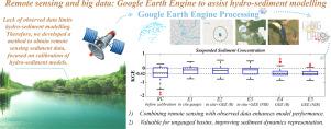
Mathematical modeling aids in understanding large-scale erosion and sedimentation. However, sediment transport models calibration is constrained by data scarcity. This study explores the use of remote sensing (RS) imagery to supplement observed data, addressing three key questions: (1) How can high-resolution RS data be obtained using cloud-based methods for hydro-sediment applications, considering river changes? (2) What are the benefits of RS data in data-scarce conditions? (3) How can RS data improve hydro-sediment modeling in data-deficient regions? We developed a method to acquire large-scale RS data using Google Earth Engine (GEE) to obtain red and infrared reflectance from satellite imagery. After filtering errors, the data were used to calibrate a hydro-sediment model. Results showed that RS data, when combined with observed data, provided similar outcomes but performed better for lower values. Calibration with RS data alone improved the Kling-Gupta Efficiency (KGE) by 5%–18% and correlation by 5%–15%. Key conclusions are: (I) Cloud-based calibration is superior to using limited virtual stations; (II) RS data effectively complements observed data in hydro-sediment modeling; (III) Calibration using only RS data is beneficial in ungauged basins and preferable to no calibration.

遥感和大数据:谷歌地球引擎数据协助大尺度水文沉积模型的校准过程
数学建模有助于了解大规模侵蚀和沉积作用。然而,沉积物输运模型的校准受到数据稀缺的限制。本研究探讨了如何利用遥感(RS)图像来补充观测数据,解决了三个关键问题:(1)考虑到河流的变化,如何利用基于云的方法获得高分辨率的 RS 数据,用于水文沉积应用?(2) 在数据稀缺的条件下,RS 数据有什么好处?(3) RS 数据如何改善数据不足地区的水文沉积模型?我们开发了一种获取大规模 RS 数据的方法,利用谷歌地球引擎(GEE)从卫星图像中获取红外和红外反射率。在过滤误差后,这些数据被用于校准水文沉积模型。结果表明,当 RS 数据与观测数据相结合时,可提供相似的结果,但对较低值的结果表现更好。仅使用 RS 数据进行校准,克林-古普塔效率(KGE)提高了 5%-18%,相关性提高了 5%-15%。主要结论如下(I) 基于云的校准优于使用有限的虚拟站点;(II) RS 数据可有效补充水文沉积模型中的观测数据;(III) 仅使用 RS 数据进行校准有利于无测站流域,优于不进行校准。
本文章由计算机程序翻译,如有差异,请以英文原文为准。
求助全文
约1分钟内获得全文
求助全文
来源期刊
CiteScore
8.00
自引率
8.50%
发文量
204
审稿时长
65 days
期刊介绍:
The journal ''Remote Sensing Applications: Society and Environment'' (RSASE) focuses on remote sensing studies that address specific topics with an emphasis on environmental and societal issues - regional / local studies with global significance. Subjects are encouraged to have an interdisciplinary approach and include, but are not limited by: " -Global and climate change studies addressing the impact of increasing concentrations of greenhouse gases, CO2 emission, carbon balance and carbon mitigation, energy system on social and environmental systems -Ecological and environmental issues including biodiversity, ecosystem dynamics, land degradation, atmospheric and water pollution, urban footprint, ecosystem management and natural hazards (e.g. earthquakes, typhoons, floods, landslides) -Natural resource studies including land-use in general, biomass estimation, forests, agricultural land, plantation, soils, coral reefs, wetland and water resources -Agriculture, food production systems and food security outcomes -Socio-economic issues including urban systems, urban growth, public health, epidemics, land-use transition and land use conflicts -Oceanography and coastal zone studies, including sea level rise projections, coastlines changes and the ocean-land interface -Regional challenges for remote sensing application techniques, monitoring and analysis, such as cloud screening and atmospheric correction for tropical regions -Interdisciplinary studies combining remote sensing, household survey data, field measurements and models to address environmental, societal and sustainability issues -Quantitative and qualitative analysis that documents the impact of using remote sensing studies in social, political, environmental or economic systems

 求助内容:
求助内容: 应助结果提醒方式:


