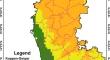
{"title":"The geospatial modelling of vegetation carbon storage analysis in Google earth engine using machine learning techniques","authors":"Arpitha M, S A Ahmed, Harishnaika N","doi":"10.1007/s12145-024-01372-w","DOIUrl":null,"url":null,"abstract":"<p>Over the past few years, forest ecosystems’ ability to store carbon has been significantly impacted by Land use and Land cover (LULC), and climate change. Thus, it is crucial to understand how these change-causing factors impact carbon sequestration (CS). Due to a limited number of carbon storage monitoring methods and the shorter period of remote sensing data, it is difficult to continually analyze carbon storage in large areas. These issues can be solved by using AVHRR (Advanced Very High-Resolution Radiometer) and MODIS (Moderate Resolution Imaging Spector radiometer) remote sensing data. The main objective of this research is to measure the spatial and temporal patterns of carbon storage across the state of Karnataka’s vegetative and non-vegetated terrains, between 2003 and 2021. To assess the effects of potential land use and land cover scenarios, our work uses spatial maps to estimate the storage of carbon sequestration from various land use patterns. To assess the spatio-temporal effects of land use and land cover (LULC) change on the availability and value of carbon storage. This research focuses on the entire Karnataka state as a study region to compute carbon storage utilizing online platforms like GEE (Google Earth Engine) using GPP (Gross Primary Productivity), and NPP (Net Primary Productivity) is an important measure to evaluate vegetation productivity using Decision Tree (DT) machine learning techniques. Statistical models like Pearson’s correlation coefficient, standardized coefficients, and Root Mean Square Error (RMSE) methods are used for the model’s performance with different indices and carbon storage. The findings show the Uttara Kannada district contains between 250 gCm − <sup>2</sup> and 300 gCm − <sup>2</sup> of carbon storage, which is relatively significant as compared to the other parts of the districts in the state.</p>","PeriodicalId":49318,"journal":{"name":"Earth Science Informatics","volume":"15 1","pages":""},"PeriodicalIF":3.0000,"publicationDate":"2024-06-27","publicationTypes":"Journal Article","fieldsOfStudy":null,"isOpenAccess":false,"openAccessPdf":"","citationCount":"0","resultStr":null,"platform":"Semanticscholar","paperid":null,"PeriodicalName":"Earth Science Informatics","FirstCategoryId":"89","ListUrlMain":"https://doi.org/10.1007/s12145-024-01372-w","RegionNum":4,"RegionCategory":"地球科学","ArticlePicture":[],"TitleCN":null,"AbstractTextCN":null,"PMCID":null,"EPubDate":"","PubModel":"","JCR":"Q2","JCRName":"COMPUTER SCIENCE, INTERDISCIPLINARY APPLICATIONS","Score":null,"Total":0}
引用次数: 0
Abstract
Over the past few years, forest ecosystems’ ability to store carbon has been significantly impacted by Land use and Land cover (LULC), and climate change. Thus, it is crucial to understand how these change-causing factors impact carbon sequestration (CS). Due to a limited number of carbon storage monitoring methods and the shorter period of remote sensing data, it is difficult to continually analyze carbon storage in large areas. These issues can be solved by using AVHRR (Advanced Very High-Resolution Radiometer) and MODIS (Moderate Resolution Imaging Spector radiometer) remote sensing data. The main objective of this research is to measure the spatial and temporal patterns of carbon storage across the state of Karnataka’s vegetative and non-vegetated terrains, between 2003 and 2021. To assess the effects of potential land use and land cover scenarios, our work uses spatial maps to estimate the storage of carbon sequestration from various land use patterns. To assess the spatio-temporal effects of land use and land cover (LULC) change on the availability and value of carbon storage. This research focuses on the entire Karnataka state as a study region to compute carbon storage utilizing online platforms like GEE (Google Earth Engine) using GPP (Gross Primary Productivity), and NPP (Net Primary Productivity) is an important measure to evaluate vegetation productivity using Decision Tree (DT) machine learning techniques. Statistical models like Pearson’s correlation coefficient, standardized coefficients, and Root Mean Square Error (RMSE) methods are used for the model’s performance with different indices and carbon storage. The findings show the Uttara Kannada district contains between 250 gCm − 2 and 300 gCm − 2 of carbon storage, which is relatively significant as compared to the other parts of the districts in the state.
期刊介绍:
The Earth Science Informatics [ESIN] journal aims at rapid publication of high-quality, current, cutting-edge, and provocative scientific work in the area of Earth Science Informatics as it relates to Earth systems science and space science. This includes articles on the application of formal and computational methods, computational Earth science, spatial and temporal analyses, and all aspects of computer applications to the acquisition, storage, processing, interchange, and visualization of data and information about the materials, properties, processes, features, and phenomena that occur at all scales and locations in the Earth system’s five components (atmosphere, hydrosphere, geosphere, biosphere, cryosphere) and in space (see "About this journal" for more detail). The quarterly journal publishes research, methodology, and software articles, as well as editorials, comments, and book and software reviews. Review articles of relevant findings, topics, and methodologies are also considered.
 求助内容:
求助内容: 应助结果提醒方式:


