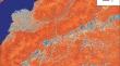
{"title":"Methodological Approaches to the Identification of Hydrologically Sensitive Landscapes (Case Study of the Selenga River Basin)","authors":"Yu. M. Semenov, M. Yu. Semenov, A. V. Silaev","doi":"10.1134/s1875372824700100","DOIUrl":null,"url":null,"abstract":"<h3 data-test=\"abstract-sub-heading\">Abstract</h3><p>Methodological approaches to the identification of hydrologically sensitive landscapes have been developed and implemented in the Selenga River basin. The topographic wetness index (TWI) is calculated to detect accumulative landscapes using the digital relief model of the region under study. Areas with TWI ranges of 12–15 and 15–18 are recognized as areas with the most likely runoff zones. To assess the possibility of their influence on the formation of the river runoff composition, a map of the total runoff is created using the flow accumulation (FA) model. Hydrologically sensitive areas (HSAs) in a watershed are determined by superimposing a spatial distribution map of areas with maximum total runoff values on the TWI differentiation map. Areas with contours located within the territories of maximum values of total runoff are identified as true hydrologically sensitive landscapes. Model polygons are selected to test the methodology for mapping hydrologically sensitive areas and primary pollution sources. Studies are carried out on the model territory of the city of Ulan-Ude, which is one of the main pollutants of the waters of the Selenga River and Lake Baikal. The main condition for the formation of secondary sources of pollution (accumulative landscapes) is the correspondence of the pollution source coverage area with HSA. The resulting map of production facilities is superimposed on the HSA spatial distribution map, fragments of which within industrial zones are identified as possible secondary sources of pollution (critical sources areas (CSAs)). The accuracy of the CSA allocation has been confirmed by the results of assessing the level of soil pollution in the city of Ulan-Ude.</p>","PeriodicalId":44739,"journal":{"name":"Geography and Natural Resources","volume":"30 1","pages":""},"PeriodicalIF":0.4000,"publicationDate":"2024-07-04","publicationTypes":"Journal Article","fieldsOfStudy":null,"isOpenAccess":false,"openAccessPdf":"","citationCount":"0","resultStr":null,"platform":"Semanticscholar","paperid":null,"PeriodicalName":"Geography and Natural Resources","FirstCategoryId":"1085","ListUrlMain":"https://doi.org/10.1134/s1875372824700100","RegionNum":0,"RegionCategory":null,"ArticlePicture":[],"TitleCN":null,"AbstractTextCN":null,"PMCID":null,"EPubDate":"","PubModel":"","JCR":"Q4","JCRName":"GEOGRAPHY","Score":null,"Total":0}
引用次数: 0
Abstract
Methodological approaches to the identification of hydrologically sensitive landscapes have been developed and implemented in the Selenga River basin. The topographic wetness index (TWI) is calculated to detect accumulative landscapes using the digital relief model of the region under study. Areas with TWI ranges of 12–15 and 15–18 are recognized as areas with the most likely runoff zones. To assess the possibility of their influence on the formation of the river runoff composition, a map of the total runoff is created using the flow accumulation (FA) model. Hydrologically sensitive areas (HSAs) in a watershed are determined by superimposing a spatial distribution map of areas with maximum total runoff values on the TWI differentiation map. Areas with contours located within the territories of maximum values of total runoff are identified as true hydrologically sensitive landscapes. Model polygons are selected to test the methodology for mapping hydrologically sensitive areas and primary pollution sources. Studies are carried out on the model territory of the city of Ulan-Ude, which is one of the main pollutants of the waters of the Selenga River and Lake Baikal. The main condition for the formation of secondary sources of pollution (accumulative landscapes) is the correspondence of the pollution source coverage area with HSA. The resulting map of production facilities is superimposed on the HSA spatial distribution map, fragments of which within industrial zones are identified as possible secondary sources of pollution (critical sources areas (CSAs)). The accuracy of the CSA allocation has been confirmed by the results of assessing the level of soil pollution in the city of Ulan-Ude.
期刊介绍:
Geography and Natural Resources publishes information on research results in the field of geographical studies of nature, the economy, and the population. It provides ample coverage of the geographical aspects related to solving major economic problems, with special emphasis on regional nature management and environmental protection, geographical forecasting, integral regional research developments, modelling of natural processes, and on the advancement of mapping techniques. The journal publishes contributions on monitoring studies, geographical research abroad, as well as discussions on the theory of science.
 求助内容:
求助内容: 应助结果提醒方式:


