{"title":"Positioning possibilities for human geographies of the sea: Automatic Identification Systems and its role in spatialising understandings of shipping","authors":"Ole J. Müller, Kimberley Peters","doi":"10.1111/gec3.12741","DOIUrl":null,"url":null,"abstract":"<p>This paper <i>positions</i> possibilities for human geographies of the sea. The growing volume of work under this banner has been largely qualitative in its approach, reflecting, in turn, the questions posed by oceanic scholars. These questions necessitate corresponding methods. Whilst this is not necessarily a problem, and the current corpus of work has offered many significant contributions, in making sense of the human dimensions of maritime worlds, other questions—and methods—may generate knowledge that is useful within this remit of work. This paper considers the place of quantitative approaches in posing lines of enquiry about shipping, one of the prominent areas of concern under the banner of ‘human geographies of the seas’. There is longstanding work in transport geographies concerned with shipping, logistics, freight movement and global connections, which embraces quantitative methods which could be bridged to ask fresh questions about oceanic spatial phenomena past and present. This paper reviews the state of the art of human geographies of the sea and transport geographies and navigates how the former field may be stimulated by some of the interests of the latter and a broader range of questions about society-sea-space relations. The paper focuses on Automatic Identification Systems (or AIS) as a potentially useful tool for connecting debates, and deepening spatial understandings of the seas and shipping beyond current scholarship. To advance the argument the example of shipping layups is used to illustrate or rather, position, the point.</p>","PeriodicalId":51411,"journal":{"name":"Geography Compass","volume":"18 4","pages":""},"PeriodicalIF":3.5000,"publicationDate":"2024-03-26","publicationTypes":"Journal Article","fieldsOfStudy":null,"isOpenAccess":false,"openAccessPdf":"https://onlinelibrary.wiley.com/doi/epdf/10.1111/gec3.12741","citationCount":"0","resultStr":null,"platform":"Semanticscholar","paperid":null,"PeriodicalName":"Geography Compass","FirstCategoryId":"89","ListUrlMain":"https://compass.onlinelibrary.wiley.com/doi/10.1111/gec3.12741","RegionNum":1,"RegionCategory":"社会学","ArticlePicture":[],"TitleCN":null,"AbstractTextCN":null,"PMCID":null,"EPubDate":"","PubModel":"","JCR":"Q1","JCRName":"GEOGRAPHY","Score":null,"Total":0}
引用次数: 0
Abstract
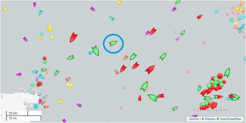
This paper positions possibilities for human geographies of the sea. The growing volume of work under this banner has been largely qualitative in its approach, reflecting, in turn, the questions posed by oceanic scholars. These questions necessitate corresponding methods. Whilst this is not necessarily a problem, and the current corpus of work has offered many significant contributions, in making sense of the human dimensions of maritime worlds, other questions—and methods—may generate knowledge that is useful within this remit of work. This paper considers the place of quantitative approaches in posing lines of enquiry about shipping, one of the prominent areas of concern under the banner of ‘human geographies of the seas’. There is longstanding work in transport geographies concerned with shipping, logistics, freight movement and global connections, which embraces quantitative methods which could be bridged to ask fresh questions about oceanic spatial phenomena past and present. This paper reviews the state of the art of human geographies of the sea and transport geographies and navigates how the former field may be stimulated by some of the interests of the latter and a broader range of questions about society-sea-space relations. The paper focuses on Automatic Identification Systems (or AIS) as a potentially useful tool for connecting debates, and deepening spatial understandings of the seas and shipping beyond current scholarship. To advance the argument the example of shipping layups is used to illustrate or rather, position, the point.
期刊介绍:
Unique in its range, Geography Compass is an online-only journal publishing original, peer-reviewed surveys of current research from across the entire discipline. Geography Compass publishes state-of-the-art reviews, supported by a comprehensive bibliography and accessible to an international readership. Geography Compass is aimed at senior undergraduates, postgraduates and academics, and will provide a unique reference tool for researching essays, preparing lectures, writing a research proposal, or just keeping up with new developments in a specific area of interest.


 求助内容:
求助内容: 应助结果提醒方式:


