Open Source Data Programs From Low-Earth Orbit Synthetic Aperture Radar Companies: Questions and answers [Industry Profiles and Activities]

IF 16.2 1区 地球科学 Q1 GEOCHEMISTRY & GEOPHYSICS
Nirav Patel
{"title":"Open Source Data Programs From Low-Earth Orbit Synthetic Aperture Radar Companies: Questions and answers [Industry Profiles and Activities]","authors":"Nirav Patel","doi":"10.1109/MGRS.2023.3321333","DOIUrl":null,"url":null,"abstract":"Synthetic aperture radar (SAR) imaging data in general have not been openly accessible for consumption to the general public in the past few decades, as mainly governments have led the development of such platforms, due to the commercial industry lacking the need of such data (with few exceptions).","PeriodicalId":48660,"journal":{"name":"IEEE Geoscience and Remote Sensing Magazine","volume":null,"pages":null},"PeriodicalIF":16.2000,"publicationDate":"2023-12-01","publicationTypes":"Journal Article","fieldsOfStudy":null,"isOpenAccess":false,"openAccessPdf":"","citationCount":"0","resultStr":null,"platform":"Semanticscholar","paperid":null,"PeriodicalName":"IEEE Geoscience and Remote Sensing Magazine","FirstCategoryId":"89","ListUrlMain":"https://doi.org/10.1109/MGRS.2023.3321333","RegionNum":1,"RegionCategory":"地球科学","ArticlePicture":[],"TitleCN":null,"AbstractTextCN":null,"PMCID":null,"EPubDate":"","PubModel":"","JCR":"Q1","JCRName":"GEOCHEMISTRY & GEOPHYSICS","Score":null,"Total":0}
引用次数: 0

Abstract

Synthetic aperture radar (SAR) imaging data in general have not been openly accessible for consumption to the general public in the past few decades, as mainly governments have led the development of such platforms, due to the commercial industry lacking the need of such data (with few exceptions).
低地轨道合成孔径雷达公司的开放源码数据程序:问与答[行业概况与活动]
在过去几十年里,合成孔径雷达(SAR)成像数据一般不对公众开放使用,因为主要是政府在主导这类平台的开发,商业界缺乏对这类数据的需求(少数例外)。
本文章由计算机程序翻译,如有差异,请以英文原文为准。
求助全文
约1分钟内获得全文 求助全文
来源期刊
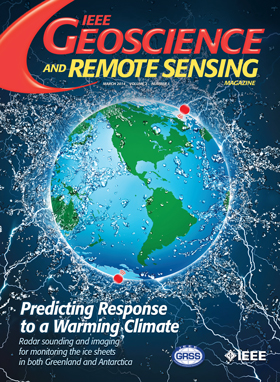
IEEE Geoscience and Remote Sensing Magazine
IEEE Geoscience and Remote Sensing Magazine Computer Science-General Computer Science
CiteScore
20.50
自引率
2.70%
发文量
58
期刊介绍: The IEEE Geoscience and Remote Sensing Magazine (GRSM) serves as an informative platform, keeping readers abreast of activities within the IEEE GRS Society, its technical committees, and chapters. In addition to updating readers on society-related news, GRSM plays a crucial role in educating and informing its audience through various channels. These include:Technical Papers,International Remote Sensing Activities,Contributions on Education Activities,Industrial and University Profiles,Conference News,Book Reviews,Calendar of Important Events.
文献相关原料
公司名称 产品信息 采购帮参考价格
×
引用
GB/T 7714-2015
复制
MLA
复制
APA
复制
导出至
BibTeX EndNote RefMan NoteFirst NoteExpress
×
提示
您的信息不完整,为了账户安全,请先补充。
现在去补充
×
提示
您因"违规操作"
具体请查看互助需知
我知道了
×
提示
确定
请完成安全验证×
copy
已复制链接
快去分享给好友吧!
我知道了
右上角分享
点击右上角分享
0
联系我们:info@booksci.cn Book学术提供免费学术资源搜索服务,方便国内外学者检索中英文文献。致力于提供最便捷和优质的服务体验。 Copyright © 2023 布克学术 All rights reserved.
京ICP备2023020795号-1
ghs 京公网安备 11010802042870号
Book学术文献互助
Book学术文献互助群
群 号:481959085
Book学术官方微信